Virton elevation
Virton (Wallonia, Province du Luxembourg), Belgium elevation is 226 meters and Virton elevation in feet is 741 ft above sea level [src 1]. Virton is a seat of a third-order administrative division (feature code) with elevation that is 127 meters (417 ft) bigger than average city elevation in Belgium.
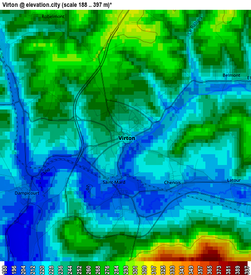
Below is the Elevation map of Virton, which displays elevation range with different colors. Scale of the first map is from 188 to 397 m (617 to 1302 ft) with average elevation of 243 meters (=797 ft) [note 1]
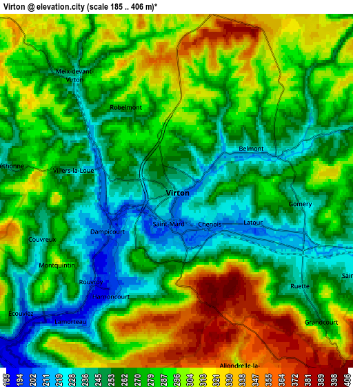
These maps also provides idea of topography and contour of this city, they are displayed at different zoom levels. More info about maps, scale and edge coordinates you can find below images.
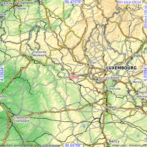
| \ | Map #1 | Map #2 | Topo.Map |
| Scale [m] | 188..397 m | 185..406 m | × |
| Scale [ft] | 617..1302 ft | 607..1332 ft | × |
| Average | 243 m = 797 ft | 277.8 m = 911 ft | × |
| Width | 6.34 km = 3.9 mi | 12.68 km = 7.9 mi | 202.8 km = 126 mi |
| Height | 6.34 km = 3.9 mi | 12.68 km = 7.9 mi | 202.8 km = 126 mi |
| ↑Max Latitude | 49.596732° | 49.625207° | 50.47175° |
| Latitude at center | 49.56824° | 49.56824° | 49.56824° |
| ↓Min Latitude | 49.539731° | 49.511206° | 48.64769° |
| ← Min Longitude | 5.488645° | 5.444699° | 4.12634° |
| Longitude center | 5.53259° | 5.53259° | 5.53259° |
| →Max Longitude | 5.576535° | 5.620481° | 6.93884° |
Nearby cities:
Cities around Virton sort by population:
• Arlon elevation 421 m
24.1 km,  57°
57°
• Aubange 278 m
19.6 km,  90°
90°
• Habay-la-Vieille 370 m
18.4 km,  20°
20°
• Messancy 277 m
20.8 km,  82°
82°
• Florenville 342 m
21.8 km,  312°
312°
• Étalle 334 m
12.7 km, 22°
• Chiny 375 m
23.4 km,  323°
323°
• Musson 242 m
12.5 km,  95°
95°
• Tintigny 336 m
12.9 km,  353°
353°
• Saint-Léger 268 m
10.2 km, 61°
• Meix-devant-Virton 249 m
5.6 km, 318°
• Rouvroy 199 m
4.6 km,  221°
221°
Multilingual:
 En español:
Virton elevación 226 m.
 En France:
Virton élévation 226 m.


Sources and notes:
- [note 1] Map square and city borders are not equal. Map elevation data is calculated only from area inside that square.
- [src 1] Elevation data from geonames database provided with same terms of usage.
- [src 2] The elevation map of Virton is generated using elevation data from NASA's 3 arcsec (90m) resolution SRTM data.
- [src 3] Base (background) map © OpenStreetMap contributors tiles are generated by Geofabrik and OpenTopoMap.
Copyright & License:
This Virton Elevation Map is licensed under CC BY-SA. You may reuse any part from this page, if you give a proper credit by linking to this URL:
 More info on terms of use page.