Westerlo elevation
Westerlo (Flanders, Provincie Antwerpen), Belgium elevation is 14 meters and Westerlo elevation in feet is 46 ft above sea level [src 1]. Westerlo is a populated place (feature code) with elevation that is 85 meters (279 ft) smaller than average city elevation in Belgium.
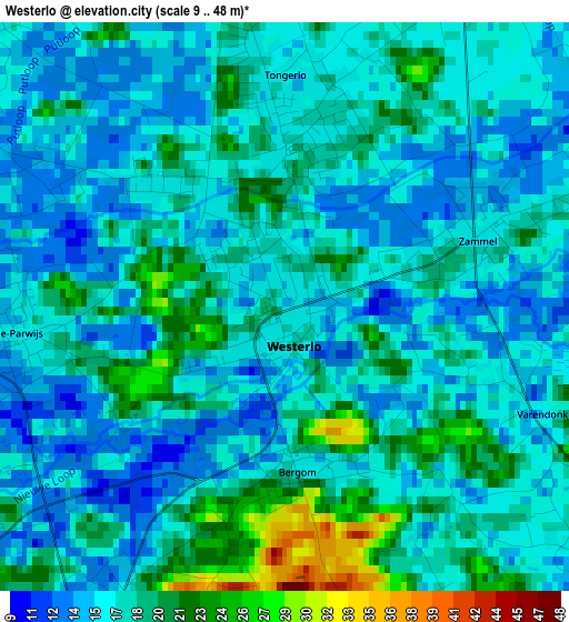
Below is the Elevation map of Westerlo, which displays elevation range with different colors. Scale of the first map is from 9 to 48 m (30 to 157 ft) with average elevation of 16.7 meters (=55 ft) [note 1]
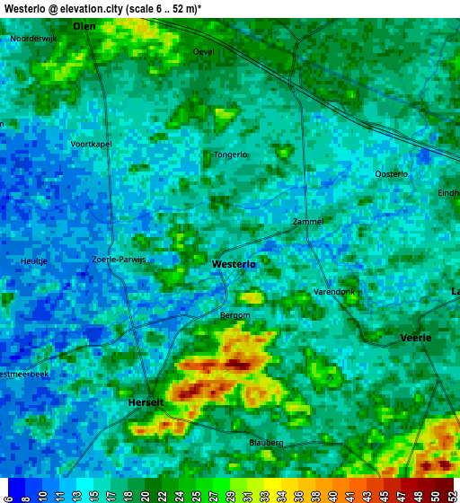
These maps also provides idea of topography and contour of this city, they are displayed at different zoom levels. More info about maps, scale and edge coordinates you can find below images.
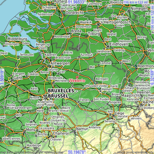
| \ | Map #1 | Map #2 | Topo.Map |
| Scale [m] | 9..48 m | 6..52 m | × |
| Scale [ft] | 30..157 ft | 20..171 ft | × |
| Average | 16.7 m = 55 ft | 17.6 m = 58 ft | × |
| Width | 6.14 km = 3.8 mi | 12.28 km = 7.6 mi | 196.4 km = 122 mi |
| Height | 6.14 km = 3.8 mi | 12.28 km = 7.6 mi | 196.4 km = 122 mi |
| ↑Max Latitude | 51.118083° | 51.14566° | 51.96533° |
| Latitude at center | 51.09049° | 51.09049° | 51.09049° |
| ↓Min Latitude | 51.06288° | 51.035254° | 50.19878° |
| ← Min Longitude | 4.871495° | 4.827549° | 3.50919° |
| Longitude center | 4.91544° | 4.91544° | 4.91544° |
| →Max Longitude | 4.959385° | 5.003331° | 6.32169° |
Nearby cities:
Cities around Westerlo sort by population:
• Heist-op-den-Berg elevation 36 m
13.2 km,  262°
262°
• Geel 22 m
9.8 km,  31°
31°
• Aarschot 14 m
12.7 km,  205°
205°
• Herentals 16 m
11.2 km,  328°
328°
• Diest 22 m
14.7 km,  139°
139°
• Tessenderlo 27 m
12.4 km,  103°
103°
• Herselt 18 m
4.9 km, 208°
• Olen 25 m
7.1 km, 326°
• Meerhout 30 m
12.3 km,  67°
67°
• Hulshout 13 m
8.9 km, 258°
• Begijnendijk 13 m
12.1 km,  229°
229°
• Herenthout 12 m
12.4 km,  296°
296°
Multilingual:
 En español:
Westerlo elevación 14 m.
 En France:
Westerlo élévation 14 m.


Sources and notes:
- [note 1] Map square and city borders are not equal. Map elevation data is calculated only from area inside that square.
- [src 1] Elevation data from geonames database provided with same terms of usage.
- [src 2] The elevation map of Westerlo is generated using elevation data from NASA's 3 arcsec (90m) resolution SRTM data.
- [src 3] Base (background) map © OpenStreetMap contributors tiles are generated by Geofabrik and OpenTopoMap.
Copyright & License:
This Westerlo Elevation Map is licensed under CC BY-SA. You may reuse any part from this page, if you give a proper credit by linking to this URL:
 More info on terms of use page.