Zonnebeke elevation
Zonnebeke (Flanders, Provincie West-Vlaanderen), Belgium elevation is 34 meters and Zonnebeke elevation in feet is 112 ft above sea level [src 1]. Zonnebeke is a populated place (feature code) with elevation that is 65 meters (213 ft) smaller than average city elevation in Belgium.
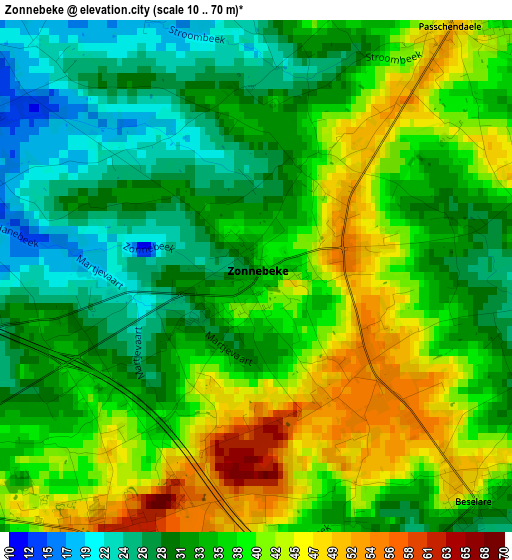
Below is the Elevation map of Zonnebeke, which displays elevation range with different colors. Scale of the first map is from 10 to 70 m (33 to 230 ft) with average elevation of 35.8 meters (=117 ft) [note 1]
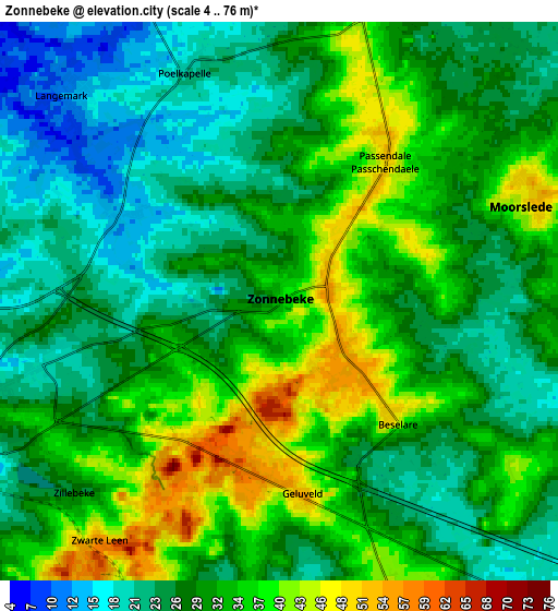
These maps also provides idea of topography and contour of this city, they are displayed at different zoom levels. More info about maps, scale and edge coordinates you can find below images.
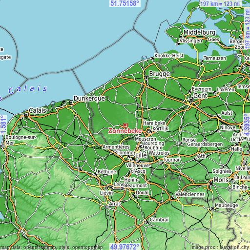
| \ | Map #1 | Map #2 | Topo.Map |
| Scale [m] | 10..70 m | 4..76 m | × |
| Scale [ft] | 33..230 ft | 13..249 ft | × |
| Average | 35.8 m = 117 ft | 30 m = 98 ft | × |
| Width | 6.17 km = 3.8 mi | 12.33 km = 7.7 mi | 197.3 km = 122.6 mi |
| Height | 6.17 km = 3.8 mi | 12.33 km = 7.7 mi | 197.3 km = 122.6 mi |
| ↑Max Latitude | 50.900323° | 50.92803° | 51.75158° |
| Latitude at center | 50.8726° | 50.8726° | 50.8726° |
| ↓Min Latitude | 50.84486° | 50.817104° | 49.97672° |
| ← Min Longitude | 2.943305° | 2.899359° | 1.581° |
| Longitude center | 2.98725° | 2.98725° | 2.98725° |
| →Max Longitude | 3.031195° | 3.075141° | 4.3935° |
Nearby cities:
Cities around Zonnebeke sort by population:
• Roeselare elevation 22 m
12.6 km,  49°
49°
• Ieper 24 m
7.5 km,  251°
251°
• Menen 18 m
12.7 km,  131°
131°
• Wevelgem 15 m
15 km,  122°
122°
• Izegem 18 m
16.5 km,  73°
73°
• Wervik 18 m
10.8 km,  160°
160°
• Staden 21 m
11.5 km,  9°
9°
• Moorslede 43 m
5.6 km, 67°
• Hooglede 41 m
14 km,  28°
28°
• Ledegem 20 m
9.7 km,  99°
99°
• Houthulst 18 m
12 km,  347°
347°
• Saint-Yvon 27 m
15.4 km,  200°
200°
Multilingual:
 En español:
Zonnebeke elevación 34 m.
 En France:
Zonnebeke élévation 34 m.
 Auf Deutsch:
Zonnebeke höhe über dem Meeresspiegel ist 34 m.

Sources and notes:
- [note 1] Map square and city borders are not equal. Map elevation data is calculated only from area inside that square.
- [src 1] Elevation data from geonames database provided with same terms of usage.
- [src 2] The elevation map of Zonnebeke is generated using elevation data from NASA's 3 arcsec (90m) resolution SRTM data.
- [src 3] Base (background) map © OpenStreetMap contributors tiles are generated by Geofabrik and OpenTopoMap.
Copyright & License:
This Zonnebeke Elevation Map is licensed under CC BY-SA. You may reuse any part from this page, if you give a proper credit by linking to this URL:
 More info on terms of use page.