Panchagarh elevation
Panchagarh (Rangpur Division), Bangladesh elevation is 79 meters and Panchagarh elevation in feet is 259 ft above sea level [src 1]. Panchagarh is a populated place (feature code) with elevation that is 61 meters (200 ft) bigger than average city elevation in Bangladesh.
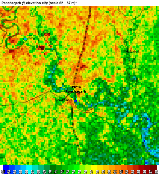
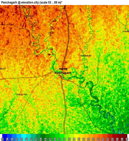
Below is the Elevation map of Panchagarh, which displays elevation range with different colors. Scale of the first map is from 62 to 87 m (203 to 285 ft) with average elevation of 75.2 meters (=247 ft) [note 1]
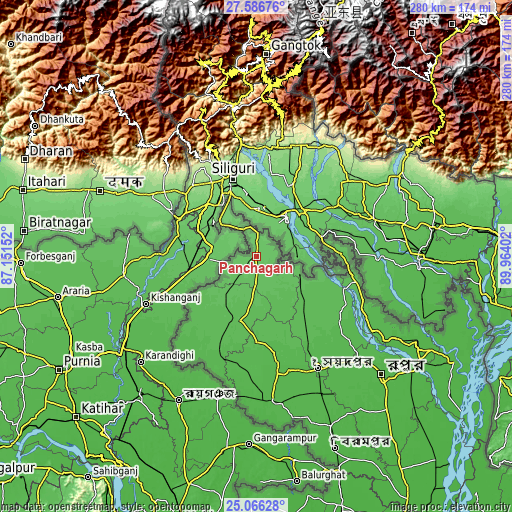
These maps also provides idea of topography and contour of this city, they are displayed at different zoom levels. More info about maps, scale and edge coordinates you can find below images.
| \ | Map #1 | Map #2 | Topo.Map |
| Scale [m] | 62..87 m | 53..89 m | × |
| Scale [ft] | 203..285 ft | 174..292 ft | × |
| Average | 75.2 m = 247 ft | 75 m = 246 ft | × |
| Width | 8.76 km = 5.4 mi | 17.52 km = 10.9 mi | 280.3 km = 174.2 mi |
| Height | 8.76 km = 5.4 mi | 17.52 km = 10.9 mi | 280.3 km = 174.2 mi |
| ↑Max Latitude | 26.372758° | 26.412123° | 27.58676° |
| Latitude at center | 26.33338° | 26.33338° | 26.33338° |
| ↓Min Latitude | 26.293988° | 26.254583° | 25.06628° |
| ← Min Longitude | 88.513825° | 88.469879° | 87.15152° |
| Longitude center | 88.55777° | 88.55777° | 88.55777° |
| →Max Longitude | 88.601715° | 88.645661° | 89.96402° |
Nearby cities:
Cities around Panchagarh sort by population:
• Rangpur elevation 36 m
95.2 km,  133°
133°
• Dinājpur 42 m
78.9 km,  174°
174°
• Saidpur 43 m
70.2 km,  151°
151°
• Joypur Hāt 24 m
144.8 km,  161°
161°
• Thākurgaon 57 m
34.7 km,  194°
194°
• Lalmonirhat 38 m
100 km,  117°
117°
• Chilmāri 27 m
140.9 km, 127°
• Nageswari 33 m
120.2 km,  109°
109°
• Parbatipur 39 m
83.3 km, 153°
• Pīrgaaj 49 m
56.7 km,  200°
200°
• Badarganj 40 m
88.5 km, 145°
• Gaibandha 28 m
149 km,  138°
138°
Multilingual:
 En español:
Panchagarh elevación 79 m.
 En France:
Panchagarh élévation 79 m.
 Auf Deutsch:
Panchagarh höhe über dem Meeresspiegel ist 79 m.

Sources and notes:
- [note 1] Map square and city borders are not equal. Map elevation data is calculated only from area inside that square.
- [src 1] Elevation data from geonames database provided with same terms of usage.
- [src 2] The elevation map of Panchagarh is generated using elevation data from NASA's 3 arcsec (90m) resolution SRTM data.
- [src 3] Base (background) map © OpenStreetMap contributors tiles are generated by Geofabrik and OpenTopoMap.
Copyright & License:
This Panchagarh Elevation Map is licensed under CC BY-SA. You may reuse any part from this page, if you give a proper credit by linking to this URL:
 More info on terms of use page.