Hacı Zeynalabdin elevation
Hacı Zeynalabdin (Sumqayit), Azerbaijan elevation is -17 meters and Hacı Zeynalabdin elevation in feet is -56 ft above sea level [src 1]. Hacı Zeynalabdin is a populated place (feature code) with elevation that is 377 meters (1237 ft) smaller than average city elevation in Azerbaijan.
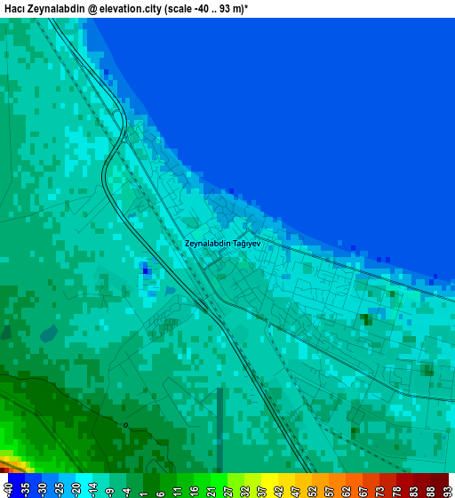
Below is the Elevation map of Hacı Zeynalabdin, which displays elevation range with different colors. Scale of the first map is from -40 to 93 m (-131 to 305 ft) with average elevation of -16.1 meters (=-53 ft) [note 1]
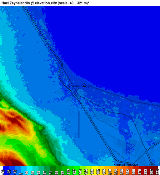
These maps also provides idea of topography and contour of this city, they are displayed at different zoom levels. More info about maps, scale and edge coordinates you can find below images.
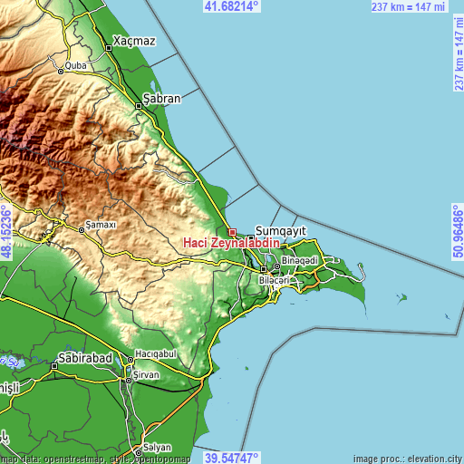
| \ | Map #1 | Map #2 | Topo.Map |
| Scale [m] | -40..93 m | -40..321 m | × |
| Scale [ft] | -131..305 ft | -131..1053 ft | × |
| Average | -16.1 m = -53 ft | 6.3 m = 21 ft | × |
| Width | 7.42 km = 4.6 mi | 14.83 km = 9.2 mi | 237.4 km = 147.5 mi |
| Height | 7.42 km = 4.6 mi | 14.83 km = 9.2 mi | 237.3 km = 147.5 mi |
| ↑Max Latitude | 40.656676° | 40.690006° | 41.68214° |
| Latitude at center | 40.62333° | 40.62333° | 40.62333° |
| ↓Min Latitude | 40.589967° | 40.556587° | 39.54747° |
| ← Min Longitude | 49.514665° | 49.470719° | 48.15236° |
| Longitude center | 49.55861° | 49.55861° | 49.55861° |
| →Max Longitude | 49.602555° | 49.646501° | 50.96486° |
Nearby cities:
Cities around Hacı Zeynalabdin sort by population:
• Sumqayıt elevation -11 m
10 km,  111°
111°
• Bilajari 25 m
28.8 km,  133°
133°
• Khirdalan 75 m
25.6 km,  139°
139°
• Binagadi 44 m
28.7 km, 127°
• Saray 42 m
16.7 km, 126°
• Corat -15 m
13.6 km, 114°
• Qobu 54 m
27.6 km,  151°
151°
• Ceyranbatan 22 m
12.5 km, 136°
• Khodzhi-Gasan 30 m
29.4 km, 142°
• Digah 39 m
30.4 km,  118°
118°
• Gyuzdek 156 m
29.6 km,  159°
159°
• Şuraabad -22 m
23.2 km,  340°
340°
Multilingual:
 En español:
Hacı Zeynalabdin elevación -17 m.
 En France:
Hacı Zeynalabdin élévation -17 m.
 Auf Deutsch:
Hacı Zeynalabdin höhe über dem Meeresspiegel ist -17 m.

Sources and notes:
- [note 1] Map square and city borders are not equal. Map elevation data is calculated only from area inside that square.
- [src 1] Elevation data from geonames database provided with same terms of usage.
- [src 2] The elevation map of Hacı Zeynalabdin is generated using elevation data from NASA's 3 arcsec (90m) resolution SRTM data.
- [src 3] Base (background) map © OpenStreetMap contributors tiles are generated by Geofabrik and OpenTopoMap.
Copyright & License:
This Hacı Zeynalabdin Elevation Map is licensed under CC BY-SA. You may reuse any part from this page, if you give a proper credit by linking to this URL:
 More info on terms of use page.