Xankandi elevation
Xankandi (Xankǝndi), Azerbaijan elevation is 850 meters and Xankandi elevation in feet is 2789 ft above sea level [src 1]. Xankandi is a populated place (feature code) with elevation that is 490 meters (1608 ft) bigger than average city elevation in Azerbaijan.
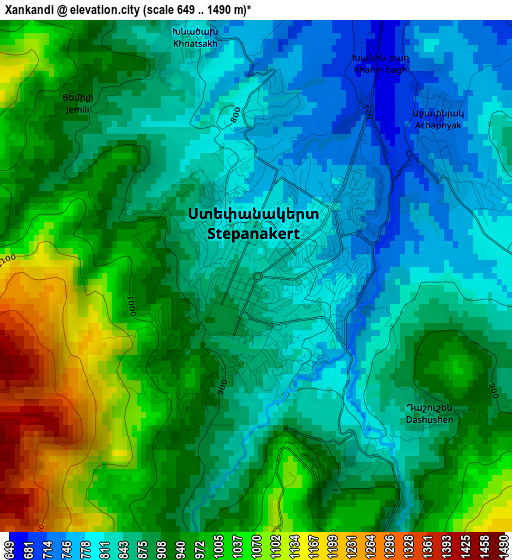
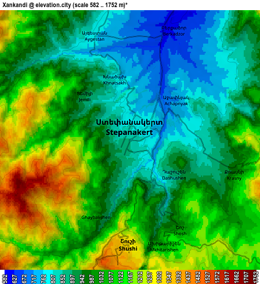
Below is the Elevation map of Xankandi, which displays elevation range with different colors. Scale of the first map is from 649 to 1490 m (2129 to 4888 ft) with average elevation of 904.5 meters (=2968 ft) [note 1]
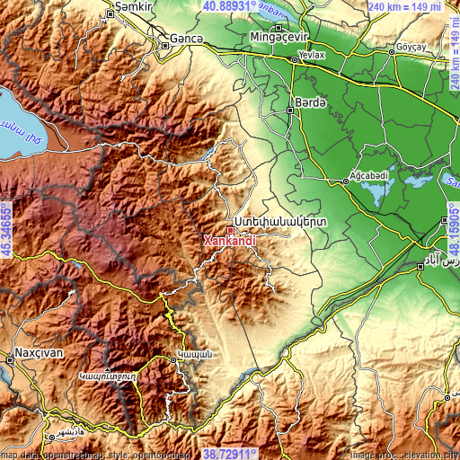
These maps also provides idea of topography and contour of this city, they are displayed at different zoom levels. More info about maps, scale and edge coordinates you can find below images.
| \ | Map #1 | Map #2 | Topo.Map |
| Scale [m] | 649..1490 m | 582..1752 m | × |
| Scale [ft] | 2129..4888 ft | 1909..5748 ft | × |
| Average | 904.5 m = 2968 ft | 1010.5 m = 3315 ft | × |
| Width | 7.51 km = 4.7 mi | 15.01 km = 9.3 mi | 240.2 km = 149.3 mi |
| Height | 7.51 km = 4.7 mi | 15.01 km = 9.3 mi | 240.2 km = 149.3 mi |
| ↑Max Latitude | 39.851445° | 39.885174° | 40.88931° |
| Latitude at center | 39.8177° | 39.8177° | 39.8177° |
| ↓Min Latitude | 39.783938° | 39.750159° | 38.72911° |
| ← Min Longitude | 46.708855° | 46.664909° | 45.34655° |
| Longitude center | 46.7528° | 46.7528° | 46.7528° |
| →Max Longitude | 46.796745° | 46.840691° | 48.15905° |
Nearby cities:
Cities around Xankandi sort by population:
• Ağdam elevation 374 m
24.3 km,  37°
37°
• Fizuli 419 m
41.3 km,  125°
125°
• Shushi 1339 m
6.4 km,  182°
182°
• Martakert 438 m
44.1 km,  7°
7°
• Jebrail 607 m
52.2 km,  153°
153°
• Xocalı 582 m
11.1 km,  16°
16°
• Novyy Karanlug 336 m
30.8 km,  94°
94°
• Hadrut 733 m
40.8 km,  144°
144°
• Laçın 889 m
29.9 km,  215°
215°
• Askyaran 498 m
15.1 km,  26°
26°
• Vank 1031 m
31.6 km,  325°
325°
• Qırmızı Bazar 638 m
23.1 km, 132°
Multilingual:
 En español:
Khankendi elevación 850 m.
 En France:
Khankendi élévation 850 m.
 Auf Deutsch:
Chankändi höhe über dem Meeresspiegel ist 850 m.

Sources and notes:
- [note 1] Map square and city borders are not equal. Map elevation data is calculated only from area inside that square.
- [src 1] Elevation data from geonames database provided with same terms of usage.
- [src 2] The elevation map of Xankandi is generated using elevation data from NASA's 3 arcsec (90m) resolution SRTM data.
- [src 3] Base (background) map © OpenStreetMap contributors tiles are generated by Geofabrik and OpenTopoMap.
Copyright & License:
This Xankandi Elevation Map is licensed under CC BY-SA. You may reuse any part from this page, if you give a proper credit by linking to this URL:
 More info on terms of use page.