Lend elevation
Lend (Styria, Graz Stadt), Austria elevation is 352 meters and Lend elevation in feet is 1155 ft above sea level [src 1]. Lend is a section of populated place (feature code) with elevation that is 157 meters (515 ft) smaller than average city elevation in Austria.
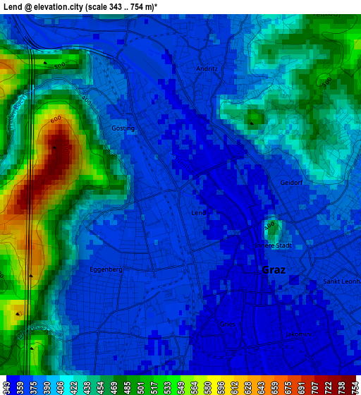
Below is the Elevation map of Lend, which displays elevation range with different colors. Scale of the first map is from 343 to 754 m (1125 to 2474 ft) with average elevation of 412 meters (=1352 ft) [note 1]
These maps also provides idea of topography and contour of this city, they are displayed at different zoom levels. More info about maps, scale and edge coordinates you can find below images.
| \ | Map #1 | Map #2 | Topo.Map |
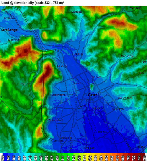
| Scale [m] | 343..754 m | 332..754 m | × |
| Scale [ft] | 1125..2474 ft | 1089..2474 ft | × |
| Average | 412 m = 1352 ft | 437.6 m = 1436 ft | × |
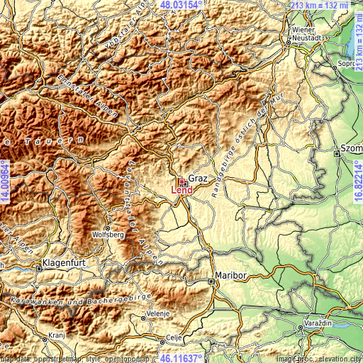
| Width | 6.65 km = 4.1 mi | 13.31 km = 8.3 mi | 212.9 km = 132.3 mi |
| Height | 6.65 km = 4.1 mi | 13.31 km = 8.3 mi | 212.9 km = 132.3 mi |
| ↑Max Latitude | 47.112476° | 47.142375° | 48.03154° |
| Latitude at center | 47.08256° | 47.08256° | 47.08256° |
| ↓Min Latitude | 47.052627° | 47.022678° | 46.11637° |
| ← Min Longitude | 15.371945° | 15.327999° | 14.00964° |
| Longitude center | 15.41589° | 15.41589° | 15.41589° |
| →Max Longitude | 15.459835° | 15.503781° | 16.82214° |
Nearby cities:
Cities around Lend sort by population:
• Graz elevation 363 m
3.1 km,  124°
124°
• Jakomini 344 m
4.1 km,  140°
140°
• Gries 342 m
2.3 km,  164°
164°
• Geidorf 397 m
2.1 km,  85°
85°
• Eggenberg 369 m
1.9 km,  222°
222°
• Andritz 366 m
3.5 km,  9°
9°
• Sankt Leonhard 365 m
3.5 km,  114°
114°
• Wetzelsdorf 362 m
3.5 km,  200°
200°
• Waltendorf 377 m
4.2 km, 114°
• Gösting 376 m
2.2 km,  321°
321°
• Innere Stadt 361 m
2.6 km,  133°
133°
• Thal 451 m
4.2 km,  260°
260°
Multilingual:
 En español:
Lend elevación 352 m.
 En France:
Lend élévation 352 m.


Sources and notes:
- [note 1] Map square and city borders are not equal. Map elevation data is calculated only from area inside that square.
- [src 1] Elevation data from geonames database provided with same terms of usage.
- [src 2] The elevation map of Lend is generated using elevation data from NASA's 3 arcsec (90m) resolution SRTM data.
- [src 3] Base (background) map © OpenStreetMap contributors tiles are generated by Geofabrik and OpenTopoMap.
Copyright & License:
This Lend Elevation Map is licensed under CC BY-SA. You may reuse any part from this page, if you give a proper credit by linking to this URL:
 More info on terms of use page.