Kreuzstetten elevation
Kreuzstetten (Lower Austria, Politischer Bezirk Mistelbach), Austria elevation is 223 meters and Kreuzstetten elevation in feet is 732 ft above sea level [src 1]. Kreuzstetten is a seat of a third-order administrative division (feature code) with elevation that is 286 meters (938 ft) smaller than average city elevation in Austria.
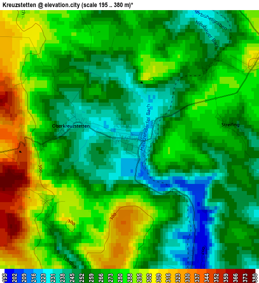
Below is the Elevation map of Kreuzstetten, which displays elevation range with different colors. Scale of the first map is from 195 to 380 m (640 to 1247 ft) with average elevation of 270.4 meters (=887 ft) [note 1]
These maps also provides idea of topography and contour of this city, they are displayed at different zoom levels. More info about maps, scale and edge coordinates you can find below images.
| \ | Map #1 | Topo.Map |
| Scale [m] | 195..380 m | × |
| Scale [ft] | 640..1247 ft | × |
| Average | 270.4 m = 887 ft | × |
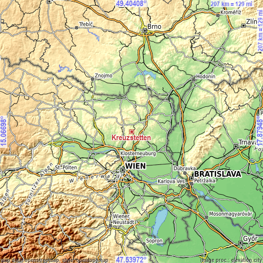
| Width | 6.48 km = 4 mi | 207.3 km = 128.8 mi |
| Height | 6.48 km = 4 mi | 207.3 km = 128.8 mi |
| ↑Max Latitude | 48.509582° | 49.40408° |
| Latitude at center | 48.48046° | 48.48046° |
| ↓Min Latitude | 48.451321° | 47.53972° |
| ← Min Longitude | 16.429285° | 15.06698° |
| Longitude center | 16.47323° | 16.47323° |
| →Max Longitude | 16.517175° | 17.87948° |
Nearby cities:
Cities around Kreuzstetten sort by population:
• Wolkersdorf im Weinviertel elevation 173 m
11.3 km,  163°
163°
• Gaweinstal 207 m
8.5 km,  90°
90°
• Ernstbrunn 352 m
10.8 km,  302°
302°
• Ladendorf 211 m
5.9 km,  7°
7°
• Bad Pirawarth 180 m
9.8 km,  108°
108°
• Ulrichskirchen 204 m
9 km,  175°
175°
• Asparn an der Zaya 215 m
11.6 km, 9°
• Schleinbach 247 m
7.1 km, 183°
• Großrußbach 269 m
4.2 km,  260°
260°
• Niederleis 265 m
9.4 km,  325°
325°
• Harmannsdorf 175 m
11.9 km,  218°
218°
• Hochleithen 212 m
5.2 km,  125°
125°
Multilingual:
 En español:
Kreuzstetten elevación 223 m.
 En France:
Kreuzstetten élévation 223 m.
 Auf Deutsch:
Kreuzstetten höhe über dem Meeresspiegel ist 223 m.

Sources and notes:
- [note 1] Map square and city borders are not equal. Map elevation data is calculated only from area inside that square.
- [src 1] Elevation data from geonames database provided with same terms of usage.
- [src 2] The elevation map of Kreuzstetten is generated using elevation data from NASA's 3 arcsec (90m) resolution SRTM data.
- [src 3] Base (background) map © OpenStreetMap contributors tiles are generated by Geofabrik and OpenTopoMap.
Copyright & License:
This Kreuzstetten Elevation Map is licensed under CC BY-SA. You may reuse any part from this page, if you give a proper credit by linking to this URL:
 More info on terms of use page.