St. Martin of Tennengebirge elevation
St. Martin of Tennengebirge (Salzburg, Politischer Bezirk Sankt Johann im Pongau), Austria elevation is 960 meters and St. Martin of Tennengebirge elevation in feet is 3150 ft above sea level [src 1]. St. Martin of Tennengebirge is a populated place (feature code) with elevation that is 451 meters (1480 ft) bigger than average city elevation in Austria.
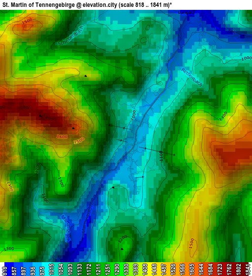
Below is the Elevation map of St. Martin of Tennengebirge, which displays elevation range with different colors. Scale of the first map is from 818 to 1841 m (2684 to 6040 ft) with average elevation of 1212.5 meters (=3978 ft) [note 1]
These maps also provides idea of topography and contour of this city, they are displayed at different zoom levels. More info about maps, scale and edge coordinates you can find below images.
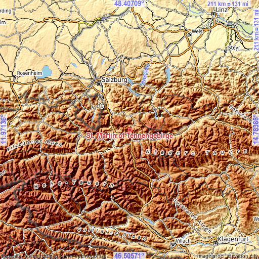
| \ | Map #1 | Topo.Map |
| Scale [m] | 818..1841 m | × |
| Scale [ft] | 2684..6040 ft | × |
| Average | 1212.5 m = 3978 ft | × |
| Width | 6.61 km = 4.1 mi | 211.4 km = 131.4 mi |
| Height | 6.61 km = 4.1 mi | 211.4 km = 131.4 mi |
| ↑Max Latitude | 47.4947° | 48.40709° |
| Latitude at center | 47.465° | 47.465° |
| ↓Min Latitude | 47.435283° | 46.50571° |
| ← Min Longitude | 13.333665° | 11.97136° |
| Longitude center | 13.37761° | 13.37761° |
| →Max Longitude | 13.421555° | 14.78386° |
Nearby cities:
Cities around St. Martin of Tennengebirge sort by population:
• Bischofshofen elevation 558 m
13.2 km,  246°
246°
• Altenmarkt im Pongau 841 m
9.5 km,  162°
162°
• Radstadt 839 m
10.6 km,  149°
149°
• Eben im Pongau 849 m
7.4 km,  166°
166°
• Mitterberghütten 564 m
14.1 km,  239°
239°
• Hof 935 m
13.6 km,  199°
199°
• Abtenau 717 m
11.2 km,  347°
347°
• Flachau 907 m
13.5 km,  175°
175°
• Filzmoos 1051 m
11 km,  108°
108°
• Werfenweng 890 m
9.2 km,  267°
267°
• Hüttau 697 m
7.6 km,  224°
224°
• Pfarrwerfen 541 m
13 km, 266°
Multilingual:
 En español:
St. Martin of Tennengebirge elevación 960 m.
 En France:
St. Martin of Tennengebirge élévation 960 m.
 Auf Deutsch:
Sankt Martin am Tennengebirge höhe über dem Meeresspiegel ist 960 m.
 На русском:
St. Martin of Tennengebirge высота над уровнем моря 960 м
Sources and notes:
- [note 1] Map square and city borders are not equal. Map elevation data is calculated only from area inside that square.
- [src 1] Elevation data from geonames database provided with same terms of usage.
- [src 2] The elevation map of St. Martin of Tennengebirge is generated using elevation data from NASA's 3 arcsec (90m) resolution SRTM data.
- [src 3] Base (background) map © OpenStreetMap contributors tiles are generated by Geofabrik and OpenTopoMap.
Copyright & License:
This St. Martin of Tennengebirge Elevation Map is licensed under CC BY-SA. You may reuse any part from this page, if you give a proper credit by linking to this URL:
 More info on terms of use page.