Altheim elevation
Altheim (Upper Austria, Politischer Bezirk Braunau am Inn), Austria elevation is 362 meters and Altheim elevation in feet is 1188 ft above sea level [src 1]. Altheim is a seat of a third-order administrative division (feature code) with elevation that is 147 meters (482 ft) smaller than average city elevation in Austria.
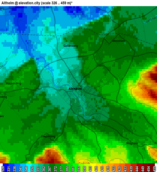
Below is the Elevation map of Altheim, which displays elevation range with different colors. Scale of the first map is from 326 to 459 m (1070 to 1506 ft) with average elevation of 369.8 meters (=1213 ft) [note 1]
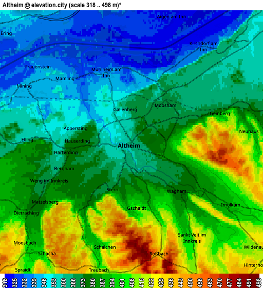
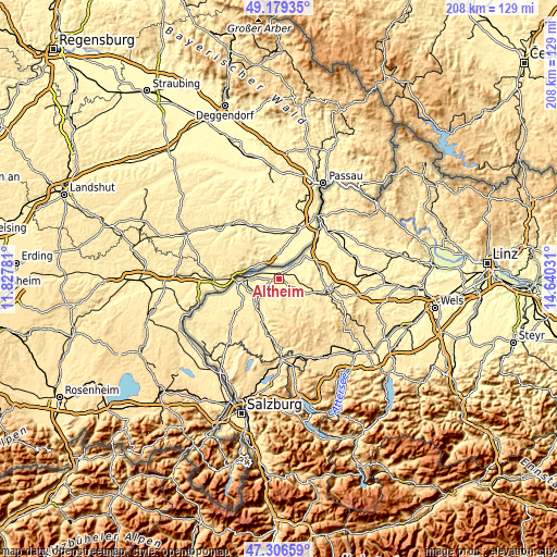
These maps also provides idea of topography and contour of this city, they are displayed at different zoom levels. More info about maps, scale and edge coordinates you can find below images.
| \ | Map #1 | Map #2 | Topo.Map |
| Scale [m] | 326..459 m | 318..498 m | × |
| Scale [ft] | 1070..1506 ft | 1043..1634 ft | × |
| Average | 369.8 m = 1213 ft | 378.1 m = 1240 ft | × |
| Width | 6.51 km = 4 mi | 13.01 km = 8.1 mi | 208.2 km = 129.4 mi |
| Height | 6.51 km = 4 mi | 13.01 km = 8.1 mi | 208.2 km = 129.4 mi |
| ↑Max Latitude | 48.280793° | 48.31003° | 49.17935° |
| Latitude at center | 48.25154° | 48.25154° | 48.25154° |
| ↓Min Latitude | 48.22227° | 48.192984° | 47.30659° |
| ← Min Longitude | 13.190115° | 13.146169° | 11.82781° |
| Longitude center | 13.23406° | 13.23406° | 13.23406° |
| →Max Longitude | 13.278005° | 13.321951° | 14.64031° |
Nearby cities:
Cities around Altheim sort by population:
• Braunau am Inn elevation 350 m
14.1 km,  272°
272°
• Laab 326 m
13.4 km, 274°
• Haselbach 352 m
13.2 km, 270°
• Mauerkirchen 399 m
10 km,  228°
228°
• Obernberg am Inn 356 m
10.7 km,  43°
43°
• Uttendorf 393 m
13.2 km,  218°
218°
• Weng im Innkreis 368 m
4.5 km,  246°
246°
• Sankt Peter am Hart 371 m
10.2 km, 270°
• Maria Schmolln 558 m
12.6 km,  184°
184°
• Weilbach 382 m
10.6 km,  74°
74°
• Wippenham 425 m
11.2 km,  106°
106°
• Sankt Georgen bei Obernberg am Inn 356 m
8.6 km,  58°
58°
Multilingual:
 En español:
Altheim elevación 362 m.
 En France:
Altheim élévation 362 m.


Sources and notes:
- [note 1] Map square and city borders are not equal. Map elevation data is calculated only from area inside that square.
- [src 1] Elevation data from geonames database provided with same terms of usage.
- [src 2] The elevation map of Altheim is generated using elevation data from NASA's 3 arcsec (90m) resolution SRTM data.
- [src 3] Base (background) map © OpenStreetMap contributors tiles are generated by Geofabrik and OpenTopoMap.
Copyright & License:
This Altheim Elevation Map is licensed under CC BY-SA. You may reuse any part from this page, if you give a proper credit by linking to this URL:
 More info on terms of use page.