Bad Ischl elevation
Bad Ischl (Upper Austria, Politischer Bezirk Gmunden), Austria elevation is 470 meters and Bad Ischl elevation in feet is 1542 ft above sea level [src 1]. Bad Ischl is a populated place (feature code) with elevation that is 39 meters (128 ft) smaller than average city elevation in Austria.
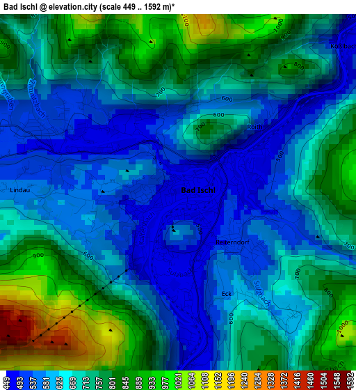
Below is the Elevation map of Bad Ischl, which displays elevation range with different colors. Scale of the first map is from 449 to 1592 m (1473 to 5223 ft) with average elevation of 688.5 meters (=2259 ft) [note 1]
These maps also provides idea of topography and contour of this city, they are displayed at different zoom levels. More info about maps, scale and edge coordinates you can find below images.
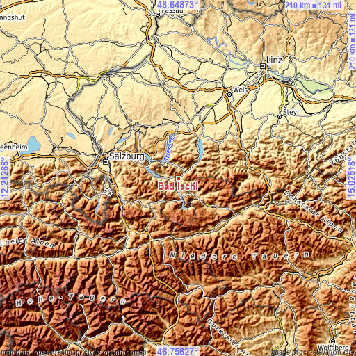
| \ | Map #1 | Topo.Map |
| Scale [m] | 449..1592 m | × |
| Scale [ft] | 1473..5223 ft | × |
| Average | 688.5 m = 2259 ft | × |
| Width | 6.58 km = 4.1 mi | 210.4 km = 130.7 mi |
| Height | 6.58 km = 4.1 mi | 210.4 km = 130.7 mi |
| ↑Max Latitude | 47.740651° | 48.64873° |
| Latitude at center | 47.71109° | 47.71109° |
| ↓Min Latitude | 47.681512° | 46.75627° |
| ← Min Longitude | 13.574985° | 12.21268° |
| Longitude center | 13.61893° | 13.61893° |
| →Max Longitude | 13.662875° | 15.02518° |
Nearby cities:
Cities around Bad Ischl sort by population:
• Ebensee elevation 423 m
16 km,  48°
48°
• Sankt Wolfgang im Salzkammergut 556 m
13.3 km,  283°
283°
• Reiterndorf 494 m
1.1 km,  137°
137°
• Bad Goisern 498 m
7.6 km,  181°
181°
• Gosau 738 m
15.5 km,  204°
204°
• Haiden 500 m
3.8 km, 281°
• Kaltenbach 477 m
0.9 km,  233°
233°
• Strobl 546 m
10.2 km,  273°
273°
• Steinfeld 477 m
1 km,  81°
81°
• Bad Aussee 659 m
16.6 km,  132°
132°
• Altaussee 723 m
13.5 km, 126°
• Steinbach am Attersee 475 m
14.4 km,  337°
337°
Multilingual:
 En español:
Bad Ischl elevación 470 m.
 En France:
Bad Ischl élévation 470 m.
 Auf Deutsch:
Bad Ischl höhe über dem Meeresspiegel ist 470 m.

Sources and notes:
- [note 1] Map square and city borders are not equal. Map elevation data is calculated only from area inside that square.
- [src 1] Elevation data from geonames database provided with same terms of usage.
- [src 2] The elevation map of Bad Ischl is generated using elevation data from NASA's 3 arcsec (90m) resolution SRTM data.
- [src 3] Base (background) map © OpenStreetMap contributors tiles are generated by Geofabrik and OpenTopoMap.
Copyright & License:
This Bad Ischl Elevation Map is licensed under CC BY-SA. You may reuse any part from this page, if you give a proper credit by linking to this URL:
 More info on terms of use page.