Enns elevation
Enns (Upper Austria, Politischer Bezirk Linz-Land), Austria elevation is 268 meters and Enns elevation in feet is 879 ft above sea level [src 1]. Enns is a populated place (feature code) with elevation that is 241 meters (791 ft) smaller than average city elevation in Austria.
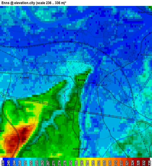
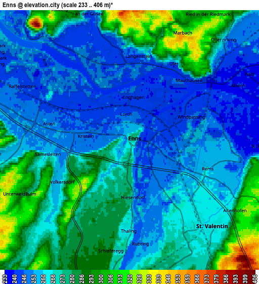
Below is the Elevation map of Enns, which displays elevation range with different colors. Scale of the first map is from 236 to 336 m (774 to 1102 ft) with average elevation of 254.5 meters (=835 ft) [note 1]
These maps also provides idea of topography and contour of this city, they are displayed at different zoom levels. More info about maps, scale and edge coordinates you can find below images.
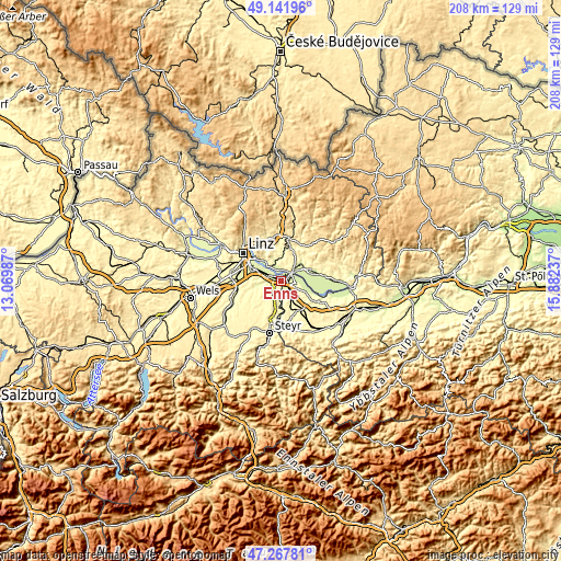
| \ | Map #1 | Map #2 | Topo.Map |
| Scale [m] | 236..336 m | 233..406 m | × |
| Scale [ft] | 774..1102 ft | 764..1332 ft | × |
| Average | 254.5 m = 835 ft | 268 m = 879 ft | × |
| Width | 6.51 km = 4 mi | 13.02 km = 8.1 mi | 208.4 km = 129.5 mi |
| Height | 6.51 km = 4 mi | 13.02 km = 8.1 mi | 208.4 km = 129.5 mi |
| ↑Max Latitude | 48.242735° | 48.271993° | 49.14196° |
| Latitude at center | 48.21346° | 48.21346° | 48.21346° |
| ↓Min Latitude | 48.184168° | 48.15486° | 47.26781° |
| ← Min Longitude | 14.432175° | 14.388229° | 13.06987° |
| Longitude center | 14.47612° | 14.47612° | 14.47612° |
| →Max Longitude | 14.520065° | 14.564011° | 15.88237° |
Nearby cities:
Cities around Enns sort by population:
• Sankt Valentin elevation 269 m
6 km,  149°
149°
• Sankt Georgen an der Gusen 245 m
6.8 km,  343°
343°
• Asten 251 m
4.4 km,  278°
278°
• Sankt Florian 285 m
7.3 km,  263°
263°
• Ennsdorf 245 m
2 km,  95°
95°
• Fisching 247 m
3.7 km,  286°
286°
• Sankt Pantaleon 237 m
6.8 km,  92°
92°
• Ufer 231 m
4.3 km,  24°
24°
• Langenstein 247 m
4.3 km,  0°
0°
• Ried in der Riedmark 303 m
7.5 km,  30°
30°
• Abwinden 253 m
6.3 km,  323°
323°
• Raffelstetten 245 m
6.1 km,  296°
296°
Multilingual:
 En español:
Enns elevación 268 m.
 En France:
Enns élévation 268 m.


Sources and notes:
- [note 1] Map square and city borders are not equal. Map elevation data is calculated only from area inside that square.
- [src 1] Elevation data from geonames database provided with same terms of usage.
- [src 2] The elevation map of Enns is generated using elevation data from NASA's 3 arcsec (90m) resolution SRTM data.
- [src 3] Base (background) map © OpenStreetMap contributors tiles are generated by Geofabrik and OpenTopoMap.
Copyright & License:
This Enns Elevation Map is licensed under CC BY-SA. You may reuse any part from this page, if you give a proper credit by linking to this URL:
 More info on terms of use page.