Fügenberg elevation
Fügenberg (Tyrol, Politischer Bezirk Schwaz), Austria elevation is 687 meters and Fügenberg elevation in feet is 2254 ft above sea level [src 1]. Fügenberg is a seat of a third-order administrative division (feature code) with elevation that is 178 meters (584 ft) bigger than average city elevation in Austria.
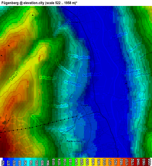
Below is the Elevation map of Fügenberg, which displays elevation range with different colors. Scale of the first map is from 522 to 1958 m (1713 to 6424 ft) with average elevation of 928 meters (=3045 ft) [note 1]
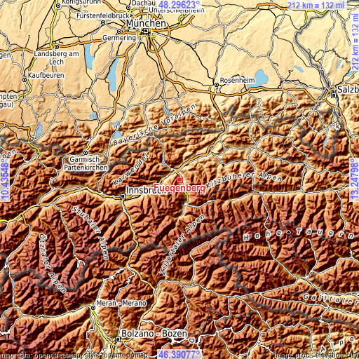
These maps also provides idea of topography and contour of this city, they are displayed at different zoom levels. More info about maps, scale and edge coordinates you can find below images.
| \ | Map #1 | Topo.Map |
| Scale [m] | 522..1958 m | × |
| Scale [ft] | 1713..6424 ft | × |
| Average | 928 m = 3045 ft | × |
| Width | 6.62 km = 4.1 mi | 211.9 km = 131.7 mi |
| Height | 6.62 km = 4.1 mi | 211.9 km = 131.7 mi |
| ↑Max Latitude | 47.381864° | 48.29623° |
| Latitude at center | 47.3521° | 47.3521° |
| ↓Min Latitude | 47.322319° | 46.39077° |
| ← Min Longitude | 11.797785° | 10.43548° |
| Longitude center | 11.84173° | 11.84173° |
| →Max Longitude | 11.885675° | 13.24798° |
Nearby cities:
Cities around Fügenberg sort by population:
• Jenbach elevation 564 m
6.8 km,  310°
310°
• Fügen 544 m
0.8 km,  134°
134°
• Buch in Tirol 553 m
7.1 km,  290°
290°
• Schlitters 532 m
3.2 km,  356°
356°
• Ried im Zillertal 588 m
6.1 km,  162°
162°
• Kapfing 600 m
2.2 km, 163°
• Wiesing 566 m
6.8 km,  330°
330°
• Uderns 541 m
4.4 km,  154°
154°
• Strass im Zillertal 524 m
5.1 km,  341°
341°
• Hart im Zillertal 534 m
1.7 km,  93°
93°
• Gallzein 895 m
5.6 km, 288°
• Bruck am Ziller 567 m
4.3 km,  9°
9°
Multilingual:
 En español:
Fügenberg elevación 687 m.
 En France:
Fügenberg élévation 687 m.
 Auf Deutsch:
Fügenberg höhe über dem Meeresspiegel ist 687 m.

Sources and notes:
- [note 1] Map square and city borders are not equal. Map elevation data is calculated only from area inside that square.
- [src 1] Elevation data from geonames database provided with same terms of usage.
- [src 2] The elevation map of Fügenberg is generated using elevation data from NASA's 3 arcsec (90m) resolution SRTM data.
- [src 3] Base (background) map © OpenStreetMap contributors tiles are generated by Geofabrik and OpenTopoMap.
Copyright & License:
This Fügenberg Elevation Map is licensed under CC BY-SA. You may reuse any part from this page, if you give a proper credit by linking to this URL:
 More info on terms of use page.