Gallneukirchen elevation
Gallneukirchen (Upper Austria, Politischer Bezirk Urfahr-Umgebung), Austria elevation is 339 meters and Gallneukirchen elevation in feet is 1112 ft above sea level [src 1]. Gallneukirchen is a seat of a third-order administrative division (feature code) with elevation that is 170 meters (558 ft) smaller than average city elevation in Austria.
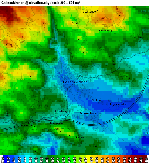
Below is the Elevation map of Gallneukirchen, which displays elevation range with different colors. Scale of the first map is from 299 to 591 m (981 to 1939 ft) with average elevation of 398.8 meters (=1308 ft) [note 1]
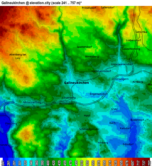
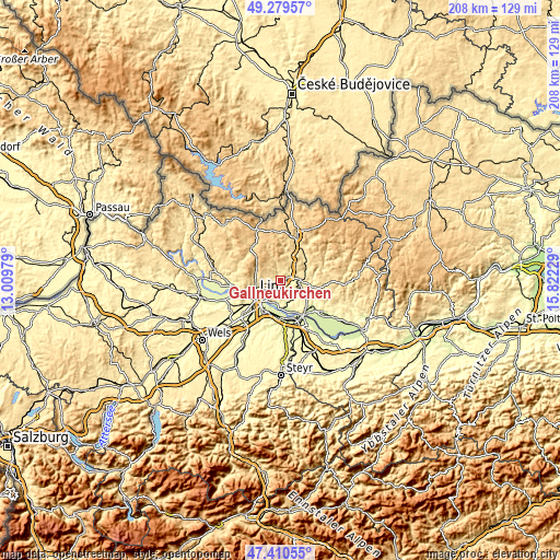
These maps also provides idea of topography and contour of this city, they are displayed at different zoom levels. More info about maps, scale and edge coordinates you can find below images.
| \ | Map #1 | Map #2 | Topo.Map |
| Scale [m] | 299..591 m | 241..757 m | × |
| Scale [ft] | 981..1939 ft | 791..2484 ft | × |
| Average | 398.8 m = 1308 ft | 437.3 m = 1435 ft | × |
| Width | 6.49 km = 4 mi | 12.99 km = 8.1 mi | 207.8 km = 129.1 mi |
| Height | 6.49 km = 4 mi | 12.99 km = 8.1 mi | 207.8 km = 129.1 mi |
| ↑Max Latitude | 48.382825° | 48.412003° | 49.27957° |
| Latitude at center | 48.35363° | 48.35363° | 48.35363° |
| ↓Min Latitude | 48.324419° | 48.29519° | 47.41055° |
| ← Min Longitude | 14.372095° | 14.328149° | 13.00979° |
| Longitude center | 14.41604° | 14.41604° | 14.41604° |
| →Max Longitude | 14.459985° | 14.503931° | 15.82229° |
Nearby cities:
Cities around Gallneukirchen sort by population:
• Steyregg elevation 252 m
8.3 km,  204°
204°
• Pregarten 423 m
8.6 km,  89°
89°
• Hagenberg im Mühlkreis 456 m
7.6 km,  77°
77°
• Luftenberg an der Donau 298 m
8.8 km,  181°
181°
• Schweinbach 337 m
1.6 km,  162°
162°
• Mittertreffling 360 m
4.1 km,  246°
246°
• Katsdorf 303 m
5.9 km,  132°
132°
• Wartberg ob der Aist 462 m
6.8 km,  95°
95°
• Altenberg bei Linz 586 m
5.3 km,  293°
293°
• Plesching 253 m
6.8 km,  237°
237°
• Alberndorf in der Riedmark 564 m
5.8 km,  358°
358°
• Engerwitzdorf 322 m
2.1 km,  116°
116°
Multilingual:
 En español:
Gallneukirchen elevación 339 m.
 En France:
Gallneukirchen élévation 339 m.
 Auf Deutsch:
Gallneukirchen höhe über dem Meeresspiegel ist 339 m.

Sources and notes:
- [note 1] Map square and city borders are not equal. Map elevation data is calculated only from area inside that square.
- [src 1] Elevation data from geonames database provided with same terms of usage.
- [src 2] The elevation map of Gallneukirchen is generated using elevation data from NASA's 3 arcsec (90m) resolution SRTM data.
- [src 3] Base (background) map © OpenStreetMap contributors tiles are generated by Geofabrik and OpenTopoMap.
Copyright & License:
This Gallneukirchen Elevation Map is licensed under CC BY-SA. You may reuse any part from this page, if you give a proper credit by linking to this URL:
 More info on terms of use page.