Götzis elevation
Götzis (Vorarlberg, Politischer Bezirk Feldkirch), Austria elevation is 427 meters and Götzis elevation in feet is 1401 ft above sea level [src 1]. Götzis is a seat of a third-order administrative division (feature code) with elevation that is 82 meters (269 ft) smaller than average city elevation in Austria.
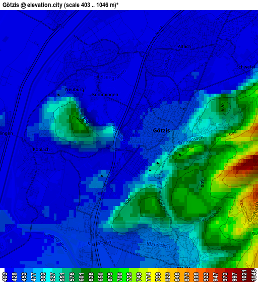
Below is the Elevation map of Götzis, which displays elevation range with different colors. Scale of the first map is from 403 to 1046 m (1322 to 3432 ft) with average elevation of 482 meters (=1581 ft) [note 1]
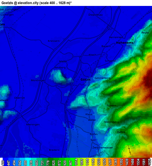
These maps also provides idea of topography and contour of this city, they are displayed at different zoom levels. More info about maps, scale and edge coordinates you can find below images.
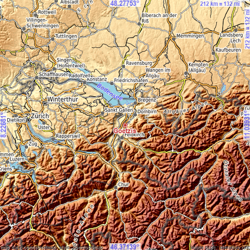
| \ | Map #1 | Map #2 | Topo.Map |
| Scale [m] | 403..1046 m | 400..1628 m | × |
| Scale [ft] | 1322..3432 ft | 1312..5341 ft | × |
| Average | 482 m = 1581 ft | 558.6 m = 1833 ft | × |
| Width | 6.62 km = 4.1 mi | 13.25 km = 8.2 mi | 211.9 km = 131.7 mi |
| Height | 6.62 km = 4.1 mi | 13.25 km = 8.2 mi | 211.9 km = 131.7 mi |
| ↑Max Latitude | 47.362835° | 47.392593° | 48.27753° |
| Latitude at center | 47.33306° | 47.33306° | 47.33306° |
| ↓Min Latitude | 47.303268° | 47.27346° | 46.37139° |
| ← Min Longitude | 9.589115° | 9.545169° | 8.22681° |
| Longitude center | 9.63306° | 9.63306° | 9.63306° |
| →Max Longitude | 9.677005° | 9.720951° | 11.03931° |
Nearby cities:
Cities around Götzis sort by population:
• Hohenems elevation 417 m
5.3 km,  45°
45°
• Altach 410 m
2.3 km,  34°
34°
• Koblach 433 m
2.5 km,  270°
270°
• Mäder 415 m
2.3 km,  326°
326°
• Klaus 476 m
2.9 km,  158°
158°
• Sulz 489 m
5.3 km, 164°
• Meiningen 426 m
5.6 km,  227°
227°
• Weiler 468 m
3.9 km, 160°
• Röthis 501 m
4.7 km, 159°
• Batschuns 478 m
5.7 km,  167°
167°
• Fraxern 820 m
3.7 km,  123°
123°
• Viktorsberg 807 m
4.8 km,  138°
138°
Multilingual:
 En español:
Götzis elevación 427 m.
 En France:
Götzis élévation 427 m.


Sources and notes:
- [note 1] Map square and city borders are not equal. Map elevation data is calculated only from area inside that square.
- [src 1] Elevation data from geonames database provided with same terms of usage.
- [src 2] The elevation map of Götzis is generated using elevation data from NASA's 3 arcsec (90m) resolution SRTM data.
- [src 3] Base (background) map © OpenStreetMap contributors tiles are generated by Geofabrik and OpenTopoMap.
Copyright & License:
This Götzis Elevation Map is licensed under CC BY-SA. You may reuse any part from this page, if you give a proper credit by linking to this URL:
 More info on terms of use page.