Großklein elevation
Großklein (Styria, Politischer Bezirk Leibnitz), Austria elevation is 330 meters and Großklein elevation in feet is 1083 ft above sea level [src 1]. Großklein is a seat of a third-order administrative division (feature code) with elevation that is 179 meters (587 ft) smaller than average city elevation in Austria.
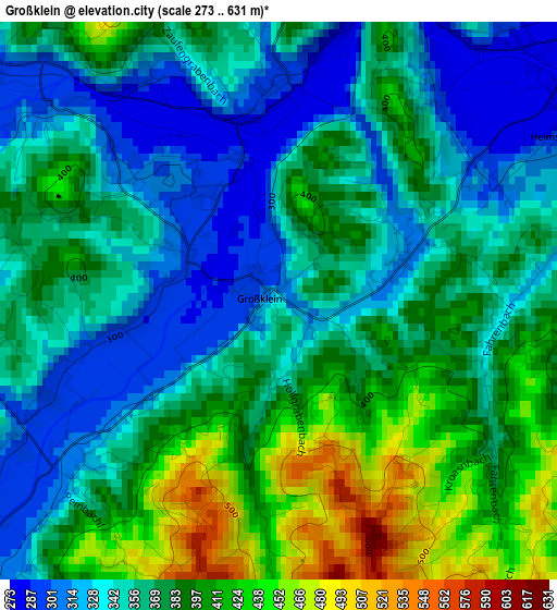
Below is the Elevation map of Großklein, which displays elevation range with different colors. Scale of the first map is from 273 to 631 m (896 to 2070 ft) with average elevation of 369.2 meters (=1211 ft) [note 1]
These maps also provides idea of topography and contour of this city, they are displayed at different zoom levels. More info about maps, scale and edge coordinates you can find below images.
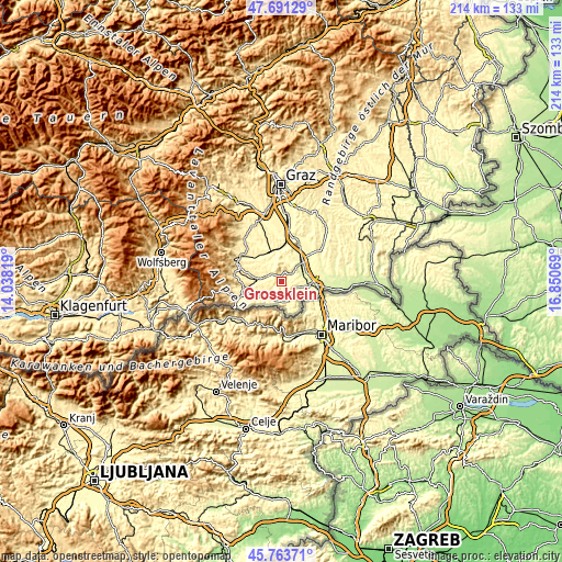
| \ | Map #1 | Topo.Map |
| Scale [m] | 273..631 m | × |
| Scale [ft] | 896..2070 ft | × |
| Average | 369.2 m = 1211 ft | × |
| Width | 6.7 km = 4.2 mi | 214.3 km = 133.2 mi |
| Height | 6.7 km = 4.2 mi | 214.3 km = 133.2 mi |
| ↑Max Latitude | 46.76622° | 47.69129° |
| Latitude at center | 46.73611° | 46.73611° |
| ↓Min Latitude | 46.705983° | 45.76371° |
| ← Min Longitude | 15.400495° | 14.03819° |
| Longitude center | 15.44444° | 15.44444° |
| →Max Longitude | 15.488385° | 16.85069° |
Nearby cities:
Cities around Großklein sort by population:
• Leibnitz elevation 273 m
8.8 km,  54°
54°
• Wagna 263 m
9.4 km,  68°
68°
• Gamlitz 279 m
8.5 km,  101°
101°
• Heimschuh 276 m
4.6 km, 54°
• Gleinstätten 298 m
6 km,  288°
288°
• Arnfels 325 m
7.4 km,  205°
205°
• Pistorf 321 m
6.8 km,  299°
299°
• Leutschach 351 m
7.9 km,  166°
166°
• Seggauberg 324 m
6.5 km,  58°
58°
• Sankt Johann im Saggautal 344 m
4.8 km,  221°
221°
• Retznei 300 m
9.3 km,  91°
91°
• Kitzeck im Sausal 550 m
5 km,  8°
8°
Multilingual:
 En español:
Großklein elevación 330 m.
 En France:
Großklein élévation 330 m.
 Auf Deutsch:
Großklein höhe über dem Meeresspiegel ist 330 m.

Sources and notes:
- [note 1] Map square and city borders are not equal. Map elevation data is calculated only from area inside that square.
- [src 1] Elevation data from geonames database provided with same terms of usage.
- [src 2] The elevation map of Großklein is generated using elevation data from NASA's 3 arcsec (90m) resolution SRTM data.
- [src 3] Base (background) map © OpenStreetMap contributors tiles are generated by Geofabrik and OpenTopoMap.
Copyright & License:
This Großklein Elevation Map is licensed under CC BY-SA. You may reuse any part from this page, if you give a proper credit by linking to this URL:
 More info on terms of use page.