Höchst elevation
Höchst (Vorarlberg, Politischer Bezirk Bregenz), Austria elevation is 402 meters and Höchst elevation in feet is 1319 ft above sea level [src 1]. Höchst is a seat of a third-order administrative division (feature code) with elevation that is 107 meters (351 ft) smaller than average city elevation in Austria.
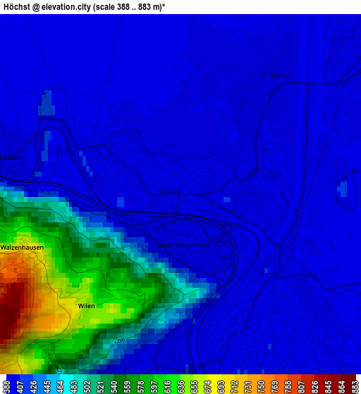
Below is the Elevation map of Höchst, which displays elevation range with different colors. Scale of the first map is from 388 to 883 m (1273 to 2897 ft) with average elevation of 439.7 meters (=1443 ft) [note 1]
These maps also provides idea of topography and contour of this city, they are displayed at different zoom levels. More info about maps, scale and edge coordinates you can find below images.
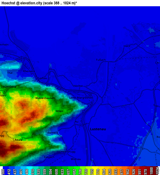
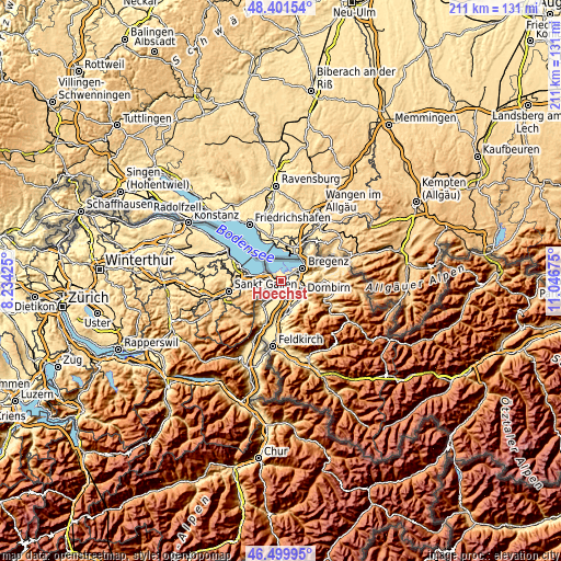
| \ | Map #1 | Map #2 | Topo.Map |
| Scale [m] | 388..883 m | 388..1024 m | × |
| Scale [ft] | 1273..2897 ft | 1273..3360 ft | × |
| Average | 439.7 m = 1443 ft | 459.6 m = 1508 ft | × |
| Width | 6.61 km = 4.1 mi | 13.21 km = 8.2 mi | 211.4 km = 131.4 mi |
| Height | 6.61 km = 4.1 mi | 13.21 km = 8.2 mi | 211.4 km = 131.4 mi |
| ↑Max Latitude | 47.489044° | 47.51873° | 48.40154° |
| Latitude at center | 47.45934° | 47.45934° | 47.45934° |
| ↓Min Latitude | 47.42962° | 47.399882° | 46.49995° |
| ← Min Longitude | 9.596555° | 9.552609° | 8.23425° |
| Longitude center | 9.6405° | 9.6405° | 9.6405° |
| →Max Longitude | 9.684445° | 9.728391° | 11.04675° |
Nearby cities:
Cities around Höchst sort by population:
• Dornbirn elevation 437 m
9.1 km,  123°
123°
• Bregenz 405 m
9.4 km,  58°
58°
• Lustenau 405 m
3.9 km,  159°
159°
• Hohenems 417 m
10.8 km, 162°
• Hard 396 m
4.1 km,  50°
50°
• Lauterach 410 m
6.9 km,  74°
74°
• Wolfurt 413 m
8.3 km,  84°
84°
• Schwarzach 430 m
9.2 km,  97°
97°
• Fußach 397 m
2.8 km,  36°
36°
• Kennelbach 507 m
9.8 km, 74°
• Gaißau 399 m
3.2 km,  284°
284°
• Bildstein 474 m
9.5 km, 96°
Multilingual:
 En español:
Höchst elevación 402 m.
 En France:
Höchst élévation 402 m.


Sources and notes:
- [note 1] Map square and city borders are not equal. Map elevation data is calculated only from area inside that square.
- [src 1] Elevation data from geonames database provided with same terms of usage.
- [src 2] The elevation map of Höchst is generated using elevation data from NASA's 3 arcsec (90m) resolution SRTM data.
- [src 3] Base (background) map © OpenStreetMap contributors tiles are generated by Geofabrik and OpenTopoMap.
Copyright & License:
This Höchst Elevation Map is licensed under CC BY-SA. You may reuse any part from this page, if you give a proper credit by linking to this URL:
 More info on terms of use page.