Kaindorf elevation
Kaindorf (Styria, Politischer Bezirk Hartberg-Fürstenfeld), Austria elevation is 338 meters and Kaindorf elevation in feet is 1109 ft above sea level [src 1]. Kaindorf is a seat of a third-order administrative division (feature code) with elevation that is 171 meters (561 ft) smaller than average city elevation in Austria.
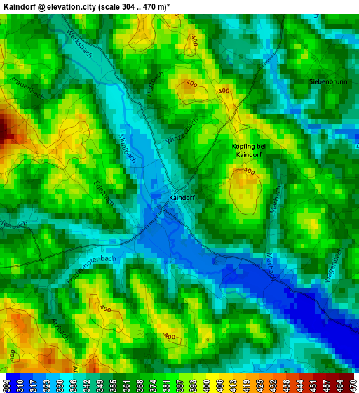
Below is the Elevation map of Kaindorf, which displays elevation range with different colors. Scale of the first map is from 304 to 470 m (997 to 1542 ft) with average elevation of 364.2 meters (=1195 ft) [note 1]
These maps also provides idea of topography and contour of this city, they are displayed at different zoom levels. More info about maps, scale and edge coordinates you can find below images.
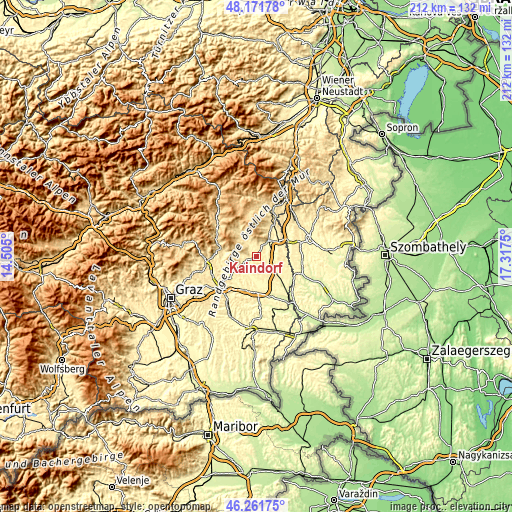
| \ | Map #1 | Topo.Map |
| Scale [m] | 304..470 m | × |
| Scale [ft] | 997..1542 ft | × |
| Average | 364.2 m = 1195 ft | × |
| Width | 6.64 km = 4.1 mi | 212.4 km = 132 mi |
| Height | 6.64 km = 4.1 mi | 212.4 km = 132 mi |
| ↑Max Latitude | 47.255206° | 48.17178° |
| Latitude at center | 47.22537° | 47.22537° |
| ↓Min Latitude | 47.195518° | 46.26175° |
| ← Min Longitude | 15.867305° | 14.505° |
| Longitude center | 15.91125° | 15.91125° |
| →Max Longitude | 15.955195° | 17.3175° |
Nearby cities:
Cities around Kaindorf sort by population:
• Hartberg elevation 396 m
7.7 km,  32°
32°
• Bad Waltersdorf 290 m
9.6 km,  130°
130°
• Ebersdorf 308 m
4.9 km, 127°
• Hartl 394 m
4.7 km,  174°
174°
• Sebersdorf 298 m
7.6 km,  124°
124°
• Dienersdorf 342 m
1.8 km,  335°
335°
• Stubenberg 444 m
8.6 km,  284°
284°
• Hirnsdorf 362 m
7.3 km,  239°
239°
• Gersdorf an der Feistritz 340 m
8 km,  215°
215°
• Sankt Johann bei Herberstein 425 m
8.9 km,  251°
251°
• Kaibing 351 m
6.5 km, 244°
• Blaindorf 348 m
6.5 km,  210°
210°
Multilingual:
 En español:
Kaindorf elevación 338 m.
 En France:
Kaindorf élévation 338 m.
 Auf Deutsch:
Kaindorf höhe über dem Meeresspiegel ist 338 m.

Sources and notes:
- [note 1] Map square and city borders are not equal. Map elevation data is calculated only from area inside that square.
- [src 1] Elevation data from geonames database provided with same terms of usage.
- [src 2] The elevation map of Kaindorf is generated using elevation data from NASA's 3 arcsec (90m) resolution SRTM data.
- [src 3] Base (background) map © OpenStreetMap contributors tiles are generated by Geofabrik and OpenTopoMap.
Copyright & License:
This Kaindorf Elevation Map is licensed under CC BY-SA. You may reuse any part from this page, if you give a proper credit by linking to this URL:
 More info on terms of use page.