Kobersdorf elevation
Kobersdorf (Burgenland, Politischer Bezirk Oberpullendorf), Austria elevation is 321 meters and Kobersdorf elevation in feet is 1053 ft above sea level [src 1]. Kobersdorf is a seat of a third-order administrative division (feature code) with elevation that is 188 meters (617 ft) smaller than average city elevation in Austria.
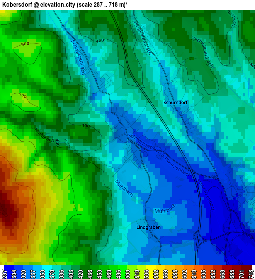
Below is the Elevation map of Kobersdorf, which displays elevation range with different colors. Scale of the first map is from 287 to 718 m (942 to 2356 ft) with average elevation of 405.1 meters (=1329 ft) [note 1]
These maps also provides idea of topography and contour of this city, they are displayed at different zoom levels. More info about maps, scale and edge coordinates you can find below images.
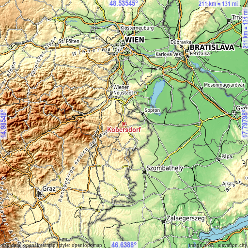
| \ | Map #1 | Topo.Map |
| Scale [m] | 287..718 m | × |
| Scale [ft] | 942..2356 ft | × |
| Average | 405.1 m = 1329 ft | × |
| Width | 6.59 km = 4.1 mi | 210.9 km = 131 mi |
| Height | 6.59 km = 4.1 mi | 210.9 km = 131 mi |
| ↑Max Latitude | 47.625346° | 48.53545° |
| Latitude at center | 47.59572° | 47.59572° |
| ↓Min Latitude | 47.566077° | 46.6388° |
| ← Min Longitude | 16.347785° | 14.98548° |
| Longitude center | 16.39173° | 16.39173° |
| →Max Longitude | 16.435675° | 17.79798° |
Nearby cities:
Cities around Kobersdorf sort by population:
• Wiesmath elevation 670 m
8.5 km,  285°
285°
• Sieggraben 466 m
6.2 km,  351°
351°
• Lackenbach 309 m
5.6 km,  96°
96°
• Neutal 274 m
6.9 km,  143°
143°
• Weppersdorf 300 m
3.2 km,  124°
124°
• Schwarzenbach 376 m
5.4 km,  325°
325°
• Ritzing 320 m
8 km,  75°
75°
• Markt Sankt Martin 314 m
4.5 km,  146°
146°
• Unterfrauenhaid 286 m
8.5 km,  108°
108°
• Kaisersdorf 362 m
6.5 km,  179°
179°
• Lackendorf 273 m
8.4 km,  94°
94°
• Weingraben 409 m
9.3 km,  193°
193°
Multilingual:
 En español:
Kobersdorf elevación 321 m.
 En France:
Kobersdorf élévation 321 m.
 Auf Deutsch:
Kobersdorf höhe über dem Meeresspiegel ist 321 m.

Sources and notes:
- [note 1] Map square and city borders are not equal. Map elevation data is calculated only from area inside that square.
- [src 1] Elevation data from geonames database provided with same terms of usage.
- [src 2] The elevation map of Kobersdorf is generated using elevation data from NASA's 3 arcsec (90m) resolution SRTM data.
- [src 3] Base (background) map © OpenStreetMap contributors tiles are generated by Geofabrik and OpenTopoMap.
Copyright & License:
This Kobersdorf Elevation Map is licensed under CC BY-SA. You may reuse any part from this page, if you give a proper credit by linking to this URL:
 More info on terms of use page.