Laa an der Thaya elevation
Laa an der Thaya (Lower Austria, Politischer Bezirk Mistelbach), Austria elevation is 179 meters and Laa an der Thaya elevation in feet is 587 ft above sea level [src 1]. Laa an der Thaya is a seat of a third-order administrative division (feature code) with elevation that is 330 meters (1083 ft) smaller than average city elevation in Austria.
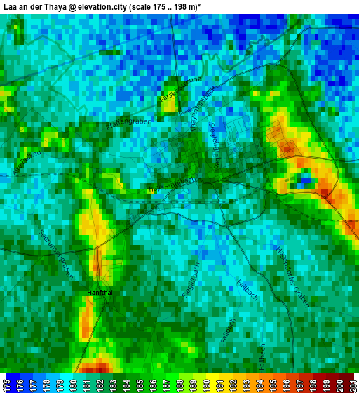
Below is the Elevation map of Laa an der Thaya, which displays elevation range with different colors. Scale of the first map is from 175 to 198 m (574 to 650 ft) with average elevation of 181.7 meters (=596 ft) [note 1]
These maps also provides idea of topography and contour of this city, they are displayed at different zoom levels. More info about maps, scale and edge coordinates you can find below images.
| \ | Map #1 | Map #2 | Topo.Map |
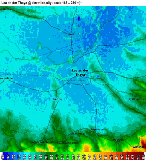
| Scale [m] | 175..198 m | 163..284 m | × |
| Scale [ft] | 574..650 ft | 535..932 ft | × |
| Average | 181.7 m = 596 ft | 187.3 m = 615 ft | × |
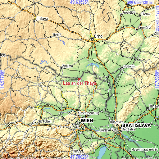
| Width | 6.45 km = 4 mi | 12.9 km = 8 mi | 206.3 km = 128.2 mi |
| Height | 6.45 km = 4 mi | 12.9 km = 8 mi | 206.3 km = 128.2 mi |
| ↑Max Latitude | 48.745656° | 48.774625° | 49.63595° |
| Latitude at center | 48.71667° | 48.71667° | 48.71667° |
| ↓Min Latitude | 48.687667° | 48.658648° | 47.78028° |
| ← Min Longitude | 16.339385° | 16.295439° | 14.97708° |
| Longitude center | 16.38333° | 16.38333° | 16.38333° |
| →Max Longitude | 16.427275° | 16.471221° | 17.78958° |
Nearby cities:
Cities around Laa an der Thaya sort by population:
• Neudorf bei Staatz elevation 202 m
7.9 km,  86°
86°
• Asparn an der Zaya 215 m
17.1 km,  149°
149°
• Stronsdorf 204 m
9.5 km,  220°
220°
• Unterstinkenbrunn 196 m
6.1 km,  206°
206°
• Mailberg 209 m
15.6 km,  252°
252°
• Großharras 195 m
11.7 km,  239°
239°
• Falkenstein 312 m
14.7 km, 90°
• Ottenthal 234 m
15.2 km,  71°
71°
• Gaubitsch 216 m
7.4 km,  180°
180°
• Gnadendorf 244 m
11.2 km,  173°
173°
• Fallbach 225 m
7.8 km,  161°
161°
• Staatz 241 m
8.9 km,  120°
120°
Multilingual:
 En español:
Laa an der Thaya elevación 179 m.
 En France:
Laa an der Thaya élévation 179 m.
 Auf Deutsch:
Laa an der Thaya höhe über dem Meeresspiegel ist 179 m.
 На русском:
Лаа-ан-дер-Тайя, Ла-ан-дер-Тайя высота над уровнем моря 179 м
Sources and notes:
- [note 1] Map square and city borders are not equal. Map elevation data is calculated only from area inside that square.
- [src 1] Elevation data from geonames database provided with same terms of usage.
- [src 2] The elevation map of Laa an der Thaya is generated using elevation data from NASA's 3 arcsec (90m) resolution SRTM data.
- [src 3] Base (background) map © OpenStreetMap contributors tiles are generated by Geofabrik and OpenTopoMap.
Copyright & License:
This Laa an der Thaya Elevation Map is licensed under CC BY-SA. You may reuse any part from this page, if you give a proper credit by linking to this URL:
 More info on terms of use page.