Langenlois elevation
Langenlois (Lower Austria, Politischer Bezirk Krems), Austria elevation is 277 meters and Langenlois elevation in feet is 909 ft above sea level [src 1]. Langenlois is a seat of a third-order administrative division (feature code) with elevation that is 232 meters (761 ft) smaller than average city elevation in Austria.
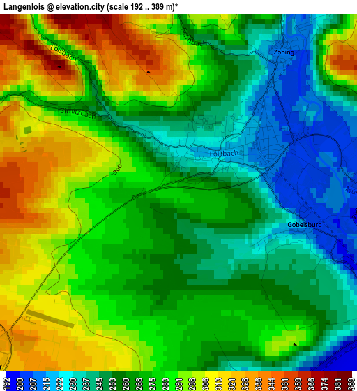
Below is the Elevation map of Langenlois, which displays elevation range with different colors. Scale of the first map is from 192 to 389 m (630 to 1276 ft) with average elevation of 273.1 meters (=896 ft) [note 1]
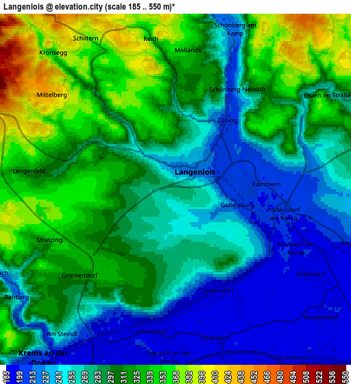
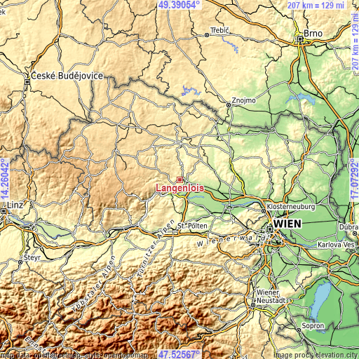
These maps also provides idea of topography and contour of this city, they are displayed at different zoom levels. More info about maps, scale and edge coordinates you can find below images.
| \ | Map #1 | Map #2 | Topo.Map |
| Scale [m] | 192..389 m | 185..550 m | × |
| Scale [ft] | 630..1276 ft | 607..1804 ft | × |
| Average | 273.1 m = 896 ft | 288.8 m = 948 ft | × |
| Width | 6.48 km = 4 mi | 12.96 km = 8.1 mi | 207.4 km = 128.9 mi |
| Height | 6.48 km = 4 mi | 12.96 km = 8.1 mi | 207.3 km = 128.8 mi |
| ↑Max Latitude | 48.4958° | 48.524913° | 49.39054° |
| Latitude at center | 48.46667° | 48.46667° | 48.46667° |
| ↓Min Latitude | 48.437523° | 48.40836° | 47.52567° |
| ← Min Longitude | 15.622725° | 15.578779° | 14.26042° |
| Longitude center | 15.66667° | 15.66667° | 15.66667° |
| →Max Longitude | 15.710615° | 15.754561° | 17.07292° |
Nearby cities:
Cities around Langenlois sort by population:
• Krems an der Donau elevation 195 m
7.5 km,  211°
211°
• Rohrendorf bei Krems 191 m
5.3 km,  187°
187°
• Lerchenfeld 193 m
6.6 km,  203°
203°
• Rehberg 226 m
7.1 km,  236°
236°
• Hadersdorf am Kamp 198 m
4.1 km,  116°
116°
• Lengenfeld 305 m
5 km,  276°
276°
• Strass 209 m
4.9 km,  90°
90°
• Gneixendorf 318 m
4.8 km,  227°
227°
• Droß 374 m
6.7 km,  267°
267°
• Stratzing 325 m
5.3 km,  249°
249°
• Gedersdorf 195 m
4.1 km,  156°
156°
• Grafenegg 196 m
7.3 km, 123°
Multilingual:
 En español:
Langenlois elevación 277 m.
 En France:
Langenlois élévation 277 m.
 Auf Deutsch:
Langenlois höhe über dem Meeresspiegel ist 277 m.

Sources and notes:
- [note 1] Map square and city borders are not equal. Map elevation data is calculated only from area inside that square.
- [src 1] Elevation data from geonames database provided with same terms of usage.
- [src 2] The elevation map of Langenlois is generated using elevation data from NASA's 3 arcsec (90m) resolution SRTM data.
- [src 3] Base (background) map © OpenStreetMap contributors tiles are generated by Geofabrik and OpenTopoMap.
Copyright & License:
This Langenlois Elevation Map is licensed under CC BY-SA. You may reuse any part from this page, if you give a proper credit by linking to this URL:
 More info on terms of use page.