Matzendorf elevation
Matzendorf (Lower Austria, Politischer Bezirk Wiener Neustadt), Austria elevation is 286 meters and Matzendorf elevation in feet is 938 ft above sea level [src 1]. Matzendorf is a populated place (feature code) with elevation that is 223 meters (732 ft) smaller than average city elevation in Austria.
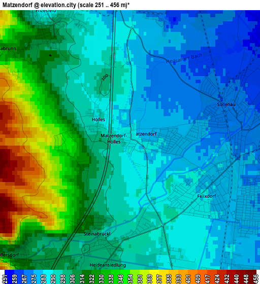
Below is the Elevation map of Matzendorf, which displays elevation range with different colors. Scale of the first map is from 251 to 456 m (823 to 1496 ft) with average elevation of 303.3 meters (=995 ft) [note 1]
These maps also provides idea of topography and contour of this city, they are displayed at different zoom levels. More info about maps, scale and edge coordinates you can find below images.
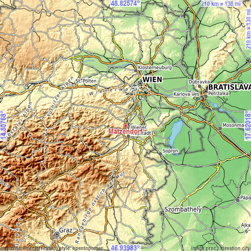
| \ | Map #1 | Topo.Map |
| Scale [m] | 251..456 m | × |
| Scale [ft] | 823..1496 ft | × |
| Average | 303.3 m = 995 ft | × |
| Width | 6.55 km = 4.1 mi | 209.7 km = 130.3 mi |
| Height | 6.55 km = 4.1 mi | 209.7 km = 130.3 mi |
| ↑Max Latitude | 47.920829° | 48.82574° |
| Latitude at center | 47.89137° | 47.89137° |
| ↓Min Latitude | 47.861895° | 46.93983° |
| ← Min Longitude | 16.169985° | 14.80768° |
| Longitude center | 16.21393° | 16.21393° |
| →Max Longitude | 16.257875° | 17.62018° |
Nearby cities:
Cities around Matzendorf sort by population:
• Kottingbrunn elevation 252 m
6.7 km,  8°
8°
• Sollenau 261 m
2.7 km,  73°
73°
• Leobersdorf 267 m
4.1 km,  2°
2°
• Felixdorf 282 m
2.4 km,  117°
117°
• Theresienfeld 280 m
4.8 km,  162°
162°
• Hirtenberg 282 m
5.1 km,  329°
329°
• Wöllersdorf 318 m
4.3 km,  227°
227°
• Markt Piesting 335 m
6.9 km,  253°
253°
• Bad Fischau 284 m
7.5 km,  207°
207°
• Steinabrückl 309 m
2.5 km,  199°
199°
• Günselsdorf 242 m
6.8 km,  30°
30°
• Schönau an der Triesting 250 m
5.6 km, 31°
Multilingual:
 En español:
Matzendorf elevación 286 m.
 En France:
Matzendorf élévation 286 m.
 Auf Deutsch:
Matzendorf höhe über dem Meeresspiegel ist 286 m.

Sources and notes:
- [note 1] Map square and city borders are not equal. Map elevation data is calculated only from area inside that square.
- [src 1] Elevation data from geonames database provided with same terms of usage.
- [src 2] The elevation map of Matzendorf is generated using elevation data from NASA's 3 arcsec (90m) resolution SRTM data.
- [src 3] Base (background) map © OpenStreetMap contributors tiles are generated by Geofabrik and OpenTopoMap.
Copyright & License:
This Matzendorf Elevation Map is licensed under CC BY-SA. You may reuse any part from this page, if you give a proper credit by linking to this URL:
 More info on terms of use page.