Medraz elevation
Medraz (Tyrol, Politischer Bezirk Innsbruck Land), Austria elevation is 920 meters and Medraz elevation in feet is 3018 ft above sea level [src 1]. Medraz is a populated place (feature code) with elevation that is 411 meters (1348 ft) bigger than average city elevation in Austria.
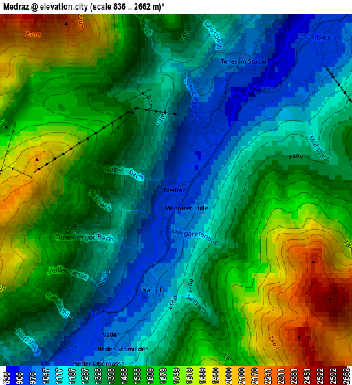
Below is the Elevation map of Medraz, which displays elevation range with different colors. Scale of the first map is from 836 to 2662 m (2743 to 8734 ft) with average elevation of 1447.5 meters (=4749 ft) [note 1]
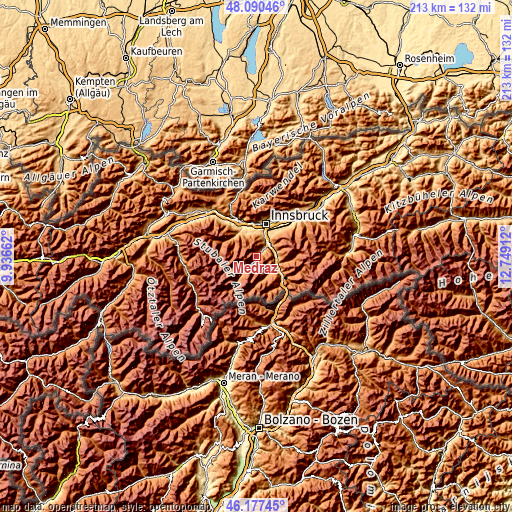
These maps also provides idea of topography and contour of this city, they are displayed at different zoom levels. More info about maps, scale and edge coordinates you can find below images.
| \ | Map #1 | Topo.Map |
| Scale [m] | 836..2662 m | × |
| Scale [ft] | 2743..8734 ft | × |
| Average | 1447.5 m = 4749 ft | × |
| Width | 6.65 km = 4.1 mi | 212.7 km = 132.2 mi |
| Height | 6.65 km = 4.1 mi | 212.7 km = 132.2 mi |
| ↑Max Latitude | 47.172442° | 48.09046° |
| Latitude at center | 47.14256° | 47.14256° |
| ↓Min Latitude | 47.112661° | 46.17745° |
| ← Min Longitude | 11.298925° | 9.93662° |
| Longitude center | 11.34287° | 11.34287° |
| →Max Longitude | 11.386815° | 12.74912° |
Nearby cities:
Cities around Medraz sort by population:
• Neustift im Stubaital elevation 970 m
3.5 km,  214°
214°
• Fulpmes 916 m
1.2 km,  24°
24°
• Natters 779 m
10.4 km,  12°
12°
• Mieders 971 m
4.1 km,  48°
48°
• Trins 1229 m
8.6 km,  139°
139°
• Ellbögen 1132 m
8.5 km,  71°
71°
• Schönberg im Stubaital 811 m
7.2 km, 50°
• Patsch 1001 m
8.9 km,  38°
38°
• Matrei am Brenner 1203 m
8.4 km,  101°
101°
• Telfes im Stubai 924 m
3.2 km,  33°
33°
• Pfons 1028 m
8.9 km,  90°
90°
• Mühlbachl 1058 m
8.2 km, 97°
Multilingual:
 En español:
Medraz elevación 920 m.
 En France:
Medraz élévation 920 m.


Sources and notes:
- [note 1] Map square and city borders are not equal. Map elevation data is calculated only from area inside that square.
- [src 1] Elevation data from geonames database provided with same terms of usage.
- [src 2] The elevation map of Medraz is generated using elevation data from NASA's 3 arcsec (90m) resolution SRTM data.
- [src 3] Base (background) map © OpenStreetMap contributors tiles are generated by Geofabrik and OpenTopoMap.
Copyright & License:
This Medraz Elevation Map is licensed under CC BY-SA. You may reuse any part from this page, if you give a proper credit by linking to this URL:
 More info on terms of use page.