Mitterkirchen im Machland elevation
Mitterkirchen im Machland (Upper Austria, Politischer Bezirk Perg), Austria elevation is 233 meters and Mitterkirchen im Machland elevation in feet is 764 ft above sea level [src 1]. Mitterkirchen im Machland is a seat of a third-order administrative division (feature code) with elevation that is 276 meters (906 ft) smaller than average city elevation in Austria.
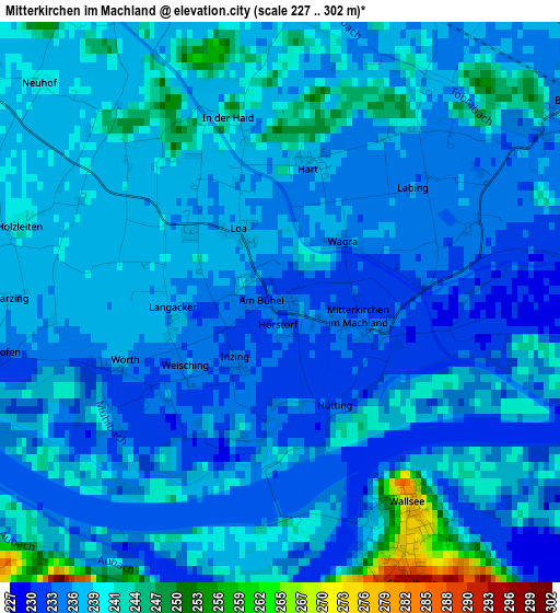
Below is the Elevation map of Mitterkirchen im Machland, which displays elevation range with different colors. Scale of the first map is from 227 to 302 m (745 to 991 ft) with average elevation of 237.1 meters (=778 ft) [note 1]
These maps also provides idea of topography and contour of this city, they are displayed at different zoom levels. More info about maps, scale and edge coordinates you can find below images.
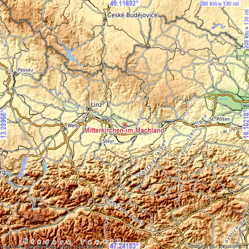
| \ | Map #1 | Topo.Map |
| Scale [m] | 227..302 m | × |
| Scale [ft] | 745..991 ft | × |
| Average | 237.1 m = 778 ft | × |
| Width | 6.52 km = 4.1 mi | 208.5 km = 129.6 mi |
| Height | 6.52 km = 4.1 mi | 208.5 km = 129.6 mi |
| ↑Max Latitude | 48.217239° | 49.11692° |
| Latitude at center | 48.18795° | 48.18795° |
| ↓Min Latitude | 48.158644° | 47.24183° |
| ← Min Longitude | 14.651985° | 13.28968° |
| Longitude center | 14.69593° | 14.69593° |
| →Max Longitude | 14.739875° | 16.10218° |
Nearby cities:
Cities around Mitterkirchen im Machland sort by population:
• Perg elevation 252 m
8.3 km,  326°
326°
• Wallsee 276 m
2.8 km,  146°
146°
• Zeillern 292 m
10.5 km,  127°
127°
• Sankt Pantaleon 237 m
9.8 km,  284°
284°
• Naarn im Machlande 243 m
7.7 km,  302°
302°
• Oehling 297 m
12.5 km,  141°
141°
• Ardagger Stift 332 m
11 km,  112°
112°
• Münzbach 415 m
8.9 km,  6°
6°
• Stephanshart 303 m
9.9 km,  115°
115°
• Bad Kreuzen 475 m
12 km,  42°
42°
• Windhaag bei Perg 517 m
10.9 km,  354°
354°
• Strengberg 327 m
5.6 km,  215°
215°
Multilingual:
 En español:
Mitterkirchen im Machland elevación 233 m.
 En France:
Mitterkirchen im Machland élévation 233 m.
 Auf Deutsch:
Mitterkirchen im Machland höhe über dem Meeresspiegel ist 233 m.

Sources and notes:
- [note 1] Map square and city borders are not equal. Map elevation data is calculated only from area inside that square.
- [src 1] Elevation data from geonames database provided with same terms of usage.
- [src 2] The elevation map of Mitterkirchen im Machland is generated using elevation data from NASA's 3 arcsec (90m) resolution SRTM data.
- [src 3] Base (background) map © OpenStreetMap contributors tiles are generated by Geofabrik and OpenTopoMap.
Copyright & License:
This Mitterkirchen im Machland Elevation Map is licensed under CC BY-SA. You may reuse any part from this page, if you give a proper credit by linking to this URL:
 More info on terms of use page.