Offenhausen elevation
Offenhausen (Upper Austria, Wels-Land), Austria elevation is 382 meters and Offenhausen elevation in feet is 1253 ft above sea level [src 1]. Offenhausen is a seat of a third-order administrative division (feature code) with elevation that is 127 meters (417 ft) smaller than average city elevation in Austria.
Below is the Elevation map of Offenhausen, which displays elevation range with different colors. Scale of the first map is from 339 to 493 m (1112 to 1617 ft) with average elevation of 416.6 meters (=1367 ft) [note 1]
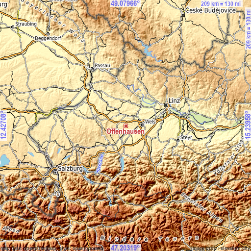
These maps also provides idea of topography and contour of this city, they are displayed at different zoom levels. More info about maps, scale and edge coordinates you can find below images.
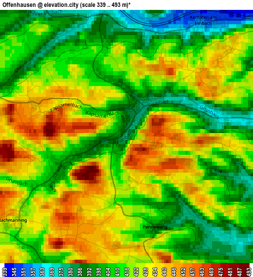
| \ | Map #1 | Topo.Map |
| Scale [m] | 339..493 m | × |
| Scale [ft] | 1112..1617 ft | × |
| Average | 416.6 m = 1367 ft | × |
| Width | 6.52 km = 4.1 mi | 208.6 km = 129.6 mi |
| Height | 6.52 km = 4.1 mi | 208.6 km = 129.6 mi |
| ↑Max Latitude | 48.179311° | 49.07966° |
| Latitude at center | 48.15° | 48.15° |
| ↓Min Latitude | 48.120672° | 47.20319° |
| ← Min Longitude | 13.789385° | 12.42708° |
| Longitude center | 13.83333° | 13.83333° |
| →Max Longitude | 13.877275° | 15.23958° |
Nearby cities:
Cities around Offenhausen sort by population:
• Lambach elevation 367 m
7.1 km,  154°
154°
• Gallspach 375 m
6.9 km,  345°
345°
• Gaspoltshofen 451 m
7.2 km,  264°
264°
• Stadl-Hausruck 354 m
7.6 km,  169°
169°
• Pichl bei Wels 329 m
6.2 km,  51°
51°
• Niederthalheim 426 m
7.4 km,  220°
220°
• Bachmanning 424 m
3.6 km,  233°
233°
• Meggenhofen 381 m
4.4 km,  320°
320°
• Neukirchen bei Lambach 394 m
5.7 km,  192°
192°
• Aichkirchen 446 m
5.5 km,  214°
214°
• Pennewang 390 m
2.2 km, 146°
• Edt bei Lambach 390 m
5.2 km,  134°
134°
Multilingual:
 En español:
Offenhausen elevación 382 m.
 En France:
Offenhausen élévation 382 m.
 Auf Deutsch:
Offenhausen höhe über dem Meeresspiegel ist 382 m.

Sources and notes:
- [note 1] Map square and city borders are not equal. Map elevation data is calculated only from area inside that square.
- [src 1] Elevation data from geonames database provided with same terms of usage.
- [src 2] The elevation map of Offenhausen is generated using elevation data from NASA's 3 arcsec (90m) resolution SRTM data.
- [src 3] Base (background) map © OpenStreetMap contributors tiles are generated by Geofabrik and OpenTopoMap.
Copyright & License:
This Offenhausen Elevation Map is licensed under CC BY-SA. You may reuse any part from this page, if you give a proper credit by linking to this URL:
 More info on terms of use page.