Paldau elevation
Paldau (Styria, Politischer Bezirk Südoststeiermark), Austria elevation is 316 meters and Paldau elevation in feet is 1037 ft above sea level [src 1]. Paldau is a seat of a third-order administrative division (feature code) with elevation that is 193 meters (633 ft) smaller than average city elevation in Austria.
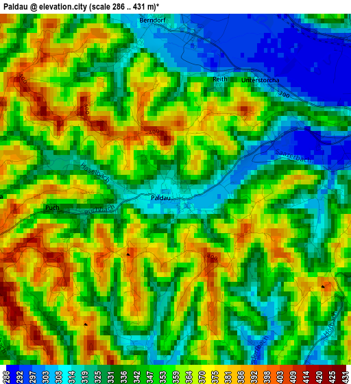
Below is the Elevation map of Paldau, which displays elevation range with different colors. Scale of the first map is from 286 to 431 m (938 to 1414 ft) with average elevation of 347.7 meters (=1141 ft) [note 1]
These maps also provides idea of topography and contour of this city, they are displayed at different zoom levels. More info about maps, scale and edge coordinates you can find below images.
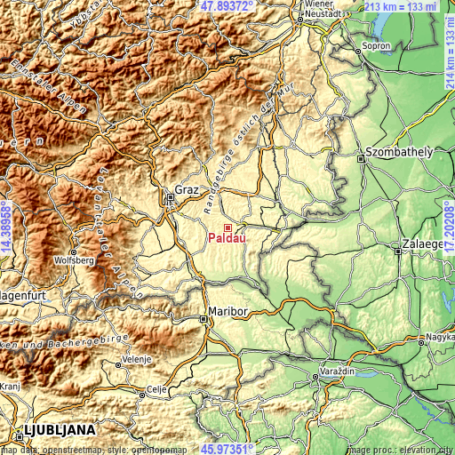
| \ | Map #1 | Topo.Map |
| Scale [m] | 286..431 m | × |
| Scale [ft] | 938..1414 ft | × |
| Average | 347.7 m = 1141 ft | × |
| Width | 6.67 km = 4.1 mi | 213.5 km = 132.7 mi |
| Height | 6.67 km = 4.1 mi | 213.5 km = 132.7 mi |
| ↑Max Latitude | 46.972215° | 47.89372° |
| Latitude at center | 46.94222° | 46.94222° |
| ↓Min Latitude | 46.912209° | 45.97351° |
| ← Min Longitude | 15.751885° | 14.38958° |
| Longitude center | 15.79583° | 15.79583° |
| →Max Longitude | 15.839775° | 17.20208° |
Nearby cities:
Cities around Paldau sort by population:
• Feldbach elevation 283 m
7.1 km,  80°
80°
• Gniebing 302 m
5.1 km,  63°
63°
• Kirchberg an der Raab 356 m
5.3 km,  335°
335°
• Fladnitz im Raabtal 312 m
5.6 km,  351°
351°
• Edelsbach bei Feldbach 304 m
6.1 km,  30°
30°
• Studenzen 319 m
7.7 km, 335°
• Oberdorf am Hochegg 360 m
6.9 km,  305°
305°
• Perlsdorf 306 m
3.5 km,  156°
156°
• Kohlberg 361 m
4.8 km,  191°
191°
• Baumgarten bei Gnas 332 m
3.6 km,  217°
217°
• Oberstorcha 298 m
2.7 km,  6°
6°
• Maierdorf 316 m
6.9 km,  143°
143°
Multilingual:
 En español:
Paldau elevación 316 m.
 En France:
Paldau élévation 316 m.


Sources and notes:
- [note 1] Map square and city borders are not equal. Map elevation data is calculated only from area inside that square.
- [src 1] Elevation data from geonames database provided with same terms of usage.
- [src 2] The elevation map of Paldau is generated using elevation data from NASA's 3 arcsec (90m) resolution SRTM data.
- [src 3] Base (background) map © OpenStreetMap contributors tiles are generated by Geofabrik and OpenTopoMap.
Copyright & License:
This Paldau Elevation Map is licensed under CC BY-SA. You may reuse any part from this page, if you give a proper credit by linking to this URL:
 More info on terms of use page.