Schärding elevation
Schärding (Upper Austria, Politischer Bezirk Schärding), Austria elevation is 319 meters and Schärding elevation in feet is 1047 ft above sea level [src 1]. Schärding is a seat of a second-order administrative division (feature code) with elevation that is 190 meters (623 ft) smaller than average city elevation in Austria.
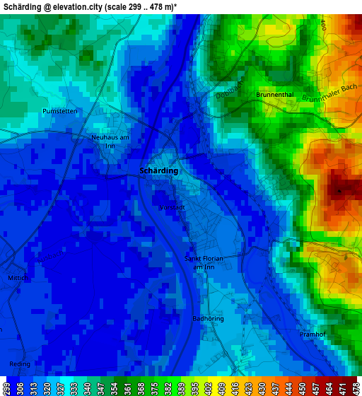
Below is the Elevation map of Schärding, which displays elevation range with different colors. Scale of the first map is from 299 to 478 m (981 to 1568 ft) with average elevation of 334.7 meters (=1098 ft) [note 1]
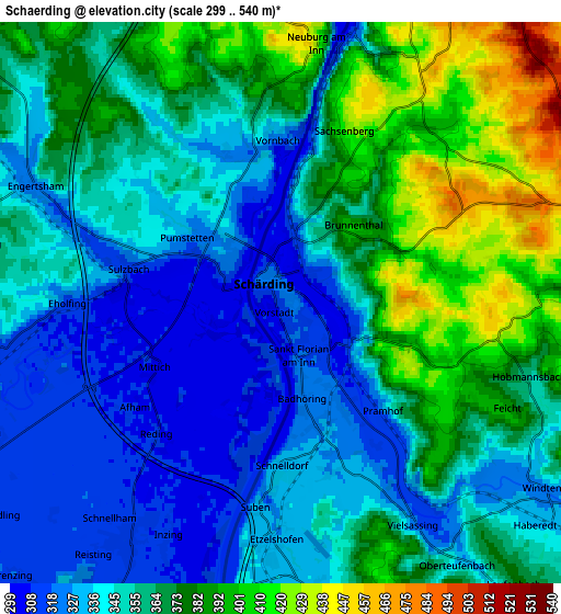
These maps also provides idea of topography and contour of this city, they are displayed at different zoom levels. More info about maps, scale and edge coordinates you can find below images.
| \ | Map #1 | Map #2 | Topo.Map |
| Scale [m] | 299..478 m | 299..540 m | × |
| Scale [ft] | 981..1568 ft | 981..1772 ft | × |
| Average | 334.7 m = 1098 ft | 357.9 m = 1174 ft | × |
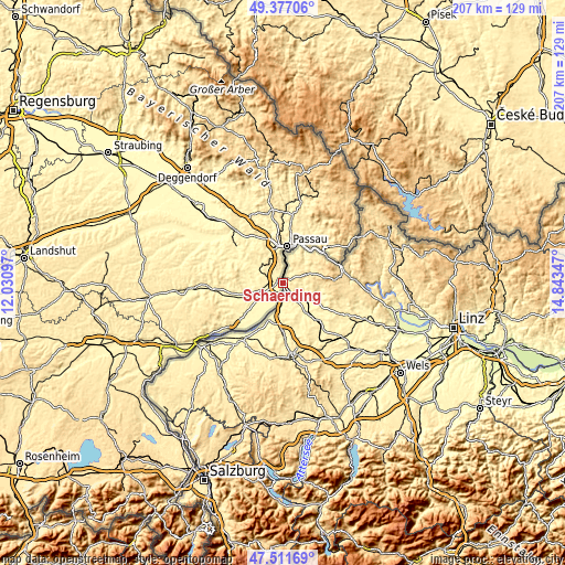
| Width | 6.48 km = 4 mi | 12.96 km = 8.1 mi | 207.4 km = 128.9 mi |
| Height | 6.48 km = 4 mi | 12.96 km = 8.1 mi | 207.4 km = 128.9 mi |
| ↑Max Latitude | 48.482078° | 48.511199° | 49.37706° |
| Latitude at center | 48.45294° | 48.45294° | 48.45294° |
| ↓Min Latitude | 48.423786° | 48.394614° | 47.51169° |
| ← Min Longitude | 13.393275° | 13.349329° | 12.03097° |
| Longitude center | 13.43722° | 13.43722° | 13.43722° |
| →Max Longitude | 13.481165° | 13.525111° | 14.84347° |
Nearby cities:
Cities around Schärding sort by population:
• Schärding Vorstadt elevation 319 m
0.2 km,  123°
123°
• Andorf 341 m
13.6 km,  131°
131°
• Münzkirchen 505 m
10.1 km,  70°
70°
• Obernberg am Inn 356 m
16.5 km,  207°
207°
• Raab 380 m
19.1 km, 125°
• Diesseits 371 m
17.9 km,  180°
180°
• Schardenberg 537 m
8.8 km,  30°
30°
• Ort im Innkreis 354 m
15.2 km, 181°
• Wernstein am Inn 320 m
6.4 km,  15°
15°
• Kopfing im Innkreis 557 m
16.4 km,  95°
95°
• Sankt Martin im Innkreis 371 m
17.7 km, 179°
• Sankt Roman 566 m
13.2 km,  75°
75°
Multilingual:
 En español:
Schärding elevación 319 m.
 En France:
Schärding élévation 319 m.
 Auf Deutsch:
Schärding höhe über dem Meeresspiegel ist 319 m.

Sources and notes:
- [note 1] Map square and city borders are not equal. Map elevation data is calculated only from area inside that square.
- [src 1] Elevation data from geonames database provided with same terms of usage.
- [src 2] The elevation map of Schärding is generated using elevation data from NASA's 3 arcsec (90m) resolution SRTM data.
- [src 3] Base (background) map © OpenStreetMap contributors tiles are generated by Geofabrik and OpenTopoMap.
Copyright & License:
This Schärding Elevation Map is licensed under CC BY-SA. You may reuse any part from this page, if you give a proper credit by linking to this URL:
 More info on terms of use page.