Spillern elevation
Spillern (Lower Austria, Politischer Bezirk Korneuburg), Austria elevation is 177 meters and Spillern elevation in feet is 581 ft above sea level [src 1]. Spillern is a seat of a third-order administrative division (feature code) with elevation that is 332 meters (1089 ft) smaller than average city elevation in Austria.
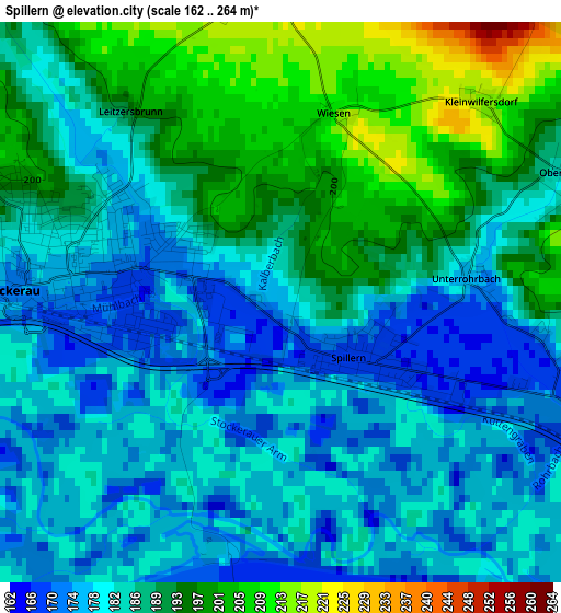
Below is the Elevation map of Spillern, which displays elevation range with different colors. Scale of the first map is from 162 to 264 m (531 to 866 ft) with average elevation of 185.6 meters (=609 ft) [note 1]
These maps also provides idea of topography and contour of this city, they are displayed at different zoom levels. More info about maps, scale and edge coordinates you can find below images.
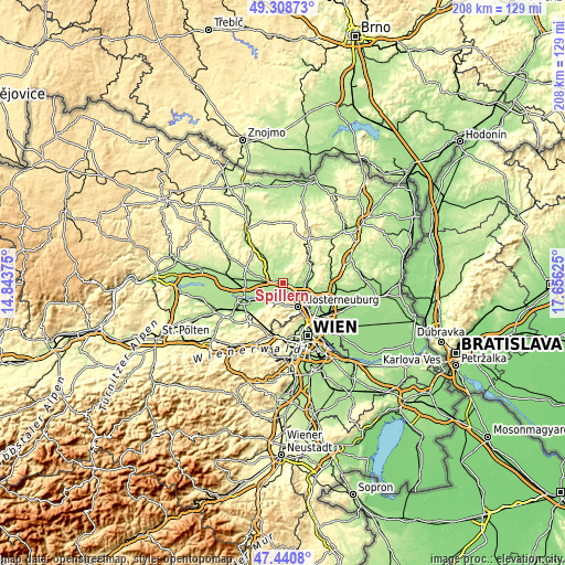
| \ | Map #1 | Topo.Map |
| Scale [m] | 162..264 m | × |
| Scale [ft] | 531..866 ft | × |
| Average | 185.6 m = 609 ft | × |
| Width | 6.49 km = 4 mi | 207.7 km = 129.1 mi |
| Height | 6.49 km = 4 mi | 207.7 km = 129.1 mi |
| ↑Max Latitude | 48.412508° | 49.30873° |
| Latitude at center | 48.38333° | 48.38333° |
| ↓Min Latitude | 48.354136° | 47.4408° |
| ← Min Longitude | 16.206055° | 14.84375° |
| Longitude center | 16.25° | 16.25° |
| →Max Longitude | 16.293945° | 17.65625° |
Nearby cities:
Cities around Spillern sort by population:
• Stockerau elevation 171 m
2.5 km,  270°
270°
• Korneuburg 164 m
7.2 km,  121°
121°
• Wördern 171 m
6.2 km,  208°
208°
• Kierling 212 m
8.4 km,  166°
166°
• Leobendorf 234 m
4.9 km,  90°
90°
• Kritzendorf 205 m
7.1 km,  148°
148°
• Sankt Andrä vor dem Hagenthale 192 m
7.5 km,  204°
204°
• Sierndorf 190 m
8.1 km,  310°
310°
• Zeiselmauer 173 m
8.2 km,  222°
222°
• Gugging 246 m
7.7 km,  180°
180°
• Leitzersdorf 223 m
4 km,  354°
354°
• Niederhollabrunn 319 m
6.7 km,  33°
33°
Multilingual:
 En español:
Spillern elevación 177 m.
 En France:
Spillern élévation 177 m.
 Auf Deutsch:
Spillern höhe über dem Meeresspiegel ist 177 m.

Sources and notes:
- [note 1] Map square and city borders are not equal. Map elevation data is calculated only from area inside that square.
- [src 1] Elevation data from geonames database provided with same terms of usage.
- [src 2] The elevation map of Spillern is generated using elevation data from NASA's 3 arcsec (90m) resolution SRTM data.
- [src 3] Base (background) map © OpenStreetMap contributors tiles are generated by Geofabrik and OpenTopoMap.
Copyright & License:
This Spillern Elevation Map is licensed under CC BY-SA. You may reuse any part from this page, if you give a proper credit by linking to this URL:
 More info on terms of use page.