Stegersbach elevation
Stegersbach (Burgenland, Politischer Bezirk Güssing), Austria elevation is 286 meters and Stegersbach elevation in feet is 938 ft above sea level [src 1]. Stegersbach is a seat of a third-order administrative division (feature code) with elevation that is 223 meters (732 ft) smaller than average city elevation in Austria.
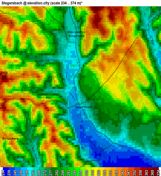
Below is the Elevation map of Stegersbach, which displays elevation range with different colors. Scale of the first map is from 234 to 374 m (768 to 1227 ft) with average elevation of 296.2 meters (=972 ft) [note 1]
These maps also provides idea of topography and contour of this city, they are displayed at different zoom levels. More info about maps, scale and edge coordinates you can find below images.
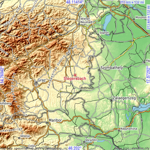
| \ | Map #1 | Topo.Map |
| Scale [m] | 234..374 m | × |
| Scale [ft] | 768..1227 ft | × |
| Average | 296.2 m = 972 ft | × |
| Width | 6.64 km = 4.1 mi | 212.6 km = 132.1 mi |
| Height | 6.64 km = 4.1 mi | 212.6 km = 132.1 mi |
| ↑Max Latitude | 47.196539° | 48.11414° |
| Latitude at center | 47.16667° | 47.16667° |
| ↓Min Latitude | 47.136785° | 46.202° |
| ← Min Longitude | 16.122725° | 14.76042° |
| Longitude center | 16.16667° | 16.16667° |
| →Max Longitude | 16.210615° | 17.57292° |
Nearby cities:
Cities around Stegersbach sort by population:
• Olbendorf elevation 310 m
3.1 km,  53°
53°
• Stinatz 343 m
4.7 km,  327°
327°
• Neudau 284 m
5 km,  281°
281°
• Litzelsdorf 332 m
4.6 km,  4°
4°
• Burgau 281 m
5.9 km,  243°
243°
• Oberdorf im Burgenland 310 m
6.7 km,  34°
34°
• Neuberg im Burgenland 303 m
7.1 km,  87°
87°
• Ollersdorf im Burgenland 308 m
1.9 km, 0°
• Bocksdorf 242 m
2.8 km,  162°
162°
• Rohr im Burgenland 252 m
5.6 km,  180°
180°
• Hackerberg 338 m
5.3 km,  314°
314°
• Heugraben 247 m
5.7 km, 161°
Multilingual:
 En español:
Stegersbach elevación 286 m.
 En France:
Stegersbach élévation 286 m.
 Auf Deutsch:
Stegersbach höhe über dem Meeresspiegel ist 286 m.
 На русском:
Штегерсбарх, Штегерсбах высота над уровнем моря 286 м
Sources and notes:
- [note 1] Map square and city borders are not equal. Map elevation data is calculated only from area inside that square.
- [src 1] Elevation data from geonames database provided with same terms of usage.
- [src 2] The elevation map of Stegersbach is generated using elevation data from NASA's 3 arcsec (90m) resolution SRTM data.
- [src 3] Base (background) map © OpenStreetMap contributors tiles are generated by Geofabrik and OpenTopoMap.
Copyright & License:
This Stegersbach Elevation Map is licensed under CC BY-SA. You may reuse any part from this page, if you give a proper credit by linking to this URL:
 More info on terms of use page.