Strasshof an der Nordbahn elevation
Strasshof an der Nordbahn (Lower Austria, Politischer Bezirk Gänserndorf), Austria elevation is 161 meters and Strasshof an der Nordbahn elevation in feet is 528 ft above sea level [src 1]. Strasshof an der Nordbahn is a seat of a third-order administrative division (feature code) with elevation that is 348 meters (1142 ft) smaller than average city elevation in Austria.
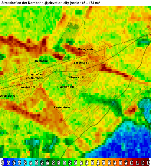
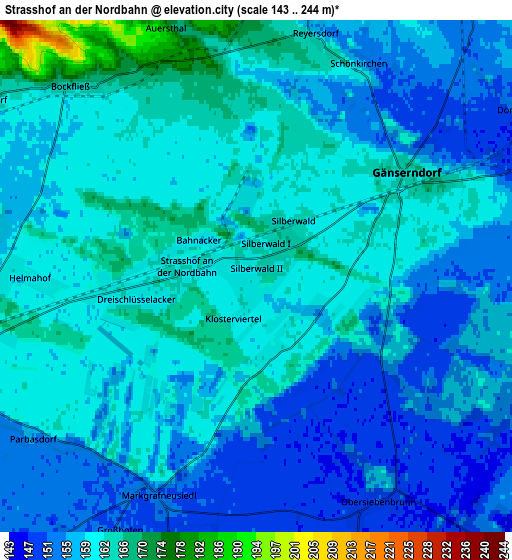
Below is the Elevation map of Strasshof an der Nordbahn, which displays elevation range with different colors. Scale of the first map is from 146 to 173 m (479 to 568 ft) with average elevation of 160.8 meters (=528 ft) [note 1]
These maps also provides idea of topography and contour of this city, they are displayed at different zoom levels. More info about maps, scale and edge coordinates you can find below images.
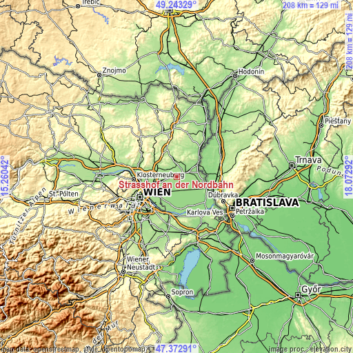
| \ | Map #1 | Map #2 | Topo.Map |
| Scale [m] | 146..173 m | 143..244 m | × |
| Scale [ft] | 479..568 ft | 469..801 ft | × |
| Average | 160.8 m = 528 ft | 158.4 m = 520 ft | × |
| Width | 6.5 km = 4 mi | 13 km = 8.1 mi | 208 km = 129.2 mi |
| Height | 6.5 km = 4 mi | 13 km = 8.1 mi | 208 km = 129.2 mi |
| ↑Max Latitude | 48.345886° | 48.375085° | 49.24329° |
| Latitude at center | 48.31667° | 48.31667° | 48.31667° |
| ↓Min Latitude | 48.287437° | 48.258188° | 47.37291° |
| ← Min Longitude | 16.622725° | 16.578779° | 15.26042° |
| Longitude center | 16.66667° | 16.66667° | 16.66667° |
| →Max Longitude | 16.710615° | 16.754561° | 18.07292° |
Nearby cities:
Cities around Strasshof an der Nordbahn sort by population:
• Gänserndorf elevation 164 m
4.7 km,  57°
57°
• Deutsch-Wagram 163 m
7.6 km,  255°
255°
• Schönkirchen-Reyersdorf 155 m
4.6 km,  23°
23°
• Auersthal 181 m
6.7 km,  340°
340°
• Obersiebenbrunn 148 m
6.6 km,  150°
150°
• Groß-Engersdorf 163 m
8.8 km,  302°
302°
• Bockfließ 167 m
6.7 km,  316°
316°
• Weikendorf 150 m
8 km,  67°
67°
• Markgrafneusiedl 150 m
6.1 km,  203°
203°
• Glinzendorf 151 m
8.1 km,  193°
193°
• Parbasdorf 162 m
6.2 km,  233°
233°
• Großhofen 152 m
7.4 km,  208°
208°
Multilingual:
 En español:
Strasshof an der Nordbahn elevación 161 m.
 En France:
Strasshof an der Nordbahn élévation 161 m.
 Auf Deutsch:
Strasshof an der Nordbahn höhe über dem Meeresspiegel ist 161 m.
 На русском:
Штрассхоф-ан-дер-Нордбан высота над уровнем моря 161 м
Sources and notes:
- [note 1] Map square and city borders are not equal. Map elevation data is calculated only from area inside that square.
- [src 1] Elevation data from geonames database provided with same terms of usage.
- [src 2] The elevation map of Strasshof an der Nordbahn is generated using elevation data from NASA's 3 arcsec (90m) resolution SRTM data.
- [src 3] Base (background) map © OpenStreetMap contributors tiles are generated by Geofabrik and OpenTopoMap.
Copyright & License:
This Strasshof an der Nordbahn Elevation Map is licensed under CC BY-SA. You may reuse any part from this page, if you give a proper credit by linking to this URL:
 More info on terms of use page.