Viehhofen elevation
Viehhofen (Salzburg, Politischer Bezirk Zell am See), Austria elevation is 855 meters and Viehhofen elevation in feet is 2805 ft above sea level [src 1]. Viehhofen is a seat of a third-order administrative division (feature code) with elevation that is 346 meters (1135 ft) bigger than average city elevation in Austria.
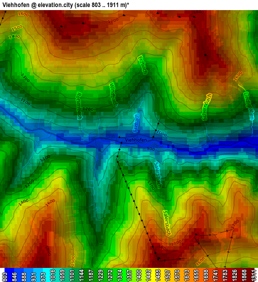
Below is the Elevation map of Viehhofen, which displays elevation range with different colors. Scale of the first map is from 803 to 1911 m (2635 to 6270 ft) with average elevation of 1373.7 meters (=4507 ft) [note 1]
These maps also provides idea of topography and contour of this city, they are displayed at different zoom levels. More info about maps, scale and edge coordinates you can find below images.
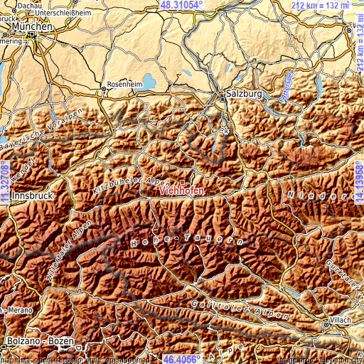
| \ | Map #1 | Topo.Map |
| Scale [m] | 803..1911 m | × |
| Scale [ft] | 2635..6270 ft | × |
| Average | 1373.7 m = 4507 ft | × |
| Width | 6.62 km = 4.1 mi | 211.8 km = 131.6 mi |
| Height | 6.62 km = 4.1 mi | 211.8 km = 131.6 mi |
| ↑Max Latitude | 47.396426° | 48.31054° |
| Latitude at center | 47.36667° | 47.36667° |
| ↓Min Latitude | 47.336897° | 46.4056° |
| ← Min Longitude | 12.689385° | 11.32708° |
| Longitude center | 12.73333° | 12.73333° |
| →Max Longitude | 12.777275° | 14.13958° |
Nearby cities:
Cities around Viehhofen sort by population:
• Saalfelden am Steinernen Meer elevation 742 m
10.9 km,  52°
52°
• Zell am See 784 m
6.5 km,  134°
134°
• Kaprun 772 m
10.7 km,  169°
169°
• Piesendorf 769 m
8.5 km,  187°
187°
• Maishofen 766 m
5 km,  90°
90°
• Saalbach 1003 m
7.8 km,  290°
290°
• Mitterhofen 777 m
5.4 km,  69°
69°
• Hinterglemm 1063 m
10.4 km,  276°
276°
• Thumersbach 769 m
7.5 km,  123°
123°
• Walchen 792 m
9.4 km,  201°
201°
• Niedernsill 769 m
11.2 km,  214°
214°
• Leogang 785 m
8.3 km,  14°
14°
Multilingual:
 En español:
Viehhofen elevación 855 m.
 En France:
Viehhofen élévation 855 m.
 Auf Deutsch:
Viehhofen höhe über dem Meeresspiegel ist 855 m.

Sources and notes:
- [note 1] Map square and city borders are not equal. Map elevation data is calculated only from area inside that square.
- [src 1] Elevation data from geonames database provided with same terms of usage.
- [src 2] The elevation map of Viehhofen is generated using elevation data from NASA's 3 arcsec (90m) resolution SRTM data.
- [src 3] Base (background) map © OpenStreetMap contributors tiles are generated by Geofabrik and OpenTopoMap.
Copyright & License:
This Viehhofen Elevation Map is licensed under CC BY-SA. You may reuse any part from this page, if you give a proper credit by linking to this URL:
 More info on terms of use page.