Wendling elevation
Wendling (Upper Austria, Politischer Bezirk Grieskirchen), Austria elevation is 409 meters and Wendling elevation in feet is 1342 ft above sea level [src 1]. Wendling is a seat of a third-order administrative division (feature code) with elevation that is 100 meters (328 ft) smaller than average city elevation in Austria.
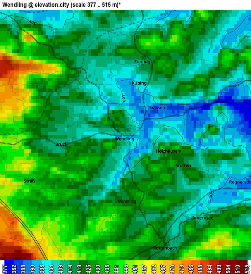
Below is the Elevation map of Wendling, which displays elevation range with different colors. Scale of the first map is from 377 to 515 m (1237 to 1690 ft) with average elevation of 422 meters (=1385 ft) [note 1]
These maps also provides idea of topography and contour of this city, they are displayed at different zoom levels. More info about maps, scale and edge coordinates you can find below images.
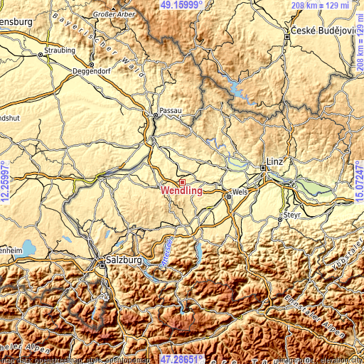
| \ | Map #1 | Topo.Map |
| Scale [m] | 377..515 m | × |
| Scale [ft] | 1237..1690 ft | × |
| Average | 422 m = 1385 ft | × |
| Width | 6.51 km = 4 mi | 208.3 km = 129.4 mi |
| Height | 6.51 km = 4 mi | 208.3 km = 129.4 mi |
| ↑Max Latitude | 48.261084° | 49.15999° |
| Latitude at center | 48.23182° | 48.23182° |
| ↓Min Latitude | 48.202539° | 47.28651° |
| ← Min Longitude | 13.622275° | 12.25997° |
| Longitude center | 13.66622° | 13.66622° |
| →Max Longitude | 13.710165° | 15.07247° |
Nearby cities:
Cities around Wendling sort by population:
• Gallspach elevation 375 m
10.9 km,  102°
102°
• Neumarkt im Hausruckkreis 381 m
6.5 km,  45°
45°
• Gaspoltshofen 451 m
11.1 km,  152°
152°
• Zell an der Pram 366 m
9.8 km,  343°
343°
• Haag am Hausruck 501 m
5.5 km,  197°
197°
• Taiskirchen im Innkreis 472 m
7.8 km,  297°
297°
• Weibern 439 m
5.9 km,  155°
155°
• Pram 435 m
4.5 km,  275°
275°
• Geboltskirchen 549 m
9.1 km, 195°
• Aistersheim 436 m
7.5 km,  131°
131°
• Taufkirchen an der Trattnach 380 m
6.3 km,  74°
74°
• Pötting 379 m
9.6 km, 53°
Multilingual:
 En español:
Wendling elevación 409 m.
 En France:
Wendling élévation 409 m.
 Auf Deutsch:
Wendling höhe über dem Meeresspiegel ist 409 m.

Sources and notes:
- [note 1] Map square and city borders are not equal. Map elevation data is calculated only from area inside that square.
- [src 1] Elevation data from geonames database provided with same terms of usage.
- [src 2] The elevation map of Wendling is generated using elevation data from NASA's 3 arcsec (90m) resolution SRTM data.
- [src 3] Base (background) map © OpenStreetMap contributors tiles are generated by Geofabrik and OpenTopoMap.
Copyright & License:
This Wendling Elevation Map is licensed under CC BY-SA. You may reuse any part from this page, if you give a proper credit by linking to this URL:
 More info on terms of use page.