Wolfau elevation
Wolfau (Burgenland, Politischer Bezirk Oberwart), Austria elevation is 370 meters and Wolfau elevation in feet is 1214 ft above sea level [src 1]. Wolfau is a seat of a third-order administrative division (feature code) with elevation that is 139 meters (456 ft) smaller than average city elevation in Austria.
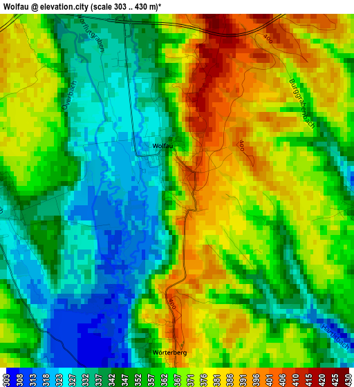
Below is the Elevation map of Wolfau, which displays elevation range with different colors. Scale of the first map is from 303 to 430 m (994 to 1411 ft) with average elevation of 358.3 meters (=1176 ft) [note 1]
These maps also provides idea of topography and contour of this city, they are displayed at different zoom levels. More info about maps, scale and edge coordinates you can find below images.
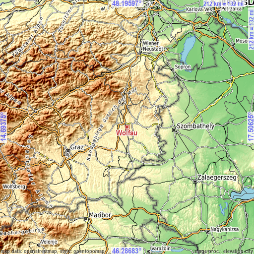
| \ | Map #1 | Topo.Map |
| Scale [m] | 303..430 m | × |
| Scale [ft] | 994..1411 ft | × |
| Average | 358.3 m = 1176 ft | × |
| Width | 6.63 km = 4.1 mi | 212.3 km = 131.9 mi |
| Height | 6.63 km = 4.1 mi | 212.3 km = 131.9 mi |
| ↑Max Latitude | 47.279822° | 48.19597° |
| Latitude at center | 47.25° | 47.25° |
| ↓Min Latitude | 47.220161° | 46.28683° |
| ← Min Longitude | 16.056055° | 14.69375° |
| Longitude center | 16.1° | 16.1° |
| →Max Longitude | 16.143945° | 17.50625° |
Nearby cities:
Cities around Wolfau sort by population:
• Oberwart elevation 316 m
9.1 km,  61°
61°
• Kemeten 296 m
3.9 km,  92°
92°
• Markt Allhau 345 m
3.9 km,  341°
341°
• Stinatz 343 m
5.8 km,  154°
154°
• Neudau 284 m
8.3 km,  179°
179°
• Litzelsdorf 332 m
7.1 km,  130°
130°
• Oberdorf im Burgenland 310 m
9.6 km,  112°
112°
• Ollersdorf im Burgenland 308 m
9 km, 145°
• Sankt Johann in der Haide 387 m
6.6 km,  301°
301°
• Wörterberg 390 m
3.7 km, 180°
• Wörth an der Lafnitz 304 m
4.3 km,  199°
199°
• Hackerberg 338 m
5.7 km,  167°
167°
Multilingual:
 En español:
Wolfau elevación 370 m.
 En France:
Wolfau élévation 370 m.


Sources and notes:
- [note 1] Map square and city borders are not equal. Map elevation data is calculated only from area inside that square.
- [src 1] Elevation data from geonames database provided with same terms of usage.
- [src 2] The elevation map of Wolfau is generated using elevation data from NASA's 3 arcsec (90m) resolution SRTM data.
- [src 3] Base (background) map © OpenStreetMap contributors tiles are generated by Geofabrik and OpenTopoMap.
Copyright & License:
This Wolfau Elevation Map is licensed under CC BY-SA. You may reuse any part from this page, if you give a proper credit by linking to this URL:
 More info on terms of use page.