Zirl elevation
Zirl (Tyrol, Politischer Bezirk Innsbruck Land), Austria elevation is 637 meters and Zirl elevation in feet is 2090 ft above sea level [src 1]. Zirl is a seat of a third-order administrative division (feature code) with elevation that is 128 meters (420 ft) bigger than average city elevation in Austria.
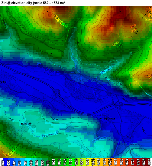
Below is the Elevation map of Zirl, which displays elevation range with different colors. Scale of the first map is from 582 to 1873 m (1909 to 6145 ft) with average elevation of 923.5 meters (=3030 ft) [note 1]
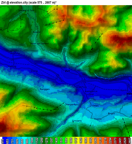
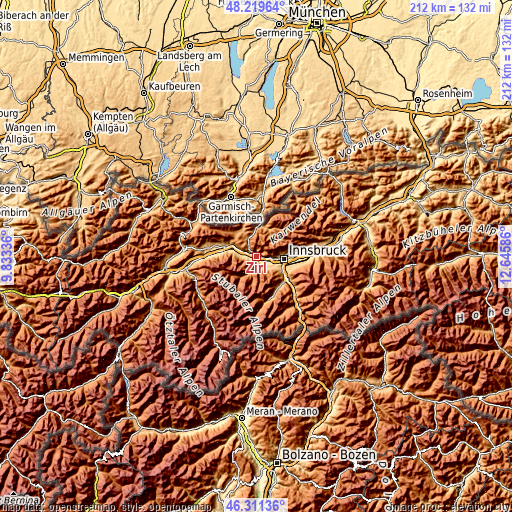
These maps also provides idea of topography and contour of this city, they are displayed at different zoom levels. More info about maps, scale and edge coordinates you can find below images.
| \ | Map #1 | Map #2 | Topo.Map |
| Scale [m] | 582..1873 m | 575..2607 m | × |
| Scale [ft] | 1909..6145 ft | 1886..8553 ft | × |
| Average | 923.5 m = 3030 ft | 1227.7 m = 4028 ft | × |
| Width | 6.63 km = 4.1 mi | 13.26 km = 8.2 mi | 212.2 km = 131.9 mi |
| Height | 6.63 km = 4.1 mi | 13.26 km = 8.2 mi | 212.2 km = 131.9 mi |
| ↑Max Latitude | 47.303908° | 47.333699° | 48.21964° |
| Latitude at center | 47.2741° | 47.2741° | 47.2741° |
| ↓Min Latitude | 47.244275° | 47.214433° | 46.31136° |
| ← Min Longitude | 11.195665° | 11.151719° | 9.83336° |
| Longitude center | 11.23961° | 11.23961° | 11.23961° |
| →Max Longitude | 11.283555° | 11.327501° | 12.64586° |
Nearby cities:
Cities around Zirl sort by population:
• Axams elevation 876 m
5.6 km,  148°
148°
• Inzing 609 m
3.2 km,  269°
269°
• Oberperfuss 812 m
3.3 km,  169°
169°
• Kematen in Tirol 630 m
3.4 km,  142°
142°
• Birgitz 859 m
6.2 km,  133°
133°
• Grinzens 937 m
5.1 km, 168°
• Reith bei Seefeld 1100 m
4.1 km,  313°
313°
• Hatting 611 m
5.4 km,  275°
275°
• Sellrain 954 m
6.6 km,  195°
195°
• Ranggen 829 m
2.8 km,  228°
228°
• Pettnau 610 m
6.4 km,  288°
288°
• Unterperfuss 595 m
1.1 km, 136°
Multilingual:
 En español:
Zirl elevación 637 m.
 En France:
Zirl élévation 637 m.


Sources and notes:
- [note 1] Map square and city borders are not equal. Map elevation data is calculated only from area inside that square.
- [src 1] Elevation data from geonames database provided with same terms of usage.
- [src 2] The elevation map of Zirl is generated using elevation data from NASA's 3 arcsec (90m) resolution SRTM data.
- [src 3] Base (background) map © OpenStreetMap contributors tiles are generated by Geofabrik and OpenTopoMap.
Copyright & License:
This Zirl Elevation Map is licensed under CC BY-SA. You may reuse any part from this page, if you give a proper credit by linking to this URL:
 More info on terms of use page.