Pergamino elevation
Pergamino (Buenos Aires, Partido de Pergamino), Argentina elevation is 69 meters and Pergamino elevation in feet is 226 ft above sea level [src 1]. Pergamino is a seat of a second-order administrative division (feature code) with elevation that is 281 meters (922 ft) smaller than average city elevation in Argentina.
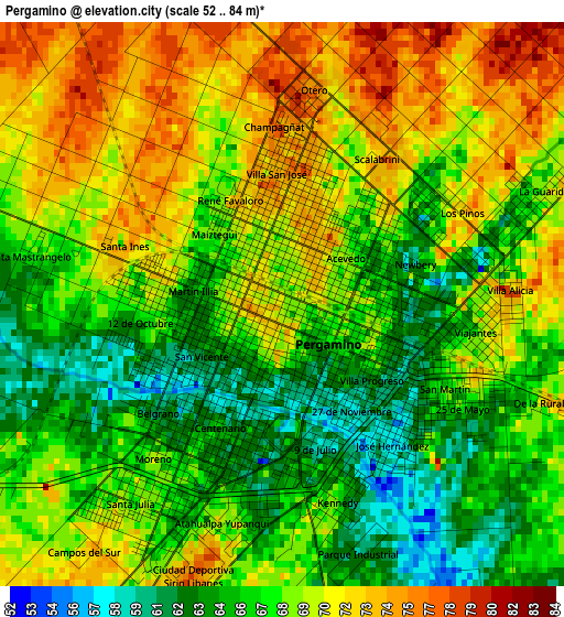
Below is the Elevation map of Pergamino, which displays elevation range with different colors. Scale of the first map is from 52 to 84 m (171 to 276 ft) with average elevation of 68.3 meters (=224 ft) [note 1]
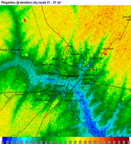
These maps also provides idea of topography and contour of this city, they are displayed at different zoom levels. More info about maps, scale and edge coordinates you can find below images.
| \ | Map #1 | Map #2 | Topo.Map |
| Scale [m] | 52..84 m | 51..97 m | × |
| Scale [ft] | 171..276 ft | 167..318 ft | × |
| Average | 68.3 m = 224 ft | 72 m = 236 ft | × |
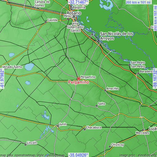
| Width | 8.11 km = 5 mi | 16.22 km = 10.1 mi | 259.6 km = 161.3 mi |
| Height | 8.11 km = 5 mi | 16.22 km = 10.1 mi | 259.6 km = 161.3 mi |
| ↑Max Latitude | -33.853463° | -33.81696° | -32.71467° |
| Latitude at center | -33.88995° | -33.88995° | -33.88995° |
| ↓Min Latitude | -33.926422° | -33.962878° | -35.04926° |
| ← Min Longitude | -60.617515° | -60.661461° | -61.97982° |
| Longitude center | -60.57357° | -60.57357° | -60.57357° |
| →Max Longitude | -60.529625° | -60.485679° | -59.16732° |
Nearby cities:
Cities around Pergamino sort by population:
• San Nicolás de los Arroyos elevation 28 m
70.3 km,  28°
28°
• Villa Constitución 32 m
77 km,  17°
17°
• Chacabuco 73 m
84.1 km,  173°
173°
• Arroyo Seco 29 m
82 km,  4°
4°
• Villa Mugueta 85 m
78.3 km,  325°
325°
• General Arenales 90 m
81.5 km,  235°
235°
• Capitán Sarmiento 51 m
78.7 km,  113°
113°
• Ramallo 23 m
69.1 km,  49°
49°
• Salto 55 m
53.6 km,  146°
146°
• Colón 91 m
48.7 km,  269°
269°
• Arrecifes 46 m
47.5 km, 114°
• Rojas 73 m
37.1 km,  203°
203°
Multilingual:
 En español:
Pergamino elevación 69 m.
 En France:
Pergamino élévation 69 m.
 Auf Deutsch:
Pergamino höhe über dem Meeresspiegel ist 69 m.

Sources and notes:
- [note 1] Map square and city borders are not equal. Map elevation data is calculated only from area inside that square.
- [src 1] Elevation data from geonames database provided with same terms of usage.
- [src 2] The elevation map of Pergamino is generated using elevation data from NASA's 3 arcsec (90m) resolution SRTM data.
- [src 3] Base (background) map © OpenStreetMap contributors tiles are generated by Geofabrik and OpenTopoMap.
Copyright & License:
This Pergamino Elevation Map is licensed under CC BY-SA. You may reuse any part from this page, if you give a proper credit by linking to this URL:
 More info on terms of use page.