Rancul elevation
Rancul (La Pampa, Departamento de Rancul), Argentina elevation is 230 meters and Rancul elevation in feet is 755 ft above sea level [src 1]. Rancul is a populated place (feature code) with elevation that is 120 meters (394 ft) smaller than average city elevation in Argentina.
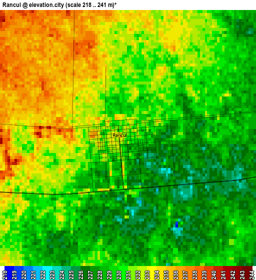
Below is the Elevation map of Rancul, which displays elevation range with different colors. Scale of the first map is from 218 to 241 m (715 to 791 ft) with average elevation of 230.3 meters (=756 ft) [note 1]
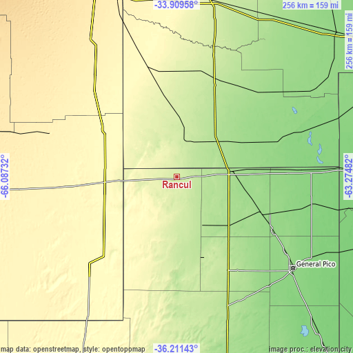
These maps also provides idea of topography and contour of this city, they are displayed at different zoom levels. More info about maps, scale and edge coordinates you can find below images.
| \ | Map #1 | Map #2 | Topo.Map |
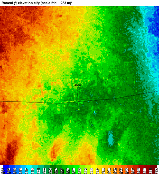
| Scale [m] | 218..241 m | 211..253 m | × |
| Scale [ft] | 715..791 ft | 692..830 ft | × |
| Average | 230.3 m = 756 ft | 232.3 m = 762 ft | × |
| Width | 8 km = 5 mi | 16 km = 9.9 mi | 255.9 km = 159 mi |
| Height | 8 km = 5 mi | 16 km = 9.9 mi | 255.9 km = 159 mi |
| ↑Max Latitude | -35.032644° | -34.996653° | -33.90958° |
| Latitude at center | -35.06862° | -35.06862° | -35.06862° |
| ↓Min Latitude | -35.10458° | -35.140524° | -36.21143° |
| ← Min Longitude | -64.725015° | -64.768961° | -66.08732° |
| Longitude center | -64.68107° | -64.68107° | -64.68107° |
| →Max Longitude | -64.637125° | -64.593179° | -63.27482° |
Nearby cities:
Cities around Rancul sort by population:
• Huinca Renancó elevation 186 m
37.7 km,  47°
47°
• Realicó 167 m
39.9 km,  84°
84°
• Villa Huidobro 219 m
27 km,  18°
18°
• Ingeniero Luiggi 192 m
40.4 km,  150°
150°
• Del Campillo 228 m
78.8 km,  12°
12°
• Buena Esperanza 323 m
62.7 km,  303°
303°
• Caleufú 208 m
59.7 km,  169°
169°
• Parera 202 m
18.5 km,  117°
117°
• Alta Italia 167 m
59.3 km, 119°
• La Maruja 283 m
71.2 km,  199°
199°
• Embajador Martini 174 m
50.7 km,  134°
134°
• Arata 217 m
69.9 km,  155°
155°
Multilingual:
 En español:
Rancul elevación 230 m.
 En France:
Rancul élévation 230 m.


Sources and notes:
- [note 1] Map square and city borders are not equal. Map elevation data is calculated only from area inside that square.
- [src 1] Elevation data from geonames database provided with same terms of usage.
- [src 2] The elevation map of Rancul is generated using elevation data from NASA's 3 arcsec (90m) resolution SRTM data.
- [src 3] Base (background) map © OpenStreetMap contributors tiles are generated by Geofabrik and OpenTopoMap.
Copyright & License:
This Rancul Elevation Map is licensed under CC BY-SA. You may reuse any part from this page, if you give a proper credit by linking to this URL:
 More info on terms of use page.