Veinticinco de Mayo elevation
Veinticinco de Mayo (Buenos Aires, Partido de Veinticinco de Mayo), Argentina elevation is 57 meters and Veinticinco de Mayo elevation in feet is 187 ft above sea level [src 1]. Veinticinco de Mayo is a seat of a second-order administrative division (feature code) with elevation that is 293 meters (961 ft) smaller than average city elevation in Argentina.
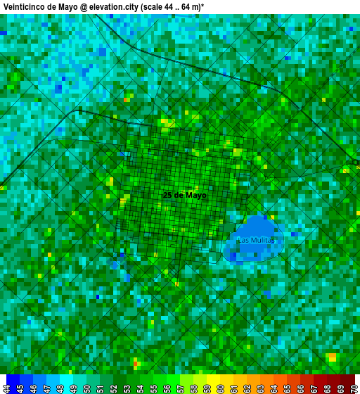
Below is the Elevation map of Veinticinco de Mayo, which displays elevation range with different colors. Scale of the first map is from 44 to 64 m (144 to 210 ft) with average elevation of 51.1 meters (=168 ft) [note 1]
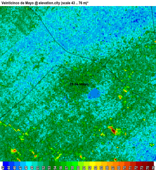
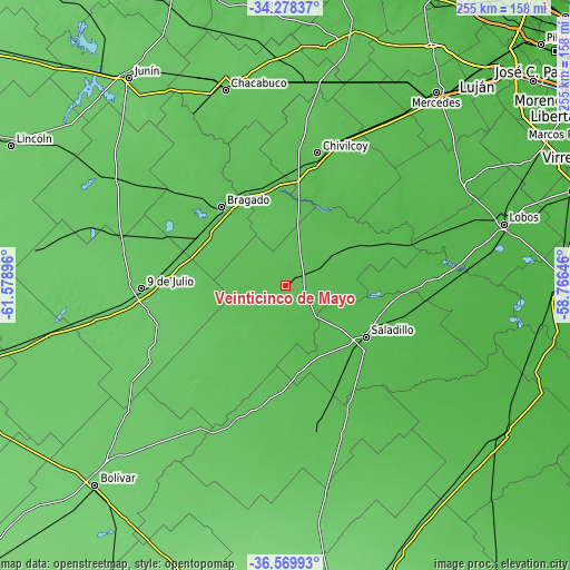
These maps also provides idea of topography and contour of this city, they are displayed at different zoom levels. More info about maps, scale and edge coordinates you can find below images.
| \ | Map #1 | Map #2 | Topo.Map |
| Scale [m] | 44..64 m | 43..76 m | × |
| Scale [ft] | 144..210 ft | 141..249 ft | × |
| Average | 51.1 m = 168 ft | 51 m = 167 ft | × |
| Width | 7.96 km = 4.9 mi | 15.93 km = 9.9 mi | 254.8 km = 158.3 mi |
| Height | 7.96 km = 4.9 mi | 15.93 km = 9.9 mi | 254.8 km = 158.3 mi |
| ↑Max Latitude | -35.396485° | -35.360655° | -34.27837° |
| Latitude at center | -35.4323° | -35.4323° | -35.4323° |
| ↓Min Latitude | -35.468099° | -35.503882° | -36.56993° |
| ← Min Longitude | -60.216655° | -60.260601° | -61.57896° |
| Longitude center | -60.17271° | -60.17271° | -60.17271° |
| →Max Longitude | -60.128765° | -60.084819° | -58.76646° |
Nearby cities:
Cities around Veinticinco de Mayo sort by population:
• Chivilcoy elevation 60 m
61.3 km,  13°
13°
• Nueve de Julio 80 m
64.4 km,  268°
268°
• Chacabuco 73 m
92.1 km,  342°
342°
• Lobos 29 m
101.3 km,  74°
74°
• Navarro 30 m
94.1 km,  59°
59°
• General Viamonte 73 m
91.9 km,  301°
301°
• Suipacha 48 m
85.8 km,  30°
30°
• Roque Pérez 34 m
76.2 km,  87°
87°
• General Alvear 57 m
67 km,  167°
167°
• Alberti 54 m
46 km,  348°
348°
• Bragado 62 m
45.2 km,  320°
320°
• Saladillo 45 m
42.4 km,  122°
122°
Multilingual:
 En español:
Veinticinco de Mayo elevación 57 m.
 En France:
Veinticinco de Mayo élévation 57 m.
 Auf Deutsch:
Veinticinco de Mayo höhe über dem Meeresspiegel ist 57 m.
 На русском:
Veinticinco de Mayo высота над уровнем моря 57 м
Sources and notes:
- [note 1] Map square and city borders are not equal. Map elevation data is calculated only from area inside that square.
- [src 1] Elevation data from geonames database provided with same terms of usage.
- [src 2] The elevation map of Veinticinco de Mayo is generated using elevation data from NASA's 3 arcsec (90m) resolution SRTM data.
- [src 3] Base (background) map © OpenStreetMap contributors tiles are generated by Geofabrik and OpenTopoMap.
Copyright & License:
This Veinticinco de Mayo Elevation Map is licensed under CC BY-SA. You may reuse any part from this page, if you give a proper credit by linking to this URL:
 More info on terms of use page.