Basail elevation
Basail (Chaco, Departamento de San Fernando), Argentina elevation is 57 meters and Basail elevation in feet is 187 ft above sea level [src 1]. Basail is a populated place (feature code) with elevation that is 293 meters (961 ft) smaller than average city elevation in Argentina.
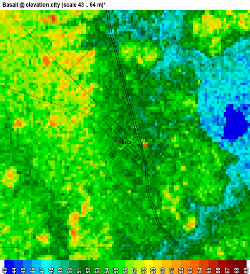
Below is the Elevation map of Basail, which displays elevation range with different colors. Scale of the first map is from 43 to 64 m (141 to 210 ft) with average elevation of 53 meters (=174 ft) [note 1]
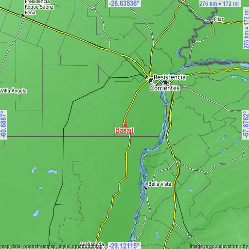
These maps also provides idea of topography and contour of this city, they are displayed at different zoom levels. More info about maps, scale and edge coordinates you can find below images.
| \ | Map #1 | Map #2 | Topo.Map |
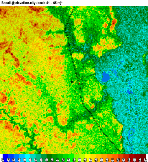
| Scale [m] | 43..64 m | 41..65 m | × |
| Scale [ft] | 141..210 ft | 135..213 ft | × |
| Average | 53 m = 174 ft | 52.7 m = 173 ft | × |
| Width | 8.64 km = 5.4 mi | 17.28 km = 10.7 mi | 276.4 km = 171.7 mi |
| Height | 8.64 km = 5.4 mi | 17.28 km = 10.7 mi | 276.4 km = 171.7 mi |
| ↑Max Latitude | -27.84654° | -27.807677° | -26.63536° |
| Latitude at center | -27.88539° | -27.88539° | -27.88539° |
| ↓Min Latitude | -27.924226° | -27.963047° | -29.12115° |
| ← Min Longitude | -59.326395° | -59.370341° | -60.6887° |
| Longitude center | -59.28245° | -59.28245° | -59.28245° |
| →Max Longitude | -59.238505° | -59.194559° | -57.8762° |
Nearby cities:
Cities around Basail sort by population:
• Resistencia elevation 56 m
55.6 km,  31°
31°
• Barranqueras 52 m
56.2 km,  36°
36°
• San Lorenzo 64 m
57.6 km,  118°
118°
• Fontana 54 m
57.9 km, 26°
• Las Toscas 53 m
52 km,  177°
177°
• Puerto Tirol 54 m
60.4 km,  19°
19°
• Puerto Vilelas 52 m
53.4 km, 39°
• Riachuelo 57 m
62.7 km,  57°
57°
• Tacuarendí 50 m
58.7 km, 177°
• Charadai 67 m
62.6 km,  294°
294°
• Coté-Lai 65 m
53 km,  323°
323°
• Empedrado 68 m
47.4 km,  98°
98°
Multilingual:
 En español:
Basail elevación 57 m.
 En France:
Basail élévation 57 m.


Sources and notes:
- [note 1] Map square and city borders are not equal. Map elevation data is calculated only from area inside that square.
- [src 1] Elevation data from geonames database provided with same terms of usage.
- [src 2] The elevation map of Basail is generated using elevation data from NASA's 3 arcsec (90m) resolution SRTM data.
- [src 3] Base (background) map © OpenStreetMap contributors tiles are generated by Geofabrik and OpenTopoMap.
Copyright & License:
This Basail Elevation Map is licensed under CC BY-SA. You may reuse any part from this page, if you give a proper credit by linking to this URL:
 More info on terms of use page.