Dolores elevation
Dolores (Buenos Aires, Partido de Dolores), Argentina elevation is 14 meters and Dolores elevation in feet is 46 ft above sea level [src 1]. Dolores is a seat of a second-order administrative division (feature code) with elevation that is 336 meters (1102 ft) smaller than average city elevation in Argentina.
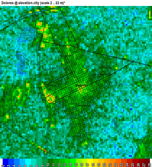
Below is the Elevation map of Dolores, which displays elevation range with different colors. Scale of the first map is from 2 to 22 m (7 to 72 ft) with average elevation of 8.8 meters (=29 ft) [note 1]
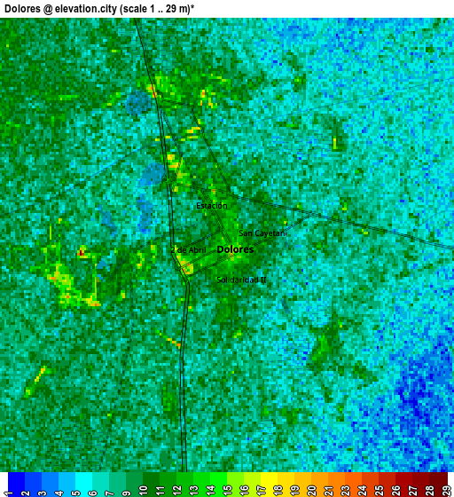
These maps also provides idea of topography and contour of this city, they are displayed at different zoom levels. More info about maps, scale and edge coordinates you can find below images.
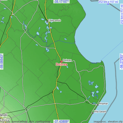
| \ | Map #1 | Map #2 | Topo.Map |
| Scale [m] | 2..22 m | 1..29 m | × |
| Scale [ft] | 7..72 ft | 3..95 ft | × |
| Average | 8.8 m = 29 ft | 8.1 m = 27 ft | × |
| Width | 7.87 km = 4.9 mi | 15.75 km = 9.8 mi | 252 km = 156.6 mi |
| Height | 7.87 km = 4.9 mi | 15.75 km = 9.8 mi | 252 km = 156.6 mi |
| ↑Max Latitude | -36.277791° | -36.242356° | -35.17187° |
| Latitude at center | -36.31321° | -36.31321° | -36.31321° |
| ↓Min Latitude | -36.348613° | -36.383999° | -37.43809° |
| ← Min Longitude | -57.723125° | -57.767071° | -59.08543° |
| Longitude center | -57.67918° | -57.67918° | -57.67918° |
| →Max Longitude | -57.635235° | -57.591289° | -56.27293° |
Nearby cities:
Cities around Dolores sort by population:
• San Clemente del Tuyú elevation 6 m
85.7 km,  93°
93°
• Ranchos 23 m
105.7 km,  326°
326°
• General Belgrano 22 m
94.9 km,  309°
309°
• Mar del Tuyú 6 m
93.3 km,  108°
108°
• General Juan Madariaga 11 m
90 km,  147°
147°
• Chascomús 15 m
87.5 km,  340°
340°
• General Lavalle 3 m
66.7 km,  98°
98°
• Maipú 16 m
63.7 km,  196°
196°
• Pila 17 m
54.3 km, 309°
• General Conesa 4 m
39.1 km,  126°
126°
• General Guido 14 m
37.8 km, 195°
• Castelli 11 m
27.3 km, 335°
Multilingual:
 En español:
Dolores elevación 14 m.
 En France:
Dolores élévation 14 m.


Sources and notes:
- [note 1] Map square and city borders are not equal. Map elevation data is calculated only from area inside that square.
- [src 1] Elevation data from geonames database provided with same terms of usage.
- [src 2] The elevation map of Dolores is generated using elevation data from NASA's 3 arcsec (90m) resolution SRTM data.
- [src 3] Base (background) map © OpenStreetMap contributors tiles are generated by Geofabrik and OpenTopoMap.
Copyright & License:
This Dolores Elevation Map is licensed under CC BY-SA. You may reuse any part from this page, if you give a proper credit by linking to this URL:
 More info on terms of use page.