Guaraní elevation
Guaraní (Misiones, Departamento de Oberá), Argentina elevation is 359 meters and Guaraní elevation in feet is 1178 ft above sea level [src 1]. Guaraní is a populated place (feature code) with elevation that is 9 meters (30 ft) bigger than average city elevation in Argentina.
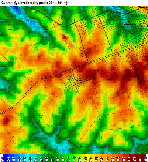
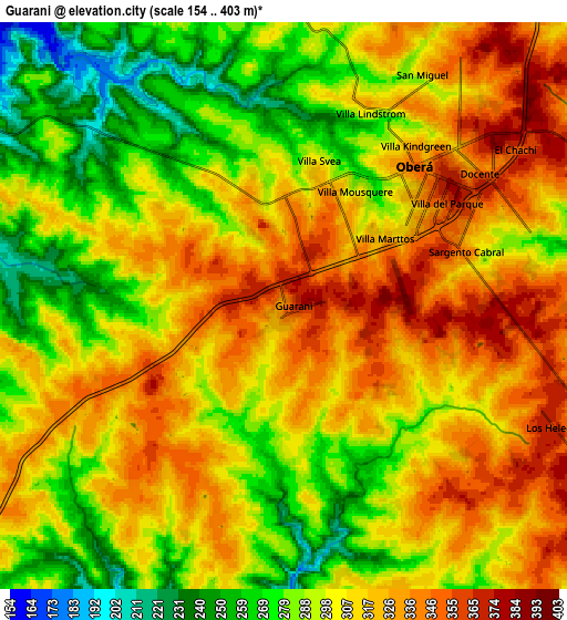
Below is the Elevation map of Guaraní, which displays elevation range with different colors. Scale of the first map is from 241 to 391 m (791 to 1283 ft) with average elevation of 325.5 meters (=1068 ft) [note 1]
These maps also provides idea of topography and contour of this city, they are displayed at different zoom levels. More info about maps, scale and edge coordinates you can find below images.
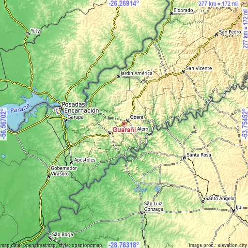
| \ | Map #1 | Map #2 | Topo.Map |
| Scale [m] | 241..391 m | 154..403 m | × |
| Scale [ft] | 791..1283 ft | 505..1322 ft | × |
| Average | 325.5 m = 1068 ft | 305.3 m = 1002 ft | × |
| Width | 8.67 km = 5.4 mi | 17.33 km = 10.8 mi | 277.3 km = 172.3 mi |
| Height | 8.67 km = 5.4 mi | 17.33 km = 10.8 mi | 277.3 km = 172.3 mi |
| ↑Max Latitude | -27.484251° | -27.445259° | -26.26914° |
| Latitude at center | -27.52323° | -27.52323° | -27.52323° |
| ↓Min Latitude | -27.562195° | -27.601146° | -28.76318° |
| ← Min Longitude | -55.204715° | -55.248661° | -56.56702° |
| Longitude center | -55.16077° | -55.16077° | -55.16077° |
| →Max Longitude | -55.116825° | -55.072879° | -53.75452° |
Nearby cities:
Cities around Guaraní sort by population:
• Oberá elevation 345 m
5.7 km,  45°
45°
• Campo Ramón 364 m
15.7 km,  61°
61°
• Campo Viera 342 m
23.6 km,  25°
25°
• Los Helechos 369 m
8.6 km,  110°
110°
• Dos Arroyos 287 m
21.6 km,  204°
204°
• Picada Gobernador López 299 m
18.4 km,  207°
207°
• Mojón Grande 327 m
21 km,  178°
178°
• Florentino Ameghino 252 m
5.5 km,  150°
150°
• General Alvear 290 m
10.8 km,  355°
355°
• Mártires 171 m
24 km,  297°
297°
• Almafuerte 328 m
23.9 km,  273°
273°
• Leandro N. Alem 296 m
18.5 km,  241°
241°
Multilingual:
 En español:
Guaraní elevación 359 m.
 En France:
Guaraní élévation 359 m.


Sources and notes:
- [note 1] Map square and city borders are not equal. Map elevation data is calculated only from area inside that square.
- [src 1] Elevation data from geonames database provided with same terms of usage.
- [src 2] The elevation map of Guaraní is generated using elevation data from NASA's 3 arcsec (90m) resolution SRTM data.
- [src 3] Base (background) map © OpenStreetMap contributors tiles are generated by Geofabrik and OpenTopoMap.
Copyright & License:
This Guaraní Elevation Map is licensed under CC BY-SA. You may reuse any part from this page, if you give a proper credit by linking to this URL:
 More info on terms of use page.