Maciá elevation
Maciá (Entre Rios, Departamento de Tala), Argentina elevation is 76 meters and Maciá elevation in feet is 249 ft above sea level [src 1]. Maciá is a populated place (feature code) with elevation that is 274 meters (899 ft) smaller than average city elevation in Argentina.
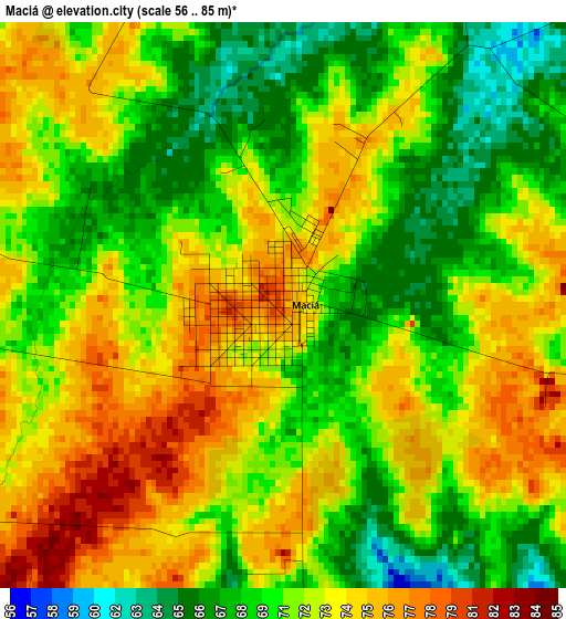
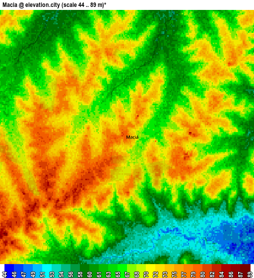
Below is the Elevation map of Maciá, which displays elevation range with different colors. Scale of the first map is from 56 to 85 m (184 to 279 ft) with average elevation of 71.5 meters (=235 ft) [note 1]
These maps also provides idea of topography and contour of this city, they are displayed at different zoom levels. More info about maps, scale and edge coordinates you can find below images.
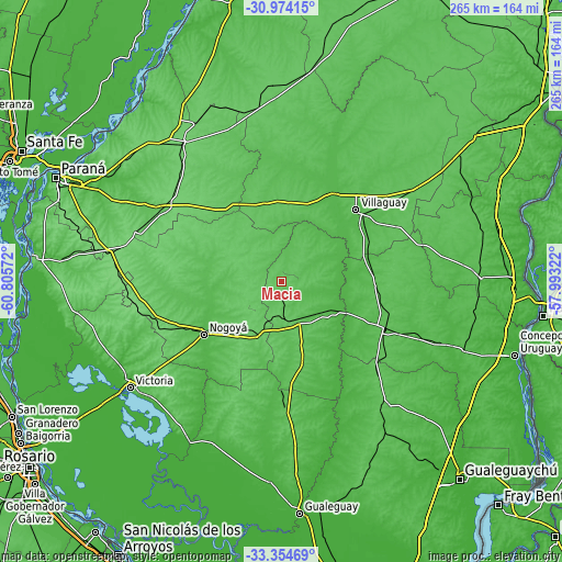
| \ | Map #1 | Map #2 | Topo.Map |
| Scale [m] | 56..85 m | 44..89 m | × |
| Scale [ft] | 184..279 ft | 144..292 ft | × |
| Average | 71.5 m = 235 ft | 67.5 m = 221 ft | × |
| Width | 8.27 km = 5.1 mi | 16.54 km = 10.3 mi | 264.7 km = 164.5 mi |
| Height | 8.27 km = 5.1 mi | 16.54 km = 10.3 mi | 264.7 km = 164.5 mi |
| ↑Max Latitude | -32.134995° | -32.097774° | -30.97415° |
| Latitude at center | -32.1722° | -32.1722° | -32.1722° |
| ↓Min Latitude | -32.20939° | -32.246565° | -33.35469° |
| ← Min Longitude | -59.443415° | -59.487361° | -60.80572° |
| Longitude center | -59.39947° | -59.39947° | -59.39947° |
| →Max Longitude | -59.355525° | -59.311579° | -57.99322° |
Nearby cities:
Cities around Maciá sort by population:
• Villaguay elevation 50 m
49 km,  45°
45°
• Rosario del Tala 39 m
28 km,  121°
121°
• Viale 71 m
66.5 km,  300°
300°
• Lucas González 94 m
26.6 km,  207°
207°
• General Galarza 54 m
60.9 km,  179°
179°
• Gobernador Mansilla 50 m
41.6 km,  174°
174°
• Domínguez 59 m
46.1 km,  63°
63°
• Hernández 100 m
61.3 km,  252°
252°
• Villa Mantero 46 m
66.3 km,  112°
112°
• Tabossi 100 m
65.2 km,  309°
309°
• Santa Anita 67 m
57.7 km,  90°
90°
• Nogoyá 50 m
44.2 km,  236°
236°
Multilingual:
 En español:
Maciá elevación 76 m.
 En France:
Maciá élévation 76 m.


Sources and notes:
- [note 1] Map square and city borders are not equal. Map elevation data is calculated only from area inside that square.
- [src 1] Elevation data from geonames database provided with same terms of usage.
- [src 2] The elevation map of Maciá is generated using elevation data from NASA's 3 arcsec (90m) resolution SRTM data.
- [src 3] Base (background) map © OpenStreetMap contributors tiles are generated by Geofabrik and OpenTopoMap.
Copyright & License:
This Maciá Elevation Map is licensed under CC BY-SA. You may reuse any part from this page, if you give a proper credit by linking to this URL:
 More info on terms of use page.