Cazaji elevation
Cazaji (Lunda Sul), Angola elevation is 1188 meters and Cazaji elevation in feet is 3898 ft above sea level [src 1]. Cazaji is a populated place (feature code) with elevation that is 219 meters (719 ft) bigger than average city elevation in Angola.
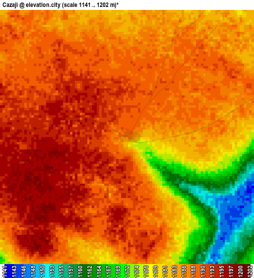
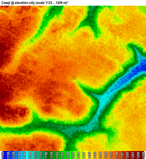
Below is the Elevation map of Cazaji, which displays elevation range with different colors. Scale of the first map is from 1141 to 1202 m (3743 to 3944 ft) with average elevation of 1185.1 meters (=3888 ft) [note 1]
These maps also provides idea of topography and contour of this city, they are displayed at different zoom levels. More info about maps, scale and edge coordinates you can find below images.
| \ | Map #1 | Map #2 | Topo.Map |
| Scale [m] | 1141..1202 m | 1133..1209 m | × |
| Scale [ft] | 3743..3944 ft | 3717..3967 ft | × |
| Average | 1185.1 m = 3888 ft | 1181.1 m = 3875 ft | × |
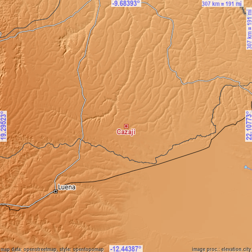
| Width | 9.59 km = 6 mi | 19.18 km = 11.9 mi | 306.9 km = 190.7 mi |
| Height | 9.59 km = 6 mi | 19.18 km = 11.9 mi | 306.9 km = 190.7 mi |
| ↑Max Latitude | -11.024019° | -10.980881° | -9.68393° |
| Latitude at center | -11.06715° | -11.06715° | -11.06715° |
| ↓Min Latitude | -11.110275° | -11.153393° | -12.44387° |
| ← Min Longitude | 20.657535° | 20.613589° | 19.29523° |
| Longitude center | 20.70148° | 20.70148° | 20.70148° |
| →Max Longitude | 20.745425° | 20.789371° | 22.10773° |
Nearby cities:
Cities around Cazaji sort by population:
• Cuito elevation 1715 m
435.5 km,  250°
250°
• Saurimo 1071 m
160 km,  347°
347°
• Luena 1337 m
116.9 km,  227°
227°
• Lucapa 955 m
294.5 km,  0°
0°
• Camacupa 1473 m
366.1 km, 253°
• Catabola 1531 m
391.3 km, 252°
• Luau 1106 m
171.1 km,  76°
76°
• Chissamba 1404 m
386.7 km, 251°
• Léua 1236 m
70.4 km,  202°
202°
• Lumeje 1144 m
54.4 km,  170°
170°
Multilingual:
 En español:
Cazaji elevación 1188 m.
 En France:
Cazaji élévation 1188 m.


Sources and notes:
- [note 1] Map square and city borders are not equal. Map elevation data is calculated only from area inside that square.
- [src 1] Elevation data from geonames database provided with same terms of usage.
- [src 2] The elevation map of Cazaji is generated using elevation data from NASA's 3 arcsec (90m) resolution SRTM data.
- [src 3] Base (background) map © OpenStreetMap contributors tiles are generated by Geofabrik and OpenTopoMap.
Copyright & License:
This Cazaji Elevation Map is licensed under CC BY-SA. You may reuse any part from this page, if you give a proper credit by linking to this URL:
 More info on terms of use page.