Ondjiva elevation
Ondjiva (Cunene), Angola elevation is 1113 meters and Ondjiva elevation in feet is 3652 ft above sea level [src 1]. Ondjiva is a seat of a first-order administrative division (feature code) with elevation that is 144 meters (472 ft) bigger than average city elevation in Angola.
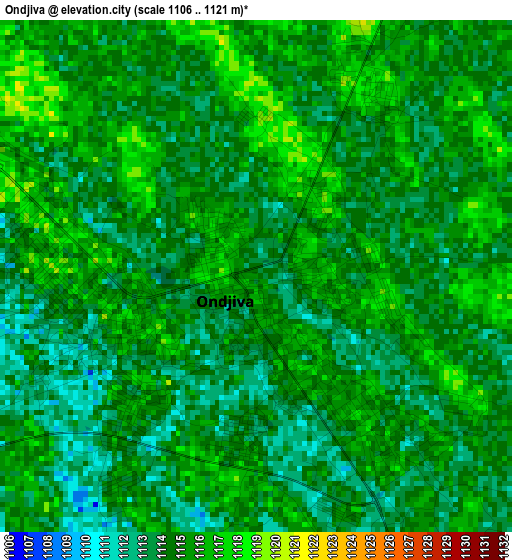
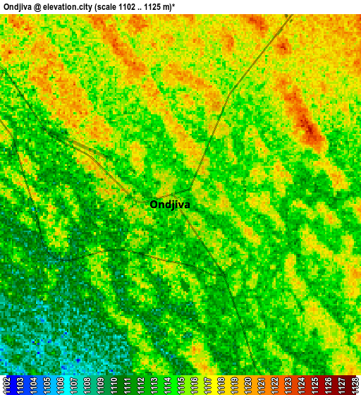
Below is the Elevation map of Ondjiva, which displays elevation range with different colors. Scale of the first map is from 1106 to 1121 m (3629 to 3678 ft) with average elevation of 1114.4 meters (=3656 ft) [note 1]
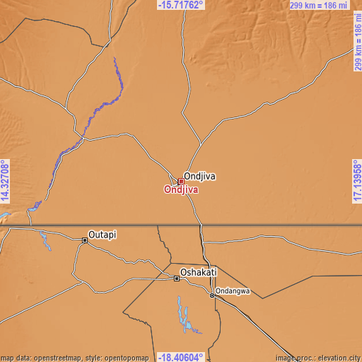
These maps also provides idea of topography and contour of this city, they are displayed at different zoom levels. More info about maps, scale and edge coordinates you can find below images.
| \ | Map #1 | Map #2 | Topo.Map |
| Scale [m] | 1106..1121 m | 1102..1125 m | × |
| Scale [ft] | 3629..3678 ft | 3615..3691 ft | × |
| Average | 1114.4 m = 3656 ft | 1114.4 m = 3656 ft | × |
| Width | 9.34 km = 5.8 mi | 18.68 km = 11.6 mi | 298.9 km = 185.7 mi |
| Height | 9.34 km = 5.8 mi | 18.68 km = 11.6 mi | 298.9 km = 185.7 mi |
| ↑Max Latitude | -17.024655° | -16.982631° | -15.71762° |
| Latitude at center | -17.06667° | -17.06667° | -17.06667° |
| ↓Min Latitude | -17.108675° | -17.150671° | -18.40604° |
| ← Min Longitude | 15.689385° | 15.645439° | 14.32708° |
| Longitude center | 15.73333° | 15.73333° | 15.73333° |
| →Max Longitude | 15.777275° | 15.821221° | 17.13958° |
Nearby cities:
Cities around Ondjiva sort by population:
• Lubango elevation 1760 m
338.3 km,  314°
314°
• Menongue 1355 m
339.9 km,  38°
38°
• Caconda 1674 m
377.5 km,  349°
349°
Multilingual:
 En español:
Ondjiva elevación 1113 m.
 En France:
Ondjiva élévation 1113 m.
 Auf Deutsch:
Ondjiva höhe über dem Meeresspiegel ist 1113 m.

Sources and notes:
- [note 1] Map square and city borders are not equal. Map elevation data is calculated only from area inside that square.
- [src 1] Elevation data from geonames database provided with same terms of usage.
- [src 2] The elevation map of Ondjiva is generated using elevation data from NASA's 3 arcsec (90m) resolution SRTM data.
- [src 3] Base (background) map © OpenStreetMap contributors tiles are generated by Geofabrik and OpenTopoMap.
Copyright & License:
This Ondjiva Elevation Map is licensed under CC BY-SA. You may reuse any part from this page, if you give a proper credit by linking to this URL:
 More info on terms of use page.