Sardarapat elevation
Sardarapat (Armavir), Armenia elevation is 862 meters and Sardarapat elevation in feet is 2828 ft above sea level [src 1]. Sardarapat is a populated place (feature code) with elevation that is 436 meters (1430 ft) smaller than average city elevation in Armenia.
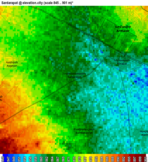
Below is the Elevation map of Sardarapat, which displays elevation range with different colors. Scale of the first map is from 845 to 901 m (2772 to 2956 ft) with average elevation of 867.6 meters (=2846 ft) [note 1]
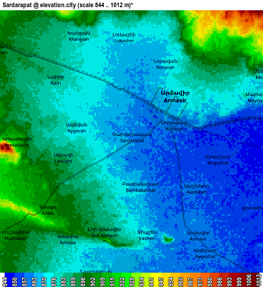
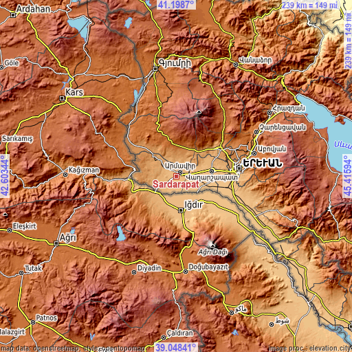
These maps also provides idea of topography and contour of this city, they are displayed at different zoom levels. More info about maps, scale and edge coordinates you can find below images.
| \ | Map #1 | Map #2 | Topo.Map |
| Scale [m] | 845..901 m | 844..1012 m | × |
| Scale [ft] | 2772..2956 ft | 2769..3320 ft | × |
| Average | 867.6 m = 2846 ft | 878.8 m = 2883 ft | × |
| Width | 7.47 km = 4.6 mi | 14.94 km = 9.3 mi | 239.1 km = 148.6 mi |
| Height | 7.47 km = 4.6 mi | 14.94 km = 9.3 mi | 239.1 km = 148.6 mi |
| ↑Max Latitude | 40.165651° | 40.199225° | 41.1987° |
| Latitude at center | 40.13206° | 40.13206° | 40.13206° |
| ↓Min Latitude | 40.098453° | 40.064829° | 39.04841° |
| ← Min Longitude | 43.965745° | 43.921799° | 42.60344° |
| Longitude center | 44.00969° | 44.00969° | 44.00969° |
| →Max Longitude | 44.053635° | 44.097581° | 45.41594° |
Nearby cities:
Cities around Sardarapat sort by population:
• Armavir elevation 870 m
3.5 km,  44°
44°
• Mrgashat 849 m
6 km,  91°
91°
• Nalbandyan 870 m
7.8 km,  193°
193°
• Bambakashat 865 m
2.8 km,  162°
162°
• Arevik 853 m
8 km,  116°
116°
• Lukashin 874 m
6.2 km,  355°
355°
• Tandzut 854 m
9.1 km,  140°
140°
• Alashkert 857 m
4.5 km,  128°
128°
• Aygeshat 859 m
7.7 km,  145°
145°
• Nor Armavir 888 m
5.3 km, 194°
• Mayisyan 874 m
7.5 km,  68°
68°
• Lenughi 887 m
4 km,  258°
258°
Multilingual:
 En español:
Sardarapat elevación 862 m.
 En France:
Sardarapat élévation 862 m.
 Auf Deutsch:
Sardarapat höhe über dem Meeresspiegel ist 862 m.

Sources and notes:
- [note 1] Map square and city borders are not equal. Map elevation data is calculated only from area inside that square.
- [src 1] Elevation data from geonames database provided with same terms of usage.
- [src 2] The elevation map of Sardarapat is generated using elevation data from NASA's 3 arcsec (90m) resolution SRTM data.
- [src 3] Base (background) map © OpenStreetMap contributors tiles are generated by Geofabrik and OpenTopoMap.
Copyright & License:
This Sardarapat Elevation Map is licensed under CC BY-SA. You may reuse any part from this page, if you give a proper credit by linking to this URL:
 More info on terms of use page.