Kapan elevation
Kapan (Syunik), Armenia elevation is 774 meters and Kapan elevation in feet is 2539 ft above sea level [src 1]. Kapan is a seat of a first-order administrative division (feature code) with elevation that is 524 meters (1719 ft) smaller than average city elevation in Armenia.
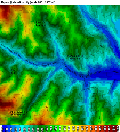
Below is the Elevation map of Kapan, which displays elevation range with different colors. Scale of the first map is from 705 to 1552 m (2313 to 5092 ft) with average elevation of 990.9 meters (=3251 ft) [note 1]
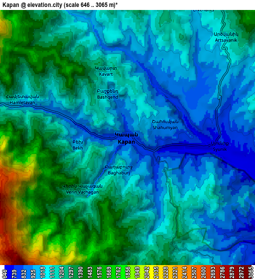
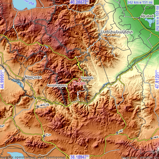
These maps also provides idea of topography and contour of this city, they are displayed at different zoom levels. More info about maps, scale and edge coordinates you can find below images.
| \ | Map #1 | Map #2 | Topo.Map |
| Scale [m] | 705..1552 m | 646..3065 m | × |
| Scale [ft] | 2313..5092 ft | 2119..10056 ft | × |
| Average | 990.9 m = 3251 ft | 1191.8 m = 3910 ft | × |
| Width | 7.57 km = 4.7 mi | 15.14 km = 9.4 mi | 242.3 km = 150.6 mi |
| Height | 7.57 km = 4.7 mi | 15.14 km = 9.4 mi | 242.3 km = 150.6 mi |
| ↑Max Latitude | 39.241593° | 39.27562° | 40.28872° |
| Latitude at center | 39.20755° | 39.20755° | 39.20755° |
| ↓Min Latitude | 39.17349° | 39.139414° | 38.10947° |
| ← Min Longitude | 46.361815° | 46.317869° | 44.99951° |
| Longitude center | 46.40576° | 46.40576° | 46.40576° |
| →Max Longitude | 46.449705° | 46.493651° | 47.81201° |
Nearby cities:
Cities around Kapan sort by population:
• Goris elevation 1351 m
34.2 km,  350°
350°
• Hats’avan 1761 m
47.1 km,  307°
307°
• Agarak 998 m
12 km,  90°
90°
• Meghri 657 m
36.6 km,  202°
202°
• Shinuhayr 1500 m
26.6 km,  343°
343°
• Tegh 1318 m
39.5 km,  9°
9°
• Verishen 1621 m
37.2 km, 348°
• Khndzoresk 1408 m
33.3 km,  4°
4°
• Brrnakot’ 1698 m
49.3 km, 310°
• Angeghakot’ 1822 m
56.5 km,  315°
315°
• Dzorastan 1206 m
8.2 km,  329°
329°
• Akner 1641 m
37.4 km, 346°
Multilingual:
 En español:
Kapan elevación 774 m.
 En France:
Kapan élévation 774 m.


Sources and notes:
- [note 1] Map square and city borders are not equal. Map elevation data is calculated only from area inside that square.
- [src 1] Elevation data from geonames database provided with same terms of usage.
- [src 2] The elevation map of Kapan is generated using elevation data from NASA's 3 arcsec (90m) resolution SRTM data.
- [src 3] Base (background) map © OpenStreetMap contributors tiles are generated by Geofabrik and OpenTopoMap.
Copyright & License:
This Kapan Elevation Map is licensed under CC BY-SA. You may reuse any part from this page, if you give a proper credit by linking to this URL:
 More info on terms of use page.