Iballë elevation
Iballë (Shkodër, Rrethi i Pukës), Albania elevation is 765 meters and Iballë elevation in feet is 2510 ft above sea level [src 1]. Iballë is a seat of a third-order administrative division (feature code) with elevation that is 391 meters (1283 ft) bigger than average city elevation in Albania.
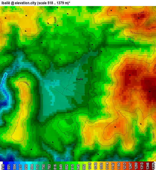
Below is the Elevation map of Iballë, which displays elevation range with different colors. Scale of the first map is from 518 to 1379 m (1699 to 4524 ft) with average elevation of 932.8 meters (=3060 ft) [note 1]
These maps also provides idea of topography and contour of this city, they are displayed at different zoom levels. More info about maps, scale and edge coordinates you can find below images.
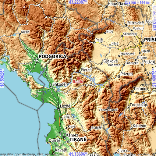
| \ | Map #1 | Topo.Map |
| Scale [m] | 518..1379 m | × |
| Scale [ft] | 1699..4524 ft | × |
| Average | 932.8 m = 3060 ft | × |
| Width | 7.24 km = 4.5 mi | 231.7 km = 144 mi |
| Height | 7.24 km = 4.5 mi | 231.7 km = 144 mi |
| ↑Max Latitude | 42.220053° | 43.22087° |
| Latitude at center | 42.1875° | 42.1875° |
| ↓Min Latitude | 42.15493° | 41.13696° |
| ← Min Longitude | 19.958555° | 18.59625° |
| Longitude center | 20.0025° | 20.0025° |
| →Max Longitude | 20.046445° | 21.40875° |
Nearby cities:
Cities around Iballë sort by population:
• Pukë elevation 799 m
18 km,  208°
208°
• Fushë-Arrëz 533 m
14 km,  175°
175°
• Bajram Curri 351 m
19.8 km,  17°
17°
• Llugaj 245 m
19.2 km,  27°
27°
• Bujan 224 m
16.6 km, 21°
• Rrapë 792 m
16.1 km,  189°
189°
• Blerim 608 m
15.9 km,  100°
100°
• Qelëz 234 m
14 km,  219°
219°
• Lekbibaj 318 m
13.3 km,  333°
333°
• Qafëmal 754 m
12.7 km,  145°
145°
• Bushat 423 m
11.4 km,  228°
228°
• Fierzë 303 m
8.2 km,  8°
8°
Multilingual:
 En español:
Iballë elevación 765 m.
 En France:
Iballë élévation 765 m.


Sources and notes:
- [note 1] Map square and city borders are not equal. Map elevation data is calculated only from area inside that square.
- [src 1] Elevation data from geonames database provided with same terms of usage.
- [src 2] The elevation map of Iballë is generated using elevation data from NASA's 3 arcsec (90m) resolution SRTM data.
- [src 3] Base (background) map © OpenStreetMap contributors tiles are generated by Geofabrik and OpenTopoMap.
Copyright & License:
This Iballë Elevation Map is licensed under CC BY-SA. You may reuse any part from this page, if you give a proper credit by linking to this URL:
 More info on terms of use page.