Peshkopi elevation
Peshkopi (Dibër), Albania elevation is 660 meters and Peshkopi elevation in feet is 2165 ft above sea level [src 1]. Peshkopi is a seat of a first-order administrative division (feature code) with elevation that is 286 meters (938 ft) bigger than average city elevation in Albania.
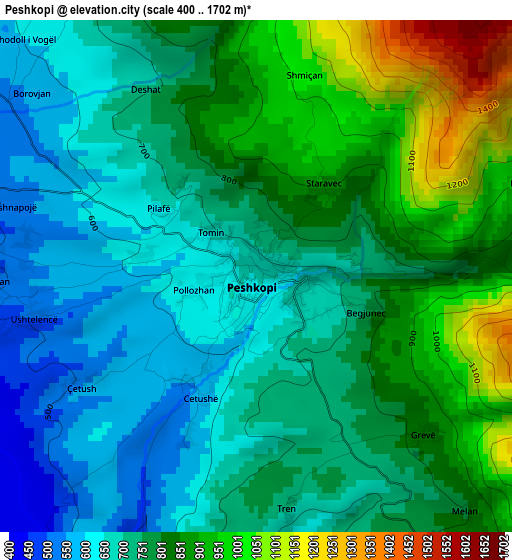
Below is the Elevation map of Peshkopi, which displays elevation range with different colors. Scale of the first map is from 400 to 1702 m (1312 to 5584 ft) with average elevation of 775.3 meters (=2544 ft) [note 1]
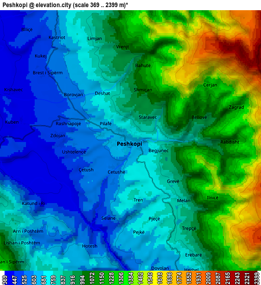
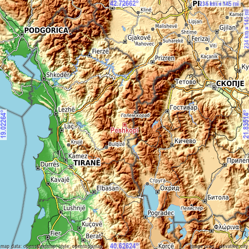
These maps also provides idea of topography and contour of this city, they are displayed at different zoom levels. More info about maps, scale and edge coordinates you can find below images.
| \ | Map #1 | Map #2 | Topo.Map |
| Scale [m] | 400..1702 m | 369..2399 m | × |
| Scale [ft] | 1312..5584 ft | 1211..7871 ft | × |
| Average | 775.3 m = 2544 ft | 914.3 m = 3000 ft | × |
| Width | 7.3 km = 4.5 mi | 14.6 km = 9.1 mi | 233.5 km = 145.1 mi |
| Height | 7.3 km = 4.5 mi | 14.6 km = 9.1 mi | 233.5 km = 145.1 mi |
| ↑Max Latitude | 41.717811° | 41.750604° | 42.72662° |
| Latitude at center | 41.685° | 41.685° | 41.685° |
| ↓Min Latitude | 41.652173° | 41.619329° | 40.62624° |
| ← Min Longitude | 20.384945° | 20.340999° | 19.02264° |
| Longitude center | 20.42889° | 20.42889° | 20.42889° |
| →Max Longitude | 20.472835° | 20.516781° | 21.83514° |
Nearby cities:
Cities around Peshkopi sort by population:
• Shupenzë elevation 499 m
17.2 km,  181°
181°
• Gjorica e Sipërme 462 m
16.8 km,  174°
174°
• Zall-Dardhë 397 m
15.6 km,  330°
330°
• Selishtë 743 m
14 km,  242°
242°
• Sllovë 914 m
13 km,  352°
352°
• Maqellarë 617 m
11.6 km,  157°
157°
• Fushë-Çidhnë 401 m
11.1 km,  319°
319°
• Arras 417 m
10.4 km,  303°
303°
• Fushë-Muhurr 411 m
8.1 km,  265°
265°
• Kastriot 562 m
6.5 km, 319°
• Melan 812 m
4.6 km,  138°
138°
• Tomin 686 m
0.9 km, 317°
Multilingual:
 En español:
Peshkopi elevación 660 m.
 En France:
Peshkopi élévation 660 m.
 Auf Deutsch:
Peshkopi höhe über dem Meeresspiegel ist 660 m.

Sources and notes:
- [note 1] Map square and city borders are not equal. Map elevation data is calculated only from area inside that square.
- [src 1] Elevation data from geonames database provided with same terms of usage.
- [src 2] The elevation map of Peshkopi is generated using elevation data from NASA's 3 arcsec (90m) resolution SRTM data.
- [src 3] Base (background) map © OpenStreetMap contributors tiles are generated by Geofabrik and OpenTopoMap.
Copyright & License:
This Peshkopi Elevation Map is licensed under CC BY-SA. You may reuse any part from this page, if you give a proper credit by linking to this URL:
 More info on terms of use page.