Krujë elevation
Krujë (Durrës, Rrethi i Krujës), Albania elevation is 509 meters and Krujë elevation in feet is 1670 ft above sea level [src 1]. Krujë is a seat of a second-order administrative division (feature code) with elevation that is 135 meters (443 ft) bigger than average city elevation in Albania.
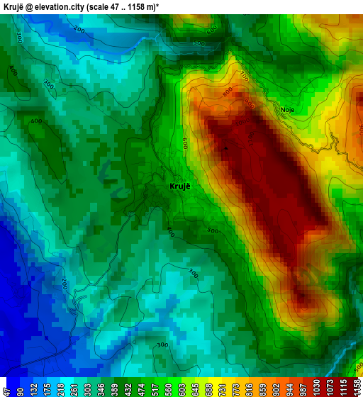
Below is the Elevation map of Krujë, which displays elevation range with different colors. Scale of the first map is from 47 to 1158 m (154 to 3799 ft) with average elevation of 472.6 meters (=1551 ft) [note 1]
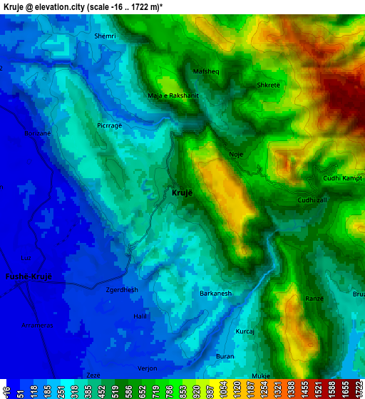
These maps also provides idea of topography and contour of this city, they are displayed at different zoom levels. More info about maps, scale and edge coordinates you can find below images.
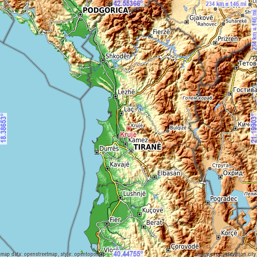
| \ | Map #1 | Map #2 | Topo.Map |
| Scale [m] | 47..1158 m | -16..1722 m | × |
| Scale [ft] | 154..3799 ft | -52..5650 ft | × |
| Average | 472.6 m = 1551 ft | 459.5 m = 1508 ft | × |
| Width | 7.32 km = 4.5 mi | 14.64 km = 9.1 mi | 234.2 km = 145.5 mi |
| Height | 7.32 km = 4.5 mi | 14.64 km = 9.1 mi | 234.2 km = 145.5 mi |
| ↑Max Latitude | 41.54207° | 41.574953° | 42.55366° |
| Latitude at center | 41.50917° | 41.50917° | 41.50917° |
| ↓Min Latitude | 41.476253° | 41.44332° | 40.44755° |
| ← Min Longitude | 19.748835° | 19.704889° | 18.38653° |
| Longitude center | 19.79278° | 19.79278° | 19.79278° |
| →Max Longitude | 19.836725° | 19.880671° | 21.19903° |
Nearby cities:
Cities around Krujë sort by population:
• Kamëz elevation 55 m
14.4 km,  190°
190°
• Fushë-Krujë 24 m
7.1 km,  241°
241°
• Mamurras 25 m
11.3 km,  312°
312°
• Selitë 637 m
14.4 km,  347°
347°
• Zall-Herr 132 m
13.6 km,  167°
167°
• Prezë 230 m
13.5 km,  227°
227°
• Bubq 28 m
12.4 km,  251°
251°
• Thumanë 14 m
10.5 km,  293°
293°
• Kallmet 132 m
10.4 km, 166°
• Hasan 18 m
8.3 km, 249°
• Nikël 59 m
8.1 km,  207°
207°
• Cudhi Zall 746 m
4.4 km,  89°
89°
Multilingual:
 En español:
Krujë elevación 509 m.
 En France:
Krujë élévation 509 m.


Sources and notes:
- [note 1] Map square and city borders are not equal. Map elevation data is calculated only from area inside that square.
- [src 1] Elevation data from geonames database provided with same terms of usage.
- [src 2] The elevation map of Krujë is generated using elevation data from NASA's 3 arcsec (90m) resolution SRTM data.
- [src 3] Base (background) map © OpenStreetMap contributors tiles are generated by Geofabrik and OpenTopoMap.
Copyright & License:
This Krujë Elevation Map is licensed under CC BY-SA. You may reuse any part from this page, if you give a proper credit by linking to this URL:
 More info on terms of use page.