Kuçovë elevation
Kuçovë (Berat, Rrethi i Kuçovës), Albania elevation is 58 meters and Kuçovë elevation in feet is 190 ft above sea level [src 1]. Kuçovë is a seat of a second-order administrative division (feature code) with elevation that is 316 meters (1037 ft) smaller than average city elevation in Albania.
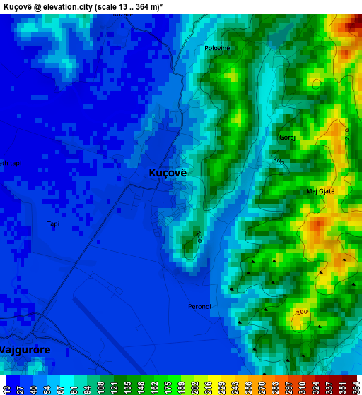
Below is the Elevation map of Kuçovë, which displays elevation range with different colors. Scale of the first map is from 13 to 364 m (43 to 1194 ft) with average elevation of 77.9 meters (=256 ft) [note 1]
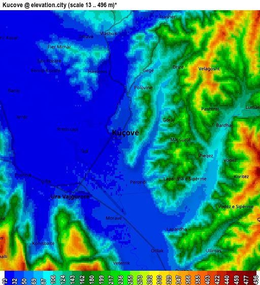
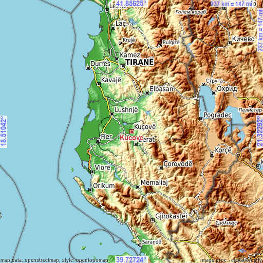
These maps also provides idea of topography and contour of this city, they are displayed at different zoom levels. More info about maps, scale and edge coordinates you can find below images.
| \ | Map #1 | Map #2 | Topo.Map |
| Scale [m] | 13..364 m | 13..496 m | × |
| Scale [ft] | 43..1194 ft | 43..1627 ft | × |
| Average | 77.9 m = 256 ft | 118.4 m = 388 ft | × |
| Width | 7.4 km = 4.6 mi | 14.8 km = 9.2 mi | 236.7 km = 147.1 mi |
| Height | 7.4 km = 4.6 mi | 14.8 km = 9.2 mi | 236.7 km = 147.1 mi |
| ↑Max Latitude | 40.833538° | 40.866779° | 41.85625° |
| Latitude at center | 40.80028° | 40.80028° | 40.80028° |
| ↓Min Latitude | 40.767005° | 40.733714° | 39.72724° |
| ← Min Longitude | 19.872725° | 19.828779° | 18.51042° |
| Longitude center | 19.91667° | 19.91667° | 19.91667° |
| →Max Longitude | 19.960615° | 20.004561° | 21.32292° |
Nearby cities:
Cities around Kuçovë sort by population:
• Berat elevation 66 m
10.9 km,  164°
164°
• Ura Vajgurore 33 m
4.8 km,  223°
223°
• Banaj 17 m
7 km,  293°
293°
• Cukalat 153 m
13.2 km,  233°
233°
• Kajan 173 m
12.9 km,  349°
349°
• Roshnik 361 m
12.8 km,  125°
125°
• Kutalli 23 m
11.1 km,  260°
260°
• Velabisht 60 m
11 km,  173°
173°
• Poshnje 31 m
6.5 km,  249°
249°
• Otllak 42 m
6.5 km, 165°
• Kozarë 28 m
3.7 km,  338°
338°
• Perondi 41 m
2.4 km, 167°
Multilingual:
 En español:
Kuçovë elevación 58 m.
 En France:
Kuçovë élévation 58 m.


Sources and notes:
- [note 1] Map square and city borders are not equal. Map elevation data is calculated only from area inside that square.
- [src 1] Elevation data from geonames database provided with same terms of usage.
- [src 2] The elevation map of Kuçovë is generated using elevation data from NASA's 3 arcsec (90m) resolution SRTM data.
- [src 3] Base (background) map © OpenStreetMap contributors tiles are generated by Geofabrik and OpenTopoMap.
Copyright & License:
This Kuçovë Elevation Map is licensed under CC BY-SA. You may reuse any part from this page, if you give a proper credit by linking to this URL:
 More info on terms of use page.