Charlotte Amalie elevation
Charlotte Amalie (Saint Thomas Island), U.S. Virgin Islands elevation is 10 meters and Charlotte Amalie elevation in feet is 33 ft above sea level [src 1]. Charlotte Amalie is a capital of a political entity (feature code) with elevation that is 12 meters (39 ft) smaller than average city elevation in U.S. Virgin Islands.
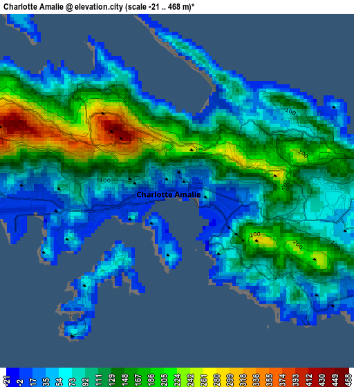
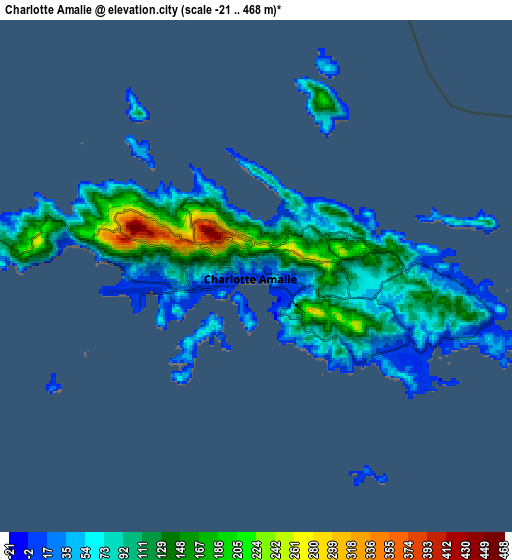
Below is the Elevation map of Charlotte Amalie, which displays elevation range with different colors. Scale of the first map is from -21 to 468 m (-69 to 1535 ft) with average elevation of 110.2 meters (=362 ft) [note 1]
These maps also provides idea of topography and contour of this city, they are displayed at different zoom levels. More info about maps, scale and edge coordinates you can find below images.
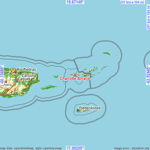
| \ | Map #1 | Map #2 | Topo.Map |
| Scale [m] | -21..468 m | -21..468 m | × |
| Scale [ft] | -69..1535 ft | -69..1535 ft | × |
| Average | 110.2 m = 362 ft | 94.5 m = 310 ft | × |
| Width | 9.28 km = 5.8 mi | 18.55 km = 11.5 mi | 296.8 km = 184.4 mi |
| Height | 9.28 km = 5.8 mi | 18.55 km = 11.5 mi | 296.8 km = 184.4 mi |
| ↑Max Latitude | 18.383608° | 18.425305° | 19.67145° |
| Latitude at center | 18.3419° | 18.3419° | 18.3419° |
| ↓Min Latitude | 18.300182° | 18.258454° | 17.00205° |
| ← Min Longitude | -64.974645° | -65.018591° | -66.33695° |
| Longitude center | -64.9307° | -64.9307° | -64.9307° |
| →Max Longitude | -64.886755° | -64.842809° | -63.52445° |
Nearby cities:
Cities around Charlotte Amalie sort by population:
• Saint Croix elevation 42 m
71 km,  164°
164°
• Cruz Bay 13 m
14.5 km,  94°
94°
Multilingual:
 En español:
Carlota Amalia elevación 10 m.
 En France:
Charlotte Amalie élévation 10 m.
 Auf Deutsch:
Charlotte Amalie höhe über dem Meeresspiegel ist 10 m.
 На русском:
Шарлота Амалия, Шарлотта-Амалия высота над уровнем моря 10 м
Sources and notes:
- [note 1] Map square and city borders are not equal. Map elevation data is calculated only from area inside that square.
- [src 1] Elevation data from geonames database provided with same terms of usage.
- [src 2] The elevation map of Charlotte Amalie is generated using elevation data from NASA's 3 arcsec (90m) resolution SRTM data.
- [src 3] Base (background) map © OpenStreetMap contributors tiles are generated by Geofabrik and OpenTopoMap.
Copyright & License:
This Charlotte Amalie Elevation Map is licensed under CC BY-SA. You may reuse any part from this page, if you give a proper credit by linking to this URL:
 More info on terms of use page.